ملف:St Mary the Virgin - geograph.org.uk - 130509.jpg
لا توجد دقة أعلى متوفرة.
St_Mary_the_Virgin_-_geograph.org.uk_-_130509.jpg (640 × 480 بكسل حجم الملف: 101 كيلوبايت، نوع MIME: image/jpeg)
وصف قصير
| Description |
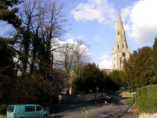
English: The junction of Cobbs Lane, Hickmire and Bell End in Wollaston, Northamptonshire. In the background are the tower and spire of St Mary the Virgin parish church. |
| Date | 2006-03-01 |
| Source | From geograph.org.uk |
| Author | Kokai |
| ⧼wm-license-cc-attribution⧽ (قالب:I18n/Credit line) |
Kokai / St Mary the Virgin / |
52°15′28″N 0°40′13″W / 52.257907°N 0.67041°W
_heading:22)
| Object location | ملف:Compass-icon bb NNE.svg | View all coordinates using: OpenStreetMap |
|---|
_heading:22.00&language=⧼lang⧽)
ترخيص
تاريخ الملف
اضغط على زمن/تاريخ لرؤية الملف كما بدا في هذا الزمن.
| زمن/تاريخ | صورة مصغرة | الأبعاد | مستخدم | تعليق | |
|---|---|---|---|---|---|
| حالي | ★ مراجعة معتمدة 02:52، 11 أكتوبر 2023 | | 640 × 480 (101 كيلوبايت) | Pastakhov (نقاش | مساهمات) | Upload https://upload.wikimedia.org/wikipedia/commons/d/d6/St_Mary_the_Virgin_-_geograph.org.uk_-_130509.jpg |
لا يمكنك استبدال هذا الملف.
وصلات
لا يوجد صفحات تصل لهذه الصورة.
معلومات الصورة (ميتا)
تصنيفات:
- Pages using gadget WikiMiniAtlas
- Broach spires in Northamptonshire
- Church spires in Northamptonshire
- Church towers in Northamptonshire
- Clocks in Northamptonshire
- Saint Mary the Virgin Church (Wollaston, Northamptonshire)
- Street lights in Northamptonshire
- Trees in Northamptonshire
- Images by Kokai
- United Kingdom photographs taken on 2006-03-01
- صفحات مع الخرائط