ملف:St Mary's Hall - geograph.org.uk - 1117033.jpg
حجم هذه المعاينة: 450 × 600 بكسل. البعد الآخر: 480 × 640 بكسل.
الملف الأصلي (480 × 640 بكسل حجم الملف: 76 كيلوبايت، نوع MIME: image/jpeg)
| Description |
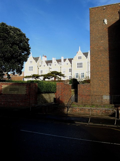
English: St Mary's Hall An independent day and boarding school for girls considered one of the oldest in the country having been founded in 1836. |
| Date | 2009-01-11 |
| Source | From geograph.org.uk |
| Author | Simon Carey |
| ⧼wm-license-information-permission⧽ (⧼wm-license-information-permission-reusing-text⧽) |
قالب:Geograph |
| ⧼wm-license-cc-attribution⧽ (قالب:I18n/Credit line) |
Simon Carey / St Mary's Hall / |
50°49′03″N 0°06′47″W / 50.81762°N 0.1130°W
_heading:0)
| Object location | ملف:Compass-icon bb N.svg | View all coordinates using: OpenStreetMap |
|---|
_heading:0.00&language=⧼lang⧽)
تاريخ الملف
اضغط على زمن/تاريخ لرؤية الملف كما بدا في هذا الزمن.
| زمن/تاريخ | صورة مصغرة | الأبعاد | مستخدم | تعليق | |
|---|---|---|---|---|---|
| حالي | ★ مراجعة معتمدة 14:50، 7 أكتوبر 2023 | | 480 × 640 (76 كيلوبايت) | Pastakhov (نقاش | مساهمات) | Upload https://upload.wikimedia.org/wikipedia/commons/e/e9/St_Mary%27s_Hall_-_geograph.org.uk_-_1117033.jpg |
لا يمكنك استبدال هذا الملف.
وصلات
لا يوجد صفحات تصل لهذه الصورة.
تصنيفات:
- Pages using gadget WikiMiniAtlas
- Boarding schools in the United Kingdom
- Buildings in Brighton, East Sussex
- Built in England in 1836
- Eastern Road, Kemptown
- Educational institutions established in 1836
- Girls' schools
- Grade II listed buildings in Brighton and Hove
- Schools in East Sussex
- Photographs by Simon Carey
- صفحات مع الخرائط