ملف:Route of the 1998 Tour de France.png
حجم هذه المعاينة: 554 × 600 بكسل. البعدان الآخران: 1٬892 × 2٬048 بكسل | 3٬198 × 3٬462 بكسل.
الملف الأصلي (3٬198 × 3٬462 بكسل حجم الملف: 2٫78 ميجابايت، نوع MIME: image/png)
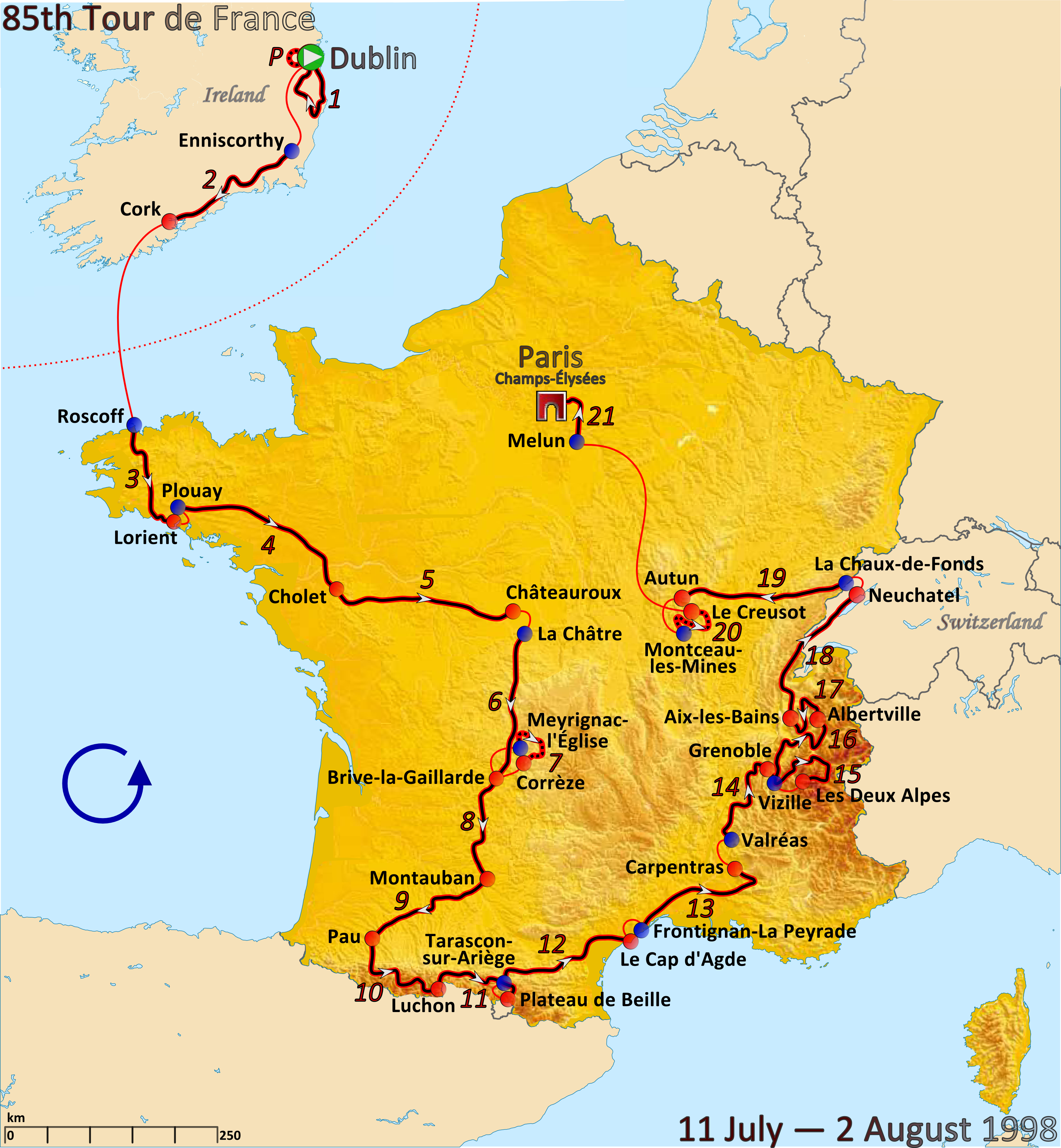
وصف قصير
| Description |
English: Map of the 1998 Tour de France created in Inkscape |
| Date | 2011-11-19 |
| Source |
|
| Author | Andrei I. Loas; underlying image: Eric Gaba |
ترخيص
|
تاريخ الملف
اضغط على زمن/تاريخ لرؤية الملف كما بدا في هذا الزمن.
| زمن/تاريخ | صورة مصغرة | الأبعاد | مستخدم | تعليق | |
|---|---|---|---|---|---|
| حالي | ★ مراجعة معتمدة 12:01، 16 أكتوبر 2023 | | 3٬198 × 3٬462 (2٫78 ميجابايت) | Pastakhov (نقاش | مساهمات) | Upload https://upload.wikimedia.org/wikipedia/commons/1/1c/Route_of_the_1998_Tour_de_France.png |
لا يمكنك استبدال هذا الملف.
وصلات
لا يوجد صفحات تصل لهذه الصورة.