ملف:Polynesian triangle.svg

حجم معاينة PNG لذلك الملف ذي الامتداد SVG: 600 × 600 بكسل. البعد الآخر: 2٬048 × 2٬048 بكسل.
الملف الأصلي (ملف SVG، أبعاده 600 × 600 بكسل، حجم الملف: 281 كيلوبايت)
وصف قصير
قالب:Igen
| Description |
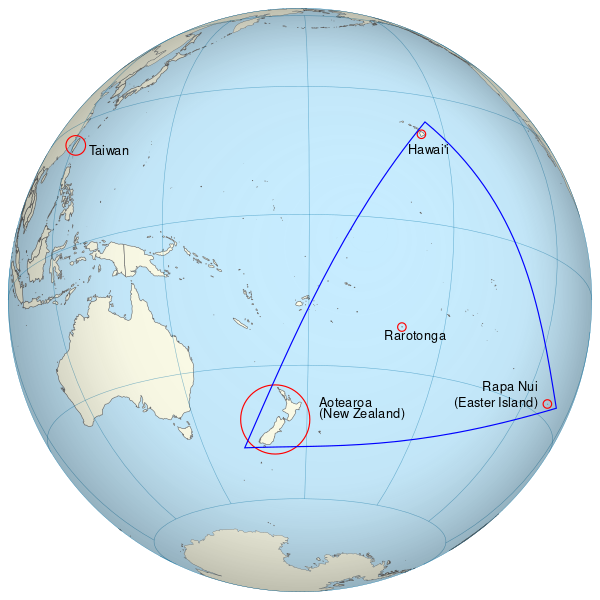
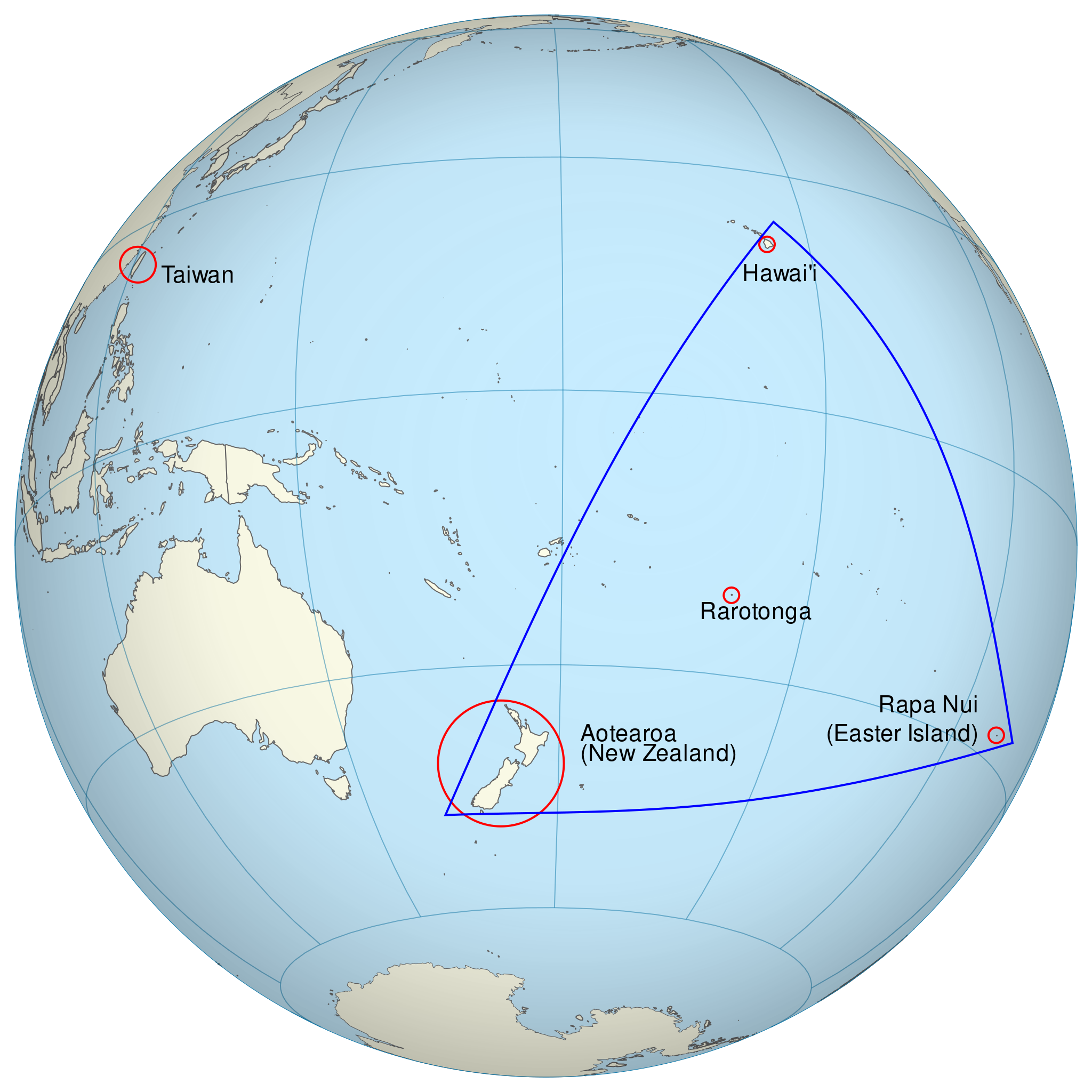
English: An orthographic projection of the pacific ocean, showing land outlines (resolution ~0.5 degrees) and the Polynesian triangle between Hawai'i, Rapa Nui and Aotearoa. Created using perlshaper to convert Natural Earth Data into an SVG file. Some tweaking was then done in Inkscape to fix up boundaries for countries on the edge of the projection. |
| Date | 2009-11-24 |
| Source | Own work |
| Author | Gringer |
| ⧼wm-license-information-other-versions⧽ | قالب:F |
ترخيص
تاريخ الملف
اضغط على زمن/تاريخ لرؤية الملف كما بدا في هذا الزمن.
| زمن/تاريخ | صورة مصغرة | الأبعاد | مستخدم | تعليق | |
|---|---|---|---|---|---|
| حالي | ★ مراجعة معتمدة 03:06، 29 نوفمبر 2023 | | 600 × 600 (281 كيلوبايت) | Pastakhov (نقاش | مساهمات) | Upload https://upload.wikimedia.org/wikipedia/commons/7/7b/Polynesian_triangle.svg |
لا يمكنك استبدال هذا الملف.
وصلات
لا يوجد صفحات تصل لهذه الصورة.