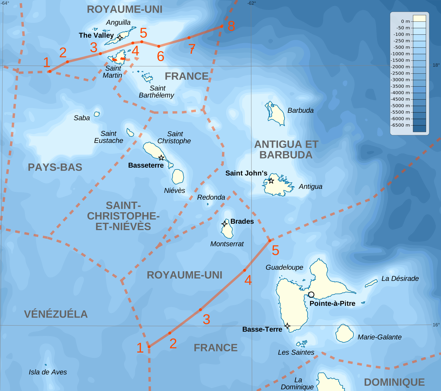
ملف:Maritime boundaries between UK and France in Antilles-fr.svg
حجم معاينة PNG لذلك الملف ذي الامتداد SVG: 676 × 599 بكسل. البعد الآخر: 2٬309 × 2٬048 بكسل.
الملف الأصلي (ملف SVG، أبعاده 1٬502 × 1٬332 بكسل، حجم الملف: 403 كيلوبايت)
وصف قصير
| Description |
English: Maritime boundaries between UK and France in Antilles. français: Frontières maritimes entre la France et le Royaume-Uni aux Antilles |
||
| Date | 2013-03-15 22:04 (UTC) | ||
| Source |
Own work. English: Sources:
français: Sources :
|
||
| Author | Sémhur (talk) | ||
| ⧼wm-license-information-other-versions⧽ | |||
| SVG |
قالب:ValidSVG
|
||
| Graphic Lab | قالب:Atelier graphique carte |

ترخيص
|


تاريخ الملف
اضغط على زمن/تاريخ لرؤية الملف كما بدا في هذا الزمن.
| زمن/تاريخ | صورة مصغرة | الأبعاد | مستخدم | تعليق | |
|---|---|---|---|---|---|
| حالي | ★ مراجعة معتمدة 12:14، 14 أكتوبر 2023 | | 1٬502 × 1٬332 (403 كيلوبايت) | Pastakhov (نقاش | مساهمات) | Upload https://upload.wikimedia.org/wikipedia/commons/1/1f/Maritime_boundaries_between_UK_and_France_in_Antilles-fr.svg |
لا يمكنك استبدال هذا الملف.
وصلات
لا يوجد صفحات تصل لهذه الصورة.
معلومات الصورة (ميتا)

تصنيفات:
- FAL files
- Creative Commons Attribution-ShareAlike 1.0–4.0 files
- Self-published work
- Maps of maritime boundary between France and the United Kingdom
- Lesser Antilles
- SVG maps of the Atlantic Ocean
- SVG maps of the Caribbean
- Files created by User:Sémhur
- Maps by User:Sémhur
- Bathymetric maps of the Caribbean
- Bathymetric maps of the North Atlantic