ملف:Maiden Way - geograph.org.uk - 621822.jpg
لا توجد دقة أعلى متوفرة.
Maiden_Way_-_geograph.org.uk_-_621822.jpg (640 × 480 بكسل حجم الملف: 149 كيلوبايت، نوع MIME: image/jpeg)
وصف قصير
| Description |
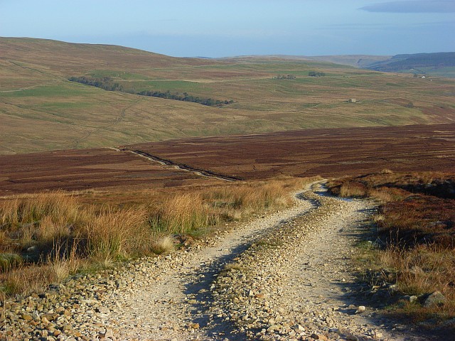
English: Maiden Way This is a Roman Road and heads towards Whitley Castle at Kirkhaugh. It was taken from where the track heads southeast to Smittergill Head. This is the more prominent of the two ways to the south. |
| Date | 2007-11-23 |
| Source | From geograph.org.uk |
| Author | Andrew Smith |
| ⧼wm-license-cc-attribution⧽ (قالب:I18n/Credit line) |
Andrew Smith / Maiden Way / |
54°44′58″N 2°30′57″W / 54.74958°N 2.5157°W
_heading:22)
| Object location | ملف:Compass-icon bb NNE.svg | View all coordinates using: OpenStreetMap |
|---|
_heading:22.00&language=⧼lang⧽)
ترخيص
تاريخ الملف
اضغط على زمن/تاريخ لرؤية الملف كما بدا في هذا الزمن.
| زمن/تاريخ | صورة مصغرة | الأبعاد | مستخدم | تعليق | |
|---|---|---|---|---|---|
| حالي | ★ مراجعة معتمدة 02:07، 13 نوفمبر 2023 | | 640 × 480 (149 كيلوبايت) | Pastakhov (نقاش | مساهمات) | Upload https://upload.wikimedia.org/wikipedia/commons/8/89/Maiden_Way_-_geograph.org.uk_-_621822.jpg |
لا يمكنك استبدال هذا الملف.
وصلات
لا يوجد صفحات تصل لهذه الصورة.