ملف:Magilligan Point - geograph.org.uk - 1553406.jpg
لا توجد دقة أعلى متوفرة.
Magilligan_Point_-_geograph.org.uk_-_1553406.jpg (640 × 457 بكسل حجم الملف: 200 كيلوبايت، نوع MIME: image/jpeg)
وصف قصير
| Description |
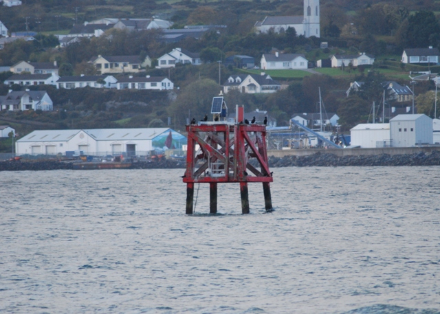
English: Magilligan Point As the coast changes from time to time the channel marker at Magilligan is some way from the shore. It is now a popular perch for cormorants and shags.
The Point was a welcome homecoming marker during WW2 for the North Atlantic convoy escorts based in Lough Foyle. If lucky they got to go right in, moor up for a few hours and allow half a watch a little time ashore in Londonderry -if not it was straight to the refuelling point off Moville. Taken from the shoreline at Magilligan beach, Greencastle harbour and church can be seen beyond. |
| Date | 2009-09-20 |
| Source | From geograph.org.uk |
| Author | Simon Huguet |
| ⧼wm-license-cc-attribution⧽ (قالب:I18n/Credit line) |
Simon Huguet / Magilligan Point / |
55°11′42″N 6°57′55″W / 55.19491°N 6.9654°W
_heading:337)
| Object location | ملف:Compass-icon bb NNW.svg | View all coordinates using: OpenStreetMap |
|---|
_heading:337.00&language=⧼lang⧽)
ترخيص
تاريخ الملف
اضغط على زمن/تاريخ لرؤية الملف كما بدا في هذا الزمن.
| زمن/تاريخ | صورة مصغرة | الأبعاد | مستخدم | تعليق | |
|---|---|---|---|---|---|
| حالي | ★ مراجعة معتمدة 18:41، 7 ديسمبر 2023 | | 640 × 457 (200 كيلوبايت) | Pastakhov (نقاش | مساهمات) | Upload https://upload.wikimedia.org/wikipedia/commons/2/27/Magilligan_Point_-_geograph.org.uk_-_1553406.jpg |
لا يمكنك استبدال هذا الملف.
وصلات
لا يوجد صفحات تصل لهذه الصورة.