ملف:MSH80 mudline muddy river with USGS scientist 10-23-80.jpg
حجم هذه المعاينة: 800 × 536 بكسل. البعد الآخر: 2٬904 × 1٬947 بكسل.
الملف الأصلي (2٬904 × 1٬947 بكسل حجم الملف: 2٫64 ميجابايت، نوع MIME: image/jpeg)
وصف قصير
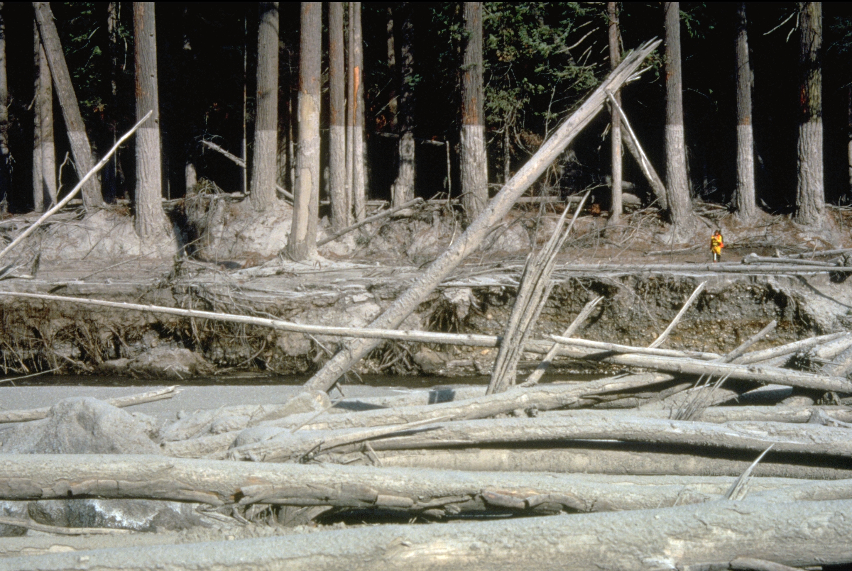
| Description |
English: (copied description from USGS site): Nearly 135 miles (220 kilometers) of river channels surrounding the volcano [Mt. St. Helens] were affected by the lahars of May 18, 1980. A mudline left behind on trees shows depths reached by the mud. A scientist (middle right) gives scale. This view is along the Muddy River, southeast of Mount St. Helens. |
| Date | قالب:Taken on |
| Source | http://vulcan.wr.usgs.gov/Glossary/Lahars/description_lahars.html |
| Author | Lyn Topinka, USGS |
ترخيص
تاريخ الملف
اضغط على زمن/تاريخ لرؤية الملف كما بدا في هذا الزمن.
| زمن/تاريخ | صورة مصغرة | الأبعاد | مستخدم | تعليق | |
|---|---|---|---|---|---|
| حالي | ★ مراجعة معتمدة 05:26، 20 أكتوبر 2023 | | 2٬904 × 1٬947 (2٫64 ميجابايت) | Pastakhov (نقاش | مساهمات) | Upload https://upload.wikimedia.org/wikipedia/commons/1/16/MSH80_mudline_muddy_river_with_USGS_scientist_10-23-80.jpg |
لا يمكنك استبدال هذا الملف.
وصلات
لا يوجد صفحات تصل لهذه الصورة.