ملف:Lees, Greater Manchester.jpg
لا توجد دقة أعلى متوفرة.
Lees,_Greater_Manchester.jpg (640 × 367 بكسل حجم الملف: 40 كيلوبايت، نوع MIME: image/jpeg)
| Object location | ملف:Compass-icon bb E.svg | View all coordinates using: OpenStreetMap |
|---|
_region:GB-GBN_heading:90.00&language=⧼lang⧽)
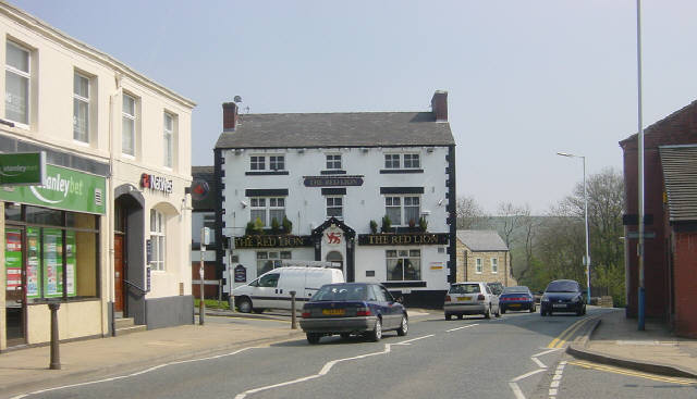
| Description |
English: Lees village centre, in Greater Manchester, England.
Looking eastwards along the A669 at Lees, near Oldham, towards County End, with the Red Lion pub on the corner. |
| Date | 2005-04-24 |
| Source | https://www.geograph.org.uk/photo/5526 |
| Author | Martin Clark |
| ⧼wm-license-information-permission⧽ (⧼wm-license-information-permission-reusing-text⧽) |
قالب:Geograph |
تاريخ الملف
اضغط على زمن/تاريخ لرؤية الملف كما بدا في هذا الزمن.
| زمن/تاريخ | صورة مصغرة | الأبعاد | مستخدم | تعليق | |
|---|---|---|---|---|---|
| حالي | ★ مراجعة معتمدة 11:07، 12 أكتوبر 2023 | | 640 × 367 (40 كيلوبايت) | Pastakhov (نقاش | مساهمات) | Upload https://upload.wikimedia.org/wikipedia/commons/8/81/Lees%2C_Greater_Manchester.jpg |
لا يمكنك استبدال هذا الملف.
وصلات
لا يوجد صفحات تصل لهذه الصورة.