ملف:Ladywell and Brockley cemetery - geograph.org.uk - 1290119.jpg
لا توجد دقة أعلى متوفرة.
Ladywell_and_Brockley_cemetery_-_geograph.org.uk_-_1290119.jpg (640 × 480 بكسل حجم الملف: 120 كيلوبايت، نوع MIME: image/jpeg)
وصف قصير
| Description |
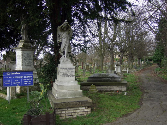
English: Ladywell and Brockley cemetery These two cemeteries, formerly known as Lewisham and Deptford, were once divided but are now merged and together cover 21 acres.
The latter, to the west, has a large number of mature trees. |
| Date | 2009-03-14 |
| Source | From geograph.org.uk |
| Author | ceridwen |
| ⧼wm-license-cc-attribution⧽ (قالب:I18n/Credit line) |
ceridwen / Ladywell and Brockley cemetery / |
51°27′25″N 0°01′54″W / 51.45686°N 0.0318°W
_heading:90)
| Object location | ملف:Compass-icon bb E.svg | View all coordinates using: OpenStreetMap |
|---|
_heading:90.00&language=⧼lang⧽)
ترخيص
تاريخ الملف
اضغط على زمن/تاريخ لرؤية الملف كما بدا في هذا الزمن.
| زمن/تاريخ | صورة مصغرة | الأبعاد | مستخدم | تعليق | |
|---|---|---|---|---|---|
| حالي | ★ مراجعة معتمدة 10:50، 9 نوفمبر 2023 | | 640 × 480 (120 كيلوبايت) | Pastakhov (نقاش | مساهمات) | Upload https://upload.wikimedia.org/wikipedia/commons/2/29/Ladywell_and_Brockley_cemetery_-_geograph.org.uk_-_1290119.jpg |
لا يمكنك استبدال هذا الملف.
وصلات
لا يوجد صفحات تصل لهذه الصورة.