ملف:Kashmir Region (2020 skirmish locations).jpg
حجم هذه المعاينة: 604 × 599 بكسل. البعد الآخر: 1٬579 × 1٬566 بكسل.
الملف الأصلي (1٬579 × 1٬566 بكسل حجم الملف: 1٫27 ميجابايت، نوع MIME: image/jpeg)
وصف قصير
| Description |
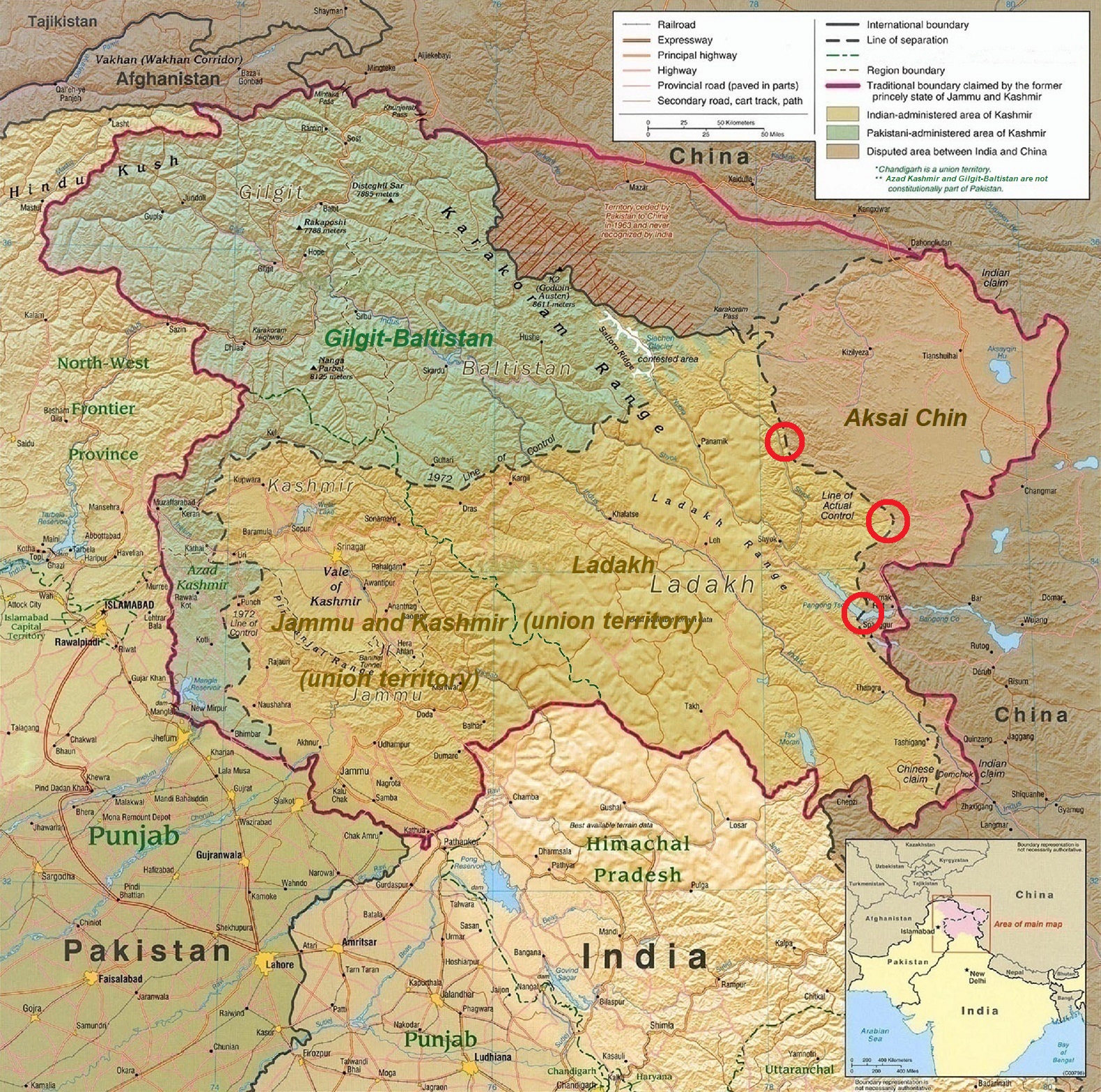
English: A map of the disputed Kashmir region created by the United States CIA in 2004 and hosted by the University of Texas at Austin Perry-Castañeda Library Map Collection; altered to show new jurisdictions by Fowler&fowler in November 2019; altered by to show 2020 skirmish locations by MarkH21 in June 2020. The red circles mark the rough locations of the conflicts at the the Galwan Valley (top), Hot Springs, Chang Chenmo Valley checkpoint (middle), and Pangong Tso (near the bottom). |
| Date | 2004-01-01 |
| Source | Map of Kashmir region created by the US Central Intelligence Agency, 2004 |
| Author | United States Central Intelligence Agency |
| ⧼wm-license-information-other-versions⧽ |


ترخيص
تاريخ الملف
اضغط على زمن/تاريخ لرؤية الملف كما بدا في هذا الزمن.
| زمن/تاريخ | صورة مصغرة | الأبعاد | مستخدم | تعليق | |
|---|---|---|---|---|---|
| حالي | ★ مراجعة معتمدة 19:54، 12 أكتوبر 2023 | | 1٬579 × 1٬566 (1٫27 ميجابايت) | Pastakhov (نقاش | مساهمات) | Upload https://upload.wikimedia.org/wikipedia/commons/3/36/Kashmir_Region_%282020_skirmish_locations%29.jpg |
لا يمكنك استبدال هذا الملف.
وصلات
لا يوجد صفحات تصل لهذه الصورة.
.jpg&oldid=3082027)