ملف:JanMayenlocation.PNG
حجم هذه المعاينة: 585 × 599 بكسل. البعد الآخر: 2٬119 × 2٬170 بكسل.
الملف الأصلي (2٬119 × 2٬170 بكسل حجم الملف: 919 كيلوبايت، نوع MIME: image/png)
وصف قصير
| Description |
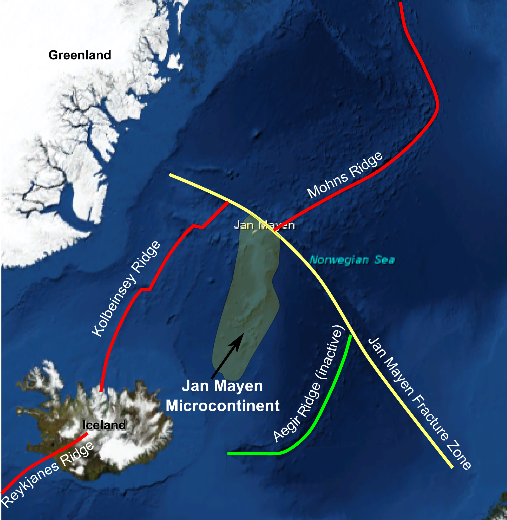
English: Location map for Jan Mayen Microcontinent using screenshot from NASA's WorldWind software, with plate boundaries added. Active spreading centres in red, inactive in yellow. |
| Date | 2010-03-28 |
| Source | Own work |
| Author | Mikenorton |
ترخيص
|

تاريخ الملف
اضغط على زمن/تاريخ لرؤية الملف كما بدا في هذا الزمن.
| زمن/تاريخ | صورة مصغرة | الأبعاد | مستخدم | تعليق | |
|---|---|---|---|---|---|
| حالي | ★ مراجعة معتمدة 13:50، 23 نوفمبر 2023 | | 2٬119 × 2٬170 (919 كيلوبايت) | Pastakhov (نقاش | مساهمات) | Upload https://upload.wikimedia.org/wikipedia/commons/b/b5/JanMayenlocation.PNG |
لا يمكنك استبدال هذا الملف.
وصلات
لا يوجد صفحات تصل لهذه الصورة.
معلومات الصورة (ميتا)
تصنيفات:
- Maps of Jan Mayen
- Satellite pictures of Jan Mayen
- Microcontinents
- Geology of the Atlantic Ocean
- Mid-ocean ridges
- Fracture zones (geology)
- Geology of Jan Mayen
- Topography of the Atlantic Ocean
- Geology of Iceland
- Jan Mayen Microcontinent
- Reykjanes Ridge
- Kolbeinsey Ridge
- Aegir Ridge
- Mohns Ridge
- Norwegian Sea
- Maps of Greenland
- Self-published work