ملف:Hofer Geschichtswege 6 Karte 20220522 HOF02374 20221206000122.png
حجم هذه المعاينة: 489 × 599 بكسل. البعد الآخر: 2٬171 × 2٬659 بكسل.
الملف الأصلي (2٬171 × 2٬659 بكسل حجم الملف: 8٫03 ميجابايت، نوع MIME: image/png)
وصف قصير
| Description |
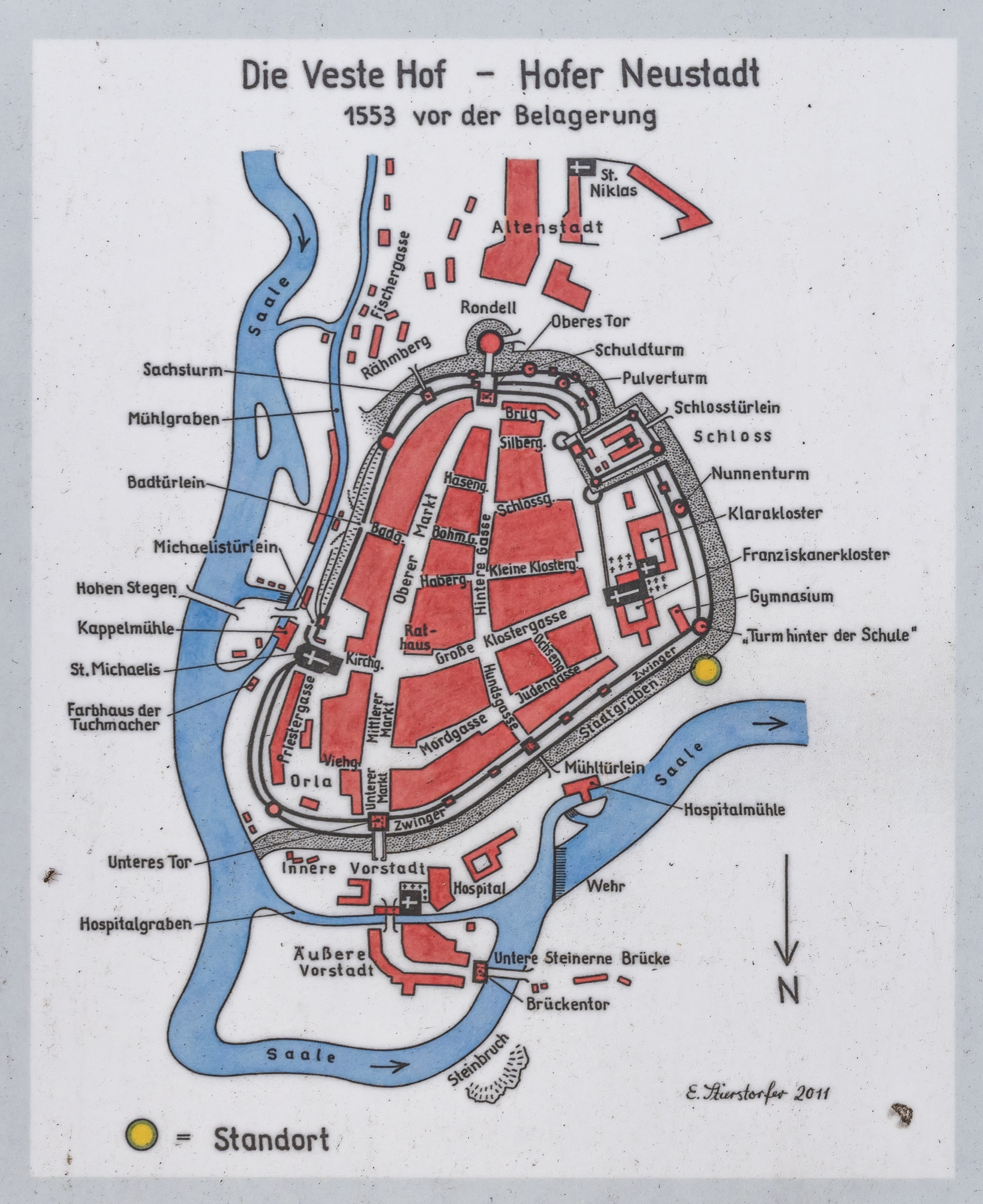
Deutsch: Hofer Geschichtswege 6 über die Stadtbefestigung vom Hofer im späten Mittelalter. Hier sieht man die Karte von der Hofer Neustadt von 1553, gezeichnet von Edda Stierstorfer.
English: Hofer Geschichtswege 6 about the city fortifications from the Hofer in the late Middle Ages. Here you can see the map of the new town of Hof from 1553, drawn by Edda Stierstorfer. |
| Date | 2022-05-22 |
| Source | Own work |
| Author |
|
50°19′20″N 11°54′50″E / 50.322085°N 11.913991°E قالب:FoP-Germany
ترخيص
تاريخ الملف
اضغط على زمن/تاريخ لرؤية الملف كما بدا في هذا الزمن.
| زمن/تاريخ | صورة مصغرة | الأبعاد | مستخدم | تعليق | |
|---|---|---|---|---|---|
| حالي | ★ مراجعة معتمدة 15:22، 23 يناير 2024 | | 2٬171 × 2٬659 (8٫03 ميجابايت) | Pastakhov (نقاش | مساهمات) | Upload https://upload.wikimedia.org/wikipedia/commons/6/67/Hofer_Geschichtswege_6_Karte_20220522_HOF02374_20221206000122.png |
لا يمكنك استبدال هذا الملف.
وصلات
لا يوجد صفحات تصل لهذه الصورة.
معلومات الصورة (ميتا)
تصنيفات:
- Pages using gadget WikiMiniAtlas
- Photographs of Hof (Saale) by PantheraLeo1359531
- Hof (Saale) photographs taken on 2022-05-22
- Photographs created by PantheraLeo1359531 on 2022-05-22
- Photographs with aspect ratio of 3:2 by PantheraLeo1359531
- ISO speed rating 50 by PantheraLeo1359531
- Taken with Sony FE 20mm F1.8 G by PantheraLeo1359531
- Lens focal length 20 mm by PantheraLeo1359531
- Taken with Sony ILCE-7RM4 by User:PantheraLeo1359531
- ISO speed rating 50
- Taken with Sony FE 20mm F1.8 G
- Lens focal length 20 mm
- Taken with Sony ILCE-7RM4
- Images of Hof (Saale) taken with Sony ILCE-7RM4
- Lossless compressed images of Hof (Saale)
- Hofer Geschichtswege
- Sigmundsgraben (Hof (Saale))
- 1553 in Hof (Saale)
- Maps of Hof (Saale)