ملف:Great Stour at Wye.jpg
لا توجد دقة أعلى متوفرة.
Great_Stour_at_Wye.jpg (640 × 480 بكسل حجم الملف: 116 كيلوبايت، نوع MIME: image/jpeg)
| Description |
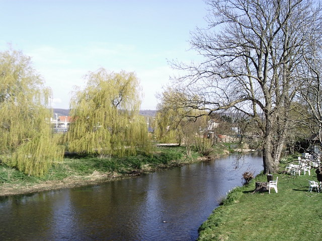
English: The River Stour at Wye in Kent. The platform lighting at Wye station can be seen through the trees together with the railway signal box. For more information see the Wikipedia articles River Stour, Kent and Wye, Kent. |
| Date | 2007-04-07 |
| Source | www.geograph.org.uk |
| Author | David Kemp |
| ⧼wm-license-information-permission⧽ (⧼wm-license-information-permission-reusing-text⧽) |
Creative Commons Attribution Share-alike license 2.0 |
| ⧼wm-license-cc-attribution⧽ (قالب:I18n/Credit line) |
David Kemp / Great Stour at Wye / |
51°11′05″N 0°55′49″E / 51.18464°N 0.9303°E
_heading:22)
| Object location | ملف:Compass-icon bb NNE.svg | View all coordinates using: OpenStreetMap |
|---|
_heading:22.00&language=⧼lang⧽)
تاريخ الملف
اضغط على زمن/تاريخ لرؤية الملف كما بدا في هذا الزمن.
| زمن/تاريخ | صورة مصغرة | الأبعاد | مستخدم | تعليق | |
|---|---|---|---|---|---|
| حالي | ★ مراجعة معتمدة 17:25، 13 أكتوبر 2023 | | 640 × 480 (116 كيلوبايت) | Pastakhov (نقاش | مساهمات) | Upload https://upload.wikimedia.org/wikipedia/commons/8/80/Great_Stour_at_Wye.jpg |
لا يمكنك استبدال هذا الملف.
وصلات
لا يوجد صفحات تصل لهذه الصورة.