ملف:Flood Basalt Map.jpg
حجم هذه المعاينة: 800 × 500 بكسل. البعد الآخر: 1٬152 × 720 بكسل.
الملف الأصلي (1٬152 × 720 بكسل حجم الملف: 138 كيلوبايت، نوع MIME: image/jpeg)
وصف قصير
| Description |
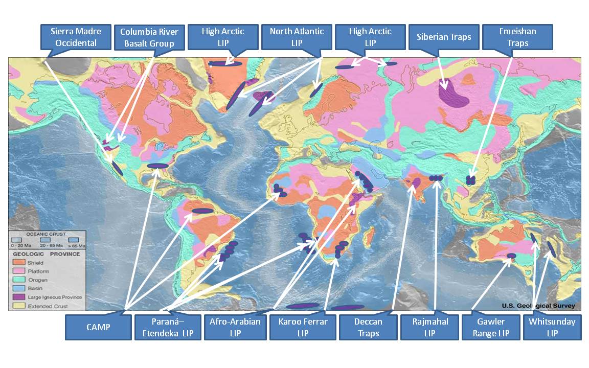
English: This file is an identification of large igneous provinces overlaid on a map produced by United States National Oceanic and Atmosphere Administration's National Geophysical Data Center. Intended for use in the Large igneous province page. |
| Date | 2011-08-03 |
| Source |
Own work - based on markup of  |
| Author | Williamborg |
ترخيص
|
تاريخ الملف
اضغط على زمن/تاريخ لرؤية الملف كما بدا في هذا الزمن.
| زمن/تاريخ | صورة مصغرة | الأبعاد | مستخدم | تعليق | |
|---|---|---|---|---|---|
| حالي | ★ مراجعة معتمدة 23:16، 6 نوفمبر 2023 | | 1٬152 × 720 (138 كيلوبايت) | Pastakhov (نقاش | مساهمات) | Upload https://upload.wikimedia.org/wikipedia/commons/0/02/Flood_Basalt_Map.jpg |
لا يمكنك استبدال هذا الملف.
وصلات
الصفحات التالية تحتوي على وصلة لهذه الصورة:
تصنيفات:
- Self-published work
- Volcanic plateaus
- Basalt
- World maps of volcanoes
- Geological maps of the world
- Flood basalts
- North Atlantic LIP
- Sierra Madre Occidental Volcanic Province
- Columbia River Basalt Group
- High Arctic LIP
- Siberian Traps
- Emeishan Traps
- CAMP (LIP)
- Paraná-Etendeka-LIP
- Afro-Arabian LIP
- Deccan Traps
- Rajmahal LIP
- Karoo Ferrar LIP
- Gawler Range LIP
- Whitsunday LIP
- Maps of Large Igneous Provinces
- Large Igneous Provinces