ملف:Farmland, Manor Valley - geograph.org.uk - 198958.jpg
لا توجد دقة أعلى متوفرة.
Farmland,_Manor_Valley_-_geograph.org.uk_-_198958.jpg (640 × 478 بكسل حجم الملف: 60 كيلوبايت، نوع MIME: image/jpeg)
وصف قصير
| Description |
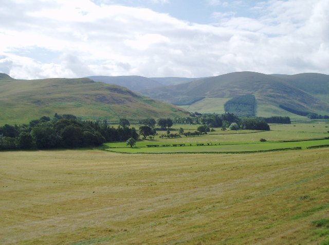
English: Farmland, Manor Valley. These fields slope down to the river, the Manor Water. In the middle distance are, on the left, the south-western slope of Cademuir Hill and, on the right, Canada Hill. |
| Date | 2006-07-08 |
| Source | From geograph.org.uk |
| Author | Eileen Henderson |
| ⧼wm-license-cc-attribution⧽ (قالب:I18n/Credit line) |
Eileen Henderson / Farmland, Manor Valley / |
55°37′37″N 3°15′07″W / 55.6269°N 3.252°W
_heading:157)
| Object location | Heading=157°  | View all coordinates using: OpenStreetMap |  |
|---|
_heading:157.00&language=⧼lang⧽)

ترخيص
 |
This image was taken from the Geograph project collection. See this photograph's page on the Geograph website for the photographer's contact details. The copyright on this image is owned by Eileen Henderson and is licensed for reuse under the Creative Commons Attribution-ShareAlike 2.0 license. |
  SA SA |
This work is licensed under the Creative Commons Attribution-ShareAlike 2.0 License. Attribution: Eileen Henderson |

تاريخ الملف
اضغط على زمن/تاريخ لرؤية الملف كما بدا في هذا الزمن.
| زمن/تاريخ | صورة مصغرة | الأبعاد | مستخدم | تعليق | |
|---|---|---|---|---|---|
| حالي | ★ مراجعة معتمدة 01:44، 13 أكتوبر 2023 | | 640 × 478 (60 كيلوبايت) | Pastakhov (نقاش | مساهمات) | Upload https://upload.wikimedia.org/wikipedia/commons/0/0b/Farmland%2C_Manor_Valley_-_geograph.org.uk_-_198958.jpg |
لا يمكنك استبدال هذا الملف.
وصلات
لا يوجد صفحات تصل لهذه الصورة.
