ملف:Dole (Arrondissement) Plan.svg

حجم معاينة PNG لذلك الملف ذي الامتداد SVG: 324 × 508 بكسل. البعد الآخر: 1٬306 × 2٬048 بكسل.
الملف الأصلي (ملف SVG، أبعاده 324 × 508 بكسل، حجم الملف: 69 كيلوبايت)
وصف قصير
| Description |
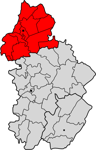
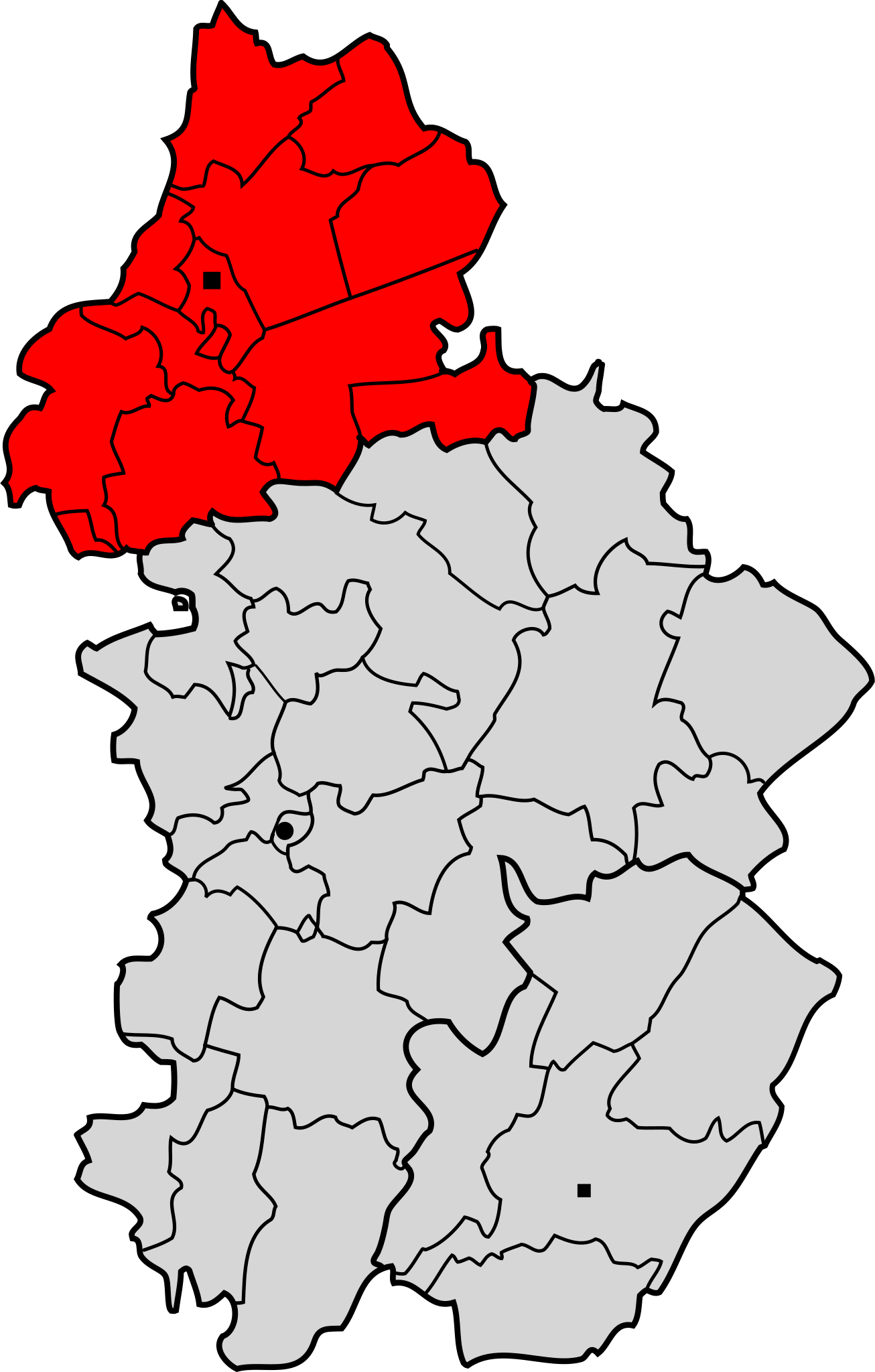
Français : Arrondissement de Dole
Deutsch: Lageplan des Arrondissements Dole im Département Jura. |
| Date | between 2007 and 2008 |
| Source | |
| Author | Pierre Audité |
ترخيص
تاريخ الملف
اضغط على زمن/تاريخ لرؤية الملف كما بدا في هذا الزمن.
| زمن/تاريخ | صورة مصغرة | الأبعاد | مستخدم | تعليق | |
|---|---|---|---|---|---|
| حالي | ★ مراجعة معتمدة 06:35، 18 يوليو 2025 | | 324 × 508 (69 كيلوبايت) | Pastakhov (نقاش | مساهمات) | Upload https://upload.wikimedia.org/wikipedia/commons/a/a8/Dole_%28Arrondissement%29_Plan.svg |
لا يمكنك استبدال هذا الملف.
وصلات
لا يوجد صفحات تصل لهذه الصورة.
_Plan.svg&oldid=4146004)