ملف:BostonCapeAnn1775.png
لا توجد دقة أعلى متوفرة.
BostonCapeAnn1775.png (766 × 551 بكسل حجم الملف: 707 كيلوبايت، نوع MIME: image/png)
وصف قصير
| Description |
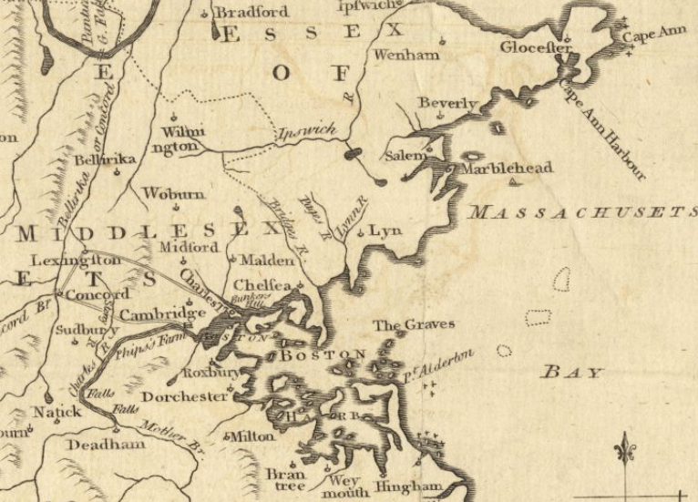
English: This is a detail from the source map, which bears this caption: A map of 100 miles round Boston. This detail is cropped to show only Boston Harbor and Cape Ann. |
| Date | 1775 |
| Source |
From the Boston Public Library Digital Maps Collection (maps.bpl.org) Call number: Call Number: G3720 1775 .M3 URL at time of upload: http://maps.bpl.org/details_10701/ |
| Author | Gentleman's Magazine (publisher); author unknown |
ترخيص
|
|
This file is in the ملكية عامة because its copyright has expired in the United States and those countries with a copyright term of no more than the life of the author plus 100 years.
|
تاريخ الملف
اضغط على زمن/تاريخ لرؤية الملف كما بدا في هذا الزمن.
| زمن/تاريخ | صورة مصغرة | الأبعاد | مستخدم | تعليق | |
|---|---|---|---|---|---|
| حالي | ★ مراجعة معتمدة 10:08، 13 أكتوبر 2023 | | 766 × 551 (707 كيلوبايت) | Pastakhov (نقاش | مساهمات) | Upload https://upload.wikimedia.org/wikipedia/commons/6/69/BostonCapeAnn1775.png |
لا يمكنك استبدال هذا الملف.
وصلات
لا يوجد صفحات تصل لهذه الصورة.