ملف:Basin of Mexico 1519 map-es.svg
حجم معاينة PNG لذلك الملف ذي الامتداد SVG: 449 × 599 بكسل. البعد الآخر: 1٬536 × 2٬048 بكسل.
الملف الأصلي (ملف SVG، أبعاده 1٬412 × 1٬883 بكسل، حجم الملف: 526 كيلوبايت)
وصف قصير
| Description |
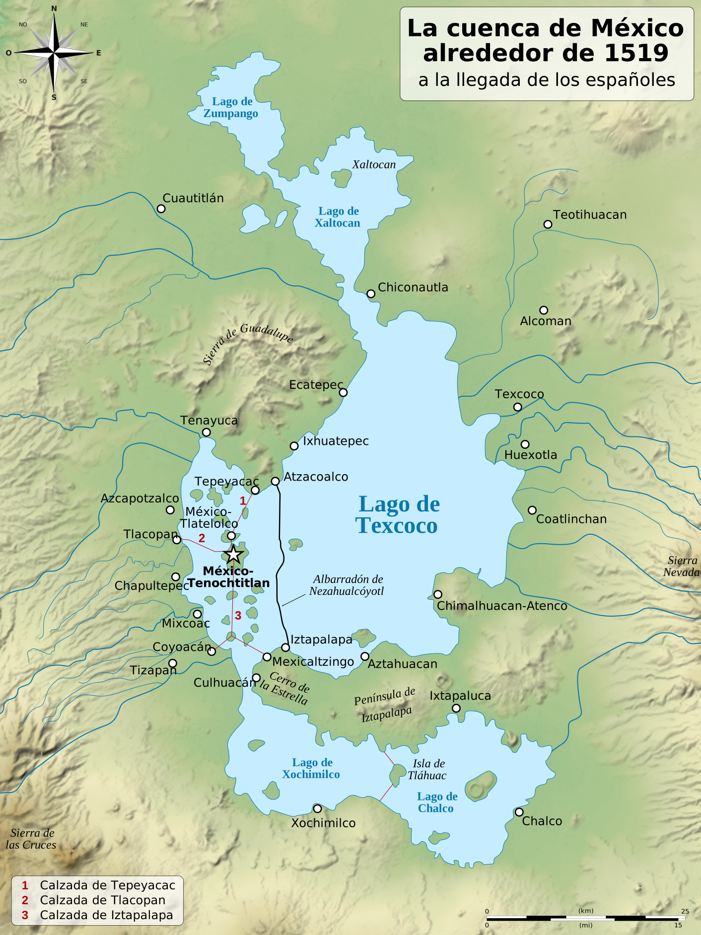
English: Map of the basin of Mexico circa 1519, at the arrival of the Spanish.
Español: Mapa de la cuenca de México en torno a 1519, a la llegada de los españoles
Français : Carte du bassin de Mexico vers 1519, à l'arrivée des Espagnols. |
| Date | 2010, {{time}} – invalid date format 03 (help) (UTC) |
| Source |
|
| Author |
|
| ⧼wm-license-information-other-versions⧽ | قالب:Other versions/Basin of Mexico 1519 map |
| ملف:Filing cabinet icon.svg | empty |
19°25′10″N 99°08′00″W / 19.4194°N 99.1333°W
ترخيص
|


⧼wm-license-original-upload-log⧽
This image is a derivative work of the following images:
- قالب:F licensed with PD-self, PD-self/fr
- 2006-09-19T01:46:06Z Yavidaxiu 1412x1644 (344123 Bytes) {{Information |Description={{es|Mapa de la cuenca de México a la llegada de los españoles}} |Source=Trabajo propio |Date=18 de septiembre de 2006 |Author=Yavidaxiu |Permission={{PD-self}} |other_versions= }} [[Category:Map
- قالب:F licensed with Cc-by-sa-2.5,2.0,1.0, Cc-by-sa-3.0-migrated, GFDL
- 2007-09-11T14:00:14Z Historicair 731x849 (270643 Bytes)
- 2007-09-11T13:51:30Z Historicair 731x849 (272818 Bytes) {{Information |Description={{fr|Les environs de Tenochtitlan vers 1519}} {{en|Valley of Mexico circa 1519}} |Source=Own work |Date=11/09/2007 |Author=~~~~ |Permission={{self2|GFDL|cc-by-sa-2.5,2.0,1.0}} |other_versions= }} {{
تاريخ الملف
اضغط على زمن/تاريخ لرؤية الملف كما بدا في هذا الزمن.
| زمن/تاريخ | صورة مصغرة | الأبعاد | مستخدم | تعليق | |
|---|---|---|---|---|---|
| حالي | ★ مراجعة معتمدة 20:13، 16 فبراير 2026 | | 1٬412 × 1٬883 (526 كيلوبايت) | Pastakhov (نقاش | مساهمات) | Upload https://upload.wikimedia.org/wikipedia/commons/b/b0/Basin_of_Mexico_1519_map-es.svg |
لا يمكنك استبدال هذا الملف.
وصلات
لا يوجد صفحات تصل لهذه الصورة.
معلومات الصورة (ميتا)

تصنيفات:
- CS1 errors: ISBN
- CS1 errors: unsupported parameter
- Pages using gadget WikiMiniAtlas
- Creative Commons Attribution-ShareAlike 1.0–4.0 files
- Self-published work
- Maps of Texcoco Lake, Mexico
- SVG maps of Mexico City
- Maps of the Aztecs
- SVG maps of the history of Mexico
- Spanish-language SVG maps showing history of Mexico
- Maps of Tenochtitlan
- Files created by User:Sémhur
- Maps by User:Sémhur
- Valley of Mexico