ملف:Arnoldafb-11mar1997.jpg
حجم هذه المعاينة: 800 × 570 بكسل. البعدان الآخران: 2٬560 × 1٬823 بكسل | 3٬300 × 2٬350 بكسل.


الملف الأصلي (3٬300 × 2٬350 بكسل حجم الملف: 3٫02 ميجابايت، نوع MIME: image/jpeg)
وصف قصير
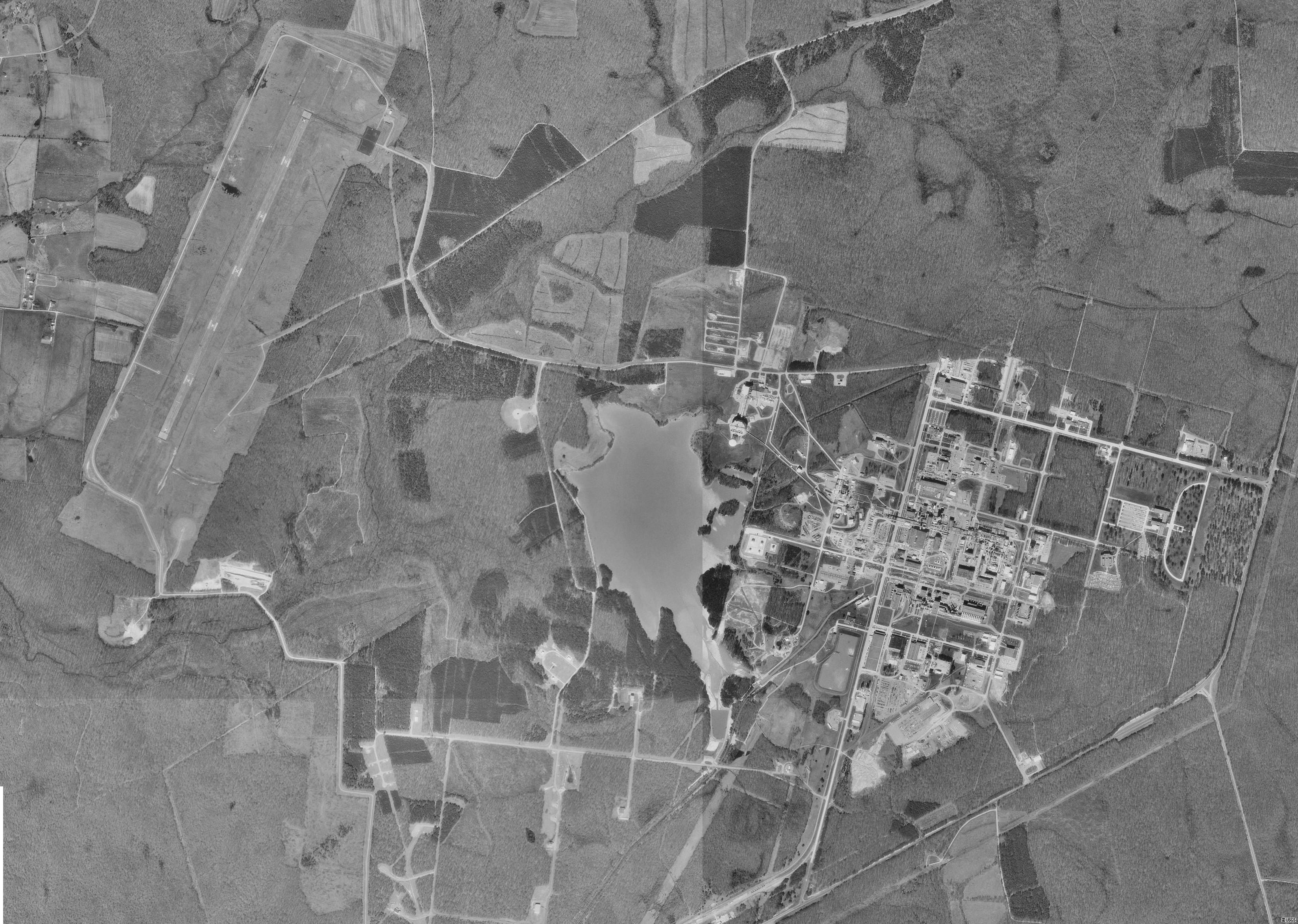
| Description | USGS digital orthophoto of Arnold Air Force Base in Tennessee, United States |
| Date | 1997; modified 2008 |
| Source |
USGS The National Map, via MSR Maps (formerly TerraServer-USA). This image is a compilation and crop of the following four images:
|
| Author | United States Geological Survey (USGS) |
| ⧼wm-license-information-permission⧽ (⧼wm-license-information-permission-reusing-text⧽) |
Public domain |
ترخيص
 |
This image is a work of a United States Geological Survey employee, taken or made as part of that person's official duties. As a work of the United States Government, the image is in the public domain in the US. For more information, see the USGS copyright policy. See Wikipedia:Public domain and Wikipedia:Copyrights for more details. |  |
⧼wm-license-original-upload-log⧽
قالب:Original description page
- 2008-01-04 11:36 Bwmoll3 416×342×8 (47391 bytes) Arnold AFB, TN - 11 Mar 1997 Source: United States Geological Survey digital orthophotoquad via TerraService WebMap Server
تاريخ الملف
اضغط على زمن/تاريخ لرؤية الملف كما بدا في هذا الزمن.
| زمن/تاريخ | صورة مصغرة | الأبعاد | مستخدم | تعليق | |
|---|---|---|---|---|---|
| حالي | ★ مراجعة معتمدة 17:38، 26 أكتوبر 2023 | | 3٬300 × 2٬350 (3٫02 ميجابايت) | Pastakhov (نقاش | مساهمات) | Upload https://upload.wikimedia.org/wikipedia/commons/6/65/Arnoldafb-11mar1997.jpg |
لا يمكنك استبدال هذا الملف.
وصلات
لا يوجد صفحات تصل لهذه الصورة.
