ملف:Ariel Way I, W12 - geograph.org.uk - 1021899.jpg
لا توجد دقة أعلى متوفرة.
Ariel_Way_I,_W12_-_geograph.org.uk_-_1021899.jpg (640 × 480 بكسل حجم الملف: 83 كيلوبايت، نوع MIME: image/jpeg)
وصف قصير
| Description |
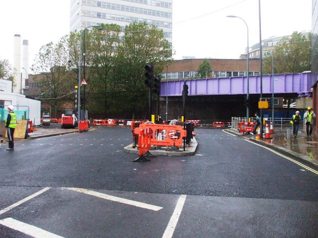
English: Ariel Way I, W12 The road has been widened, traffic lights being installed, and you can see where the new tarmac has been laid all for the new shopping centre and one of the new bus stations on the left of this picture opening on Thursday October 30 2008. |
| Date | 2008-10-26 |
| Source | From geograph.org.uk |
| Author | Phillip Perry |
| ⧼wm-license-cc-attribution⧽ (قالب:I18n/Credit line) |
Phillip Perry / Ariel Way I, W12 / |
51°30′34″N 0°13′24″W / 51.50947°N 0.2233°W
_heading:270)
| Object location | ملف:Compass-icon bb W.svg | View all coordinates using: OpenStreetMap |
|---|
_heading:270.00&language=⧼lang⧽)
ترخيص
تاريخ الملف
اضغط على زمن/تاريخ لرؤية الملف كما بدا في هذا الزمن.
| زمن/تاريخ | صورة مصغرة | الأبعاد | مستخدم | تعليق | |
|---|---|---|---|---|---|
| حالي | ★ مراجعة معتمدة 06:07، 12 نوفمبر 2023 | | 640 × 480 (83 كيلوبايت) | Pastakhov (نقاش | مساهمات) | Upload https://upload.wikimedia.org/wikipedia/commons/4/4c/Ariel_Way_I%2C_W12_-_geograph.org.uk_-_1021899.jpg |
لا يمكنك استبدال هذا الملف.
وصلات
لا يوجد صفحات تصل لهذه الصورة.