ملف:Aerial image of Schloss Charlottenburg (view from the southwest).jpg
حجم هذه المعاينة: 800 × 528 بكسل. البعدان الآخران: 2٬560 × 1٬691 بكسل | 5٬300 × 3٬500 بكسل.
الملف الأصلي (5٬300 × 3٬500 بكسل حجم الملف: 9٫92 ميجابايت، نوع MIME: image/jpeg)
وصف قصير
| Description |
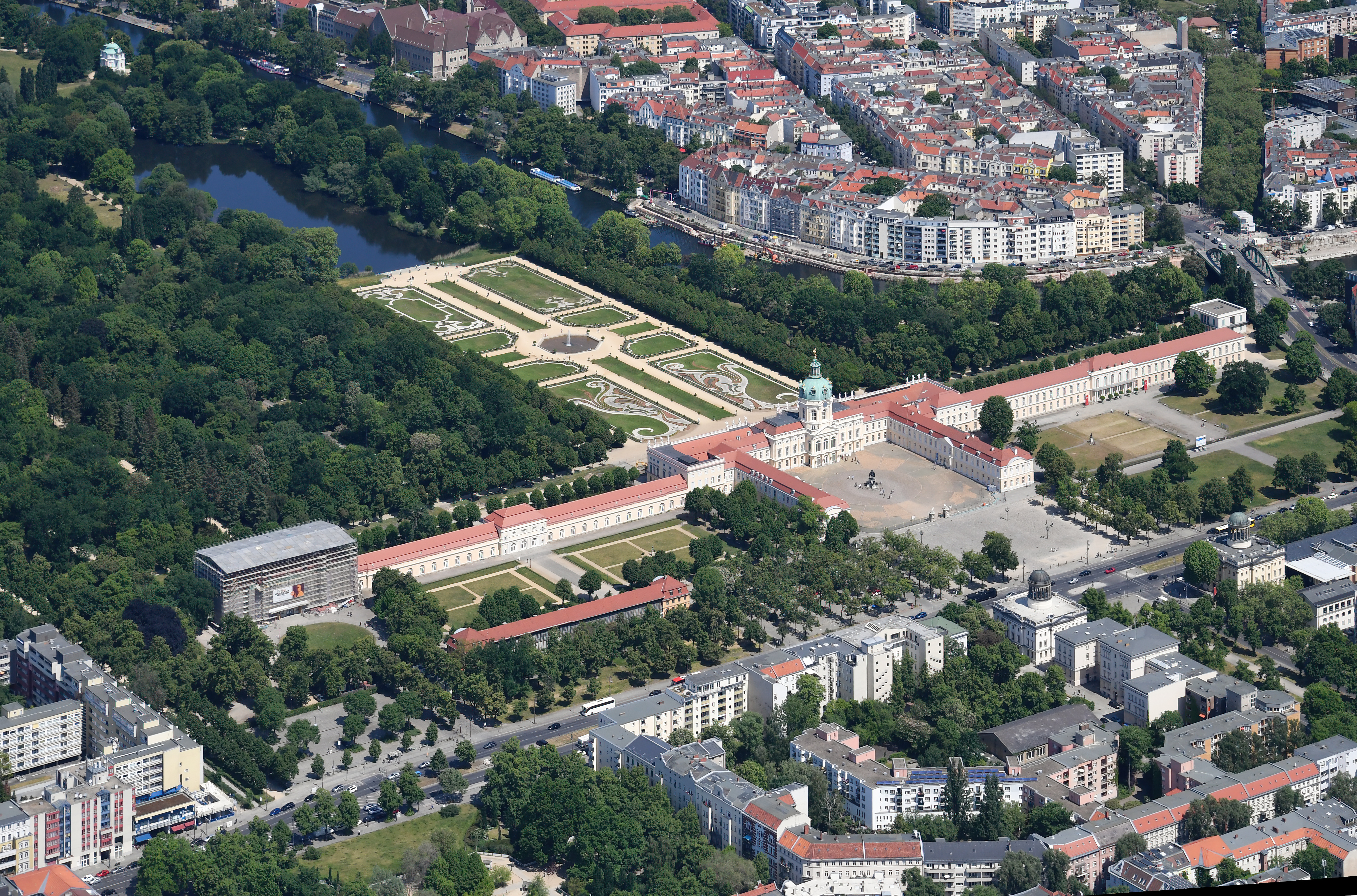
English: Aerial image of Schloss Charlottenburg (view from the southwest)
Deutsch: Luftbild des Schlosses Charlottenburg (Ansicht von Südwesten) قالب:Kulturdenkmal |
| Date | 2023-05-27 12:42:03 |
| Source | Own work |
| Author | Carsten Steger |
52°30′34″N 13°16′58″E / 52.509444°N 13.282778°E
.jpg¶ms=52.509444_N_13.282778_E_heading:35)
| Object location | | View all coordinates using: OpenStreetMap |
|---|
.jpg¶ms=052.520944_N_0013.295722_E_globe:Earth_class:object_type:object__&language=⧼lang⧽)
ترخيص
|
تاريخ الملف
اضغط على زمن/تاريخ لرؤية الملف كما بدا في هذا الزمن.
| زمن/تاريخ | صورة مصغرة | الأبعاد | مستخدم | تعليق | |
|---|---|---|---|---|---|
| حالي | ★ مراجعة معتمدة 21:20، 18 ديسمبر 2023 | | 5٬300 × 3٬500 (9٫92 ميجابايت) | Pastakhov (نقاش | مساهمات) | Upload https://upload.wikimedia.org/wikipedia/commons/f/f8/Aerial_image_of_Schloss_Charlottenburg_%28view_from_the_southwest%29.jpg |
لا يمكنك استبدال هذا الملف.
وصلات
الصفحات التالية تحتوي على وصلة لهذه الصورة:
معلومات الصورة (ميتا)
.jpg&oldid=3810480)
تصنيفات:
- Pages using gadget WikiMiniAtlas
- Self-published work
- Images from Wiki Loves Monuments 2023, DE-BE
- Exterior of Charlottenburg Palace south side
- Gardens of Charlottenburg Palace
- Aerial photographs of Berlin
- Uploaded via Campaign:wlm-de-be
- Quality images from Wiki Loves Monuments 2023 in Germany
- صفحات مع الخرائط