ملف:Aeolian Islands.jpg
حجم هذه المعاينة: 396 × 599 بكسل. البعد الآخر: 2٬032 × 3٬072 بكسل.
الملف الأصلي (2٬032 × 3٬072 بكسل حجم الملف: 610 كيلوبايت، نوع MIME: image/jpeg)
وصف قصير
| Description |
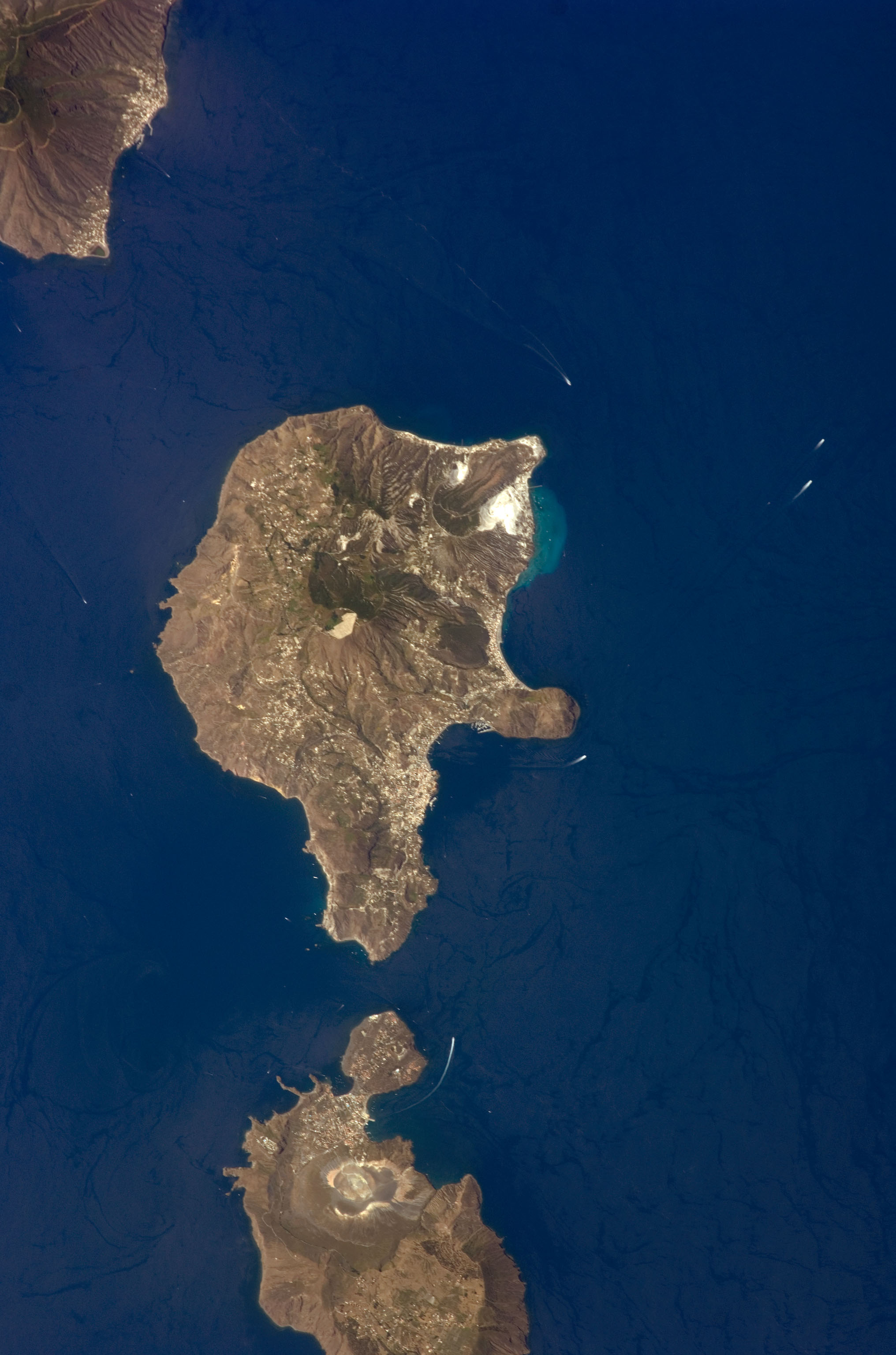
English: This detailed astronaut photograph features Lipari Island and the northern portion of Vulcano Island. Tan, speckled areas on both islands are urban areas and towns. Lipari is the largest of the Aeolian Islands, and it is a popular tourist destination due to its rugged volcanic topography and beaches (several boat wakes are visible around the islands). White pumice beaches and caves are located along the northern and northeastern coastlines of Lipari; black sand beaches derived from lava flows can also be found on the island. The most recent eruptive activity on Lipari took place from approximately AD 580–729.
قالب:ISS Crew Earth Observations |
| Date | 2008-06-24 |
| Source | NASA Earth Observatory |
| Author | This image was taken by the NASA Expedition 17 crew. |
38°30′00.0″N 14°54′00.0″E / 38.500000°N 14.900000°E قالب:NASA-image This photograph was acquired with a Nikon D2Xs digital camera fitted with a 400 mm lens, and is provided by the ISS Crew Earth Observations experiment and the Image Science & Analysis Laboratory, Johnson Space Center.
ترخيص
 |
تاريخ الملف
اضغط على زمن/تاريخ لرؤية الملف كما بدا في هذا الزمن.
| زمن/تاريخ | صورة مصغرة | الأبعاد | مستخدم | تعليق | |
|---|---|---|---|---|---|
| حالي | ★ مراجعة معتمدة 01:38، 28 أكتوبر 2023 | | 2٬032 × 3٬072 (610 كيلوبايت) | Pastakhov (نقاش | مساهمات) | Upload https://upload.wikimedia.org/wikipedia/commons/a/a6/Aeolian_Islands.jpg |
لا يمكنك استبدال هذا الملف.
وصلات
لا يوجد صفحات تصل لهذه الصورة.
معلومات الصورة (ميتا)
تصنيفات:
- Pages using gadget WikiMiniAtlas
- صور ناسا
- Taken with Nikon D2Xs
- ISS Expedition 17 Crew Earth Observations
- Satellite pictures of Aeolian Islands
- Satellite pictures of Lipari
- Vulcano Island
- Satellite pictures of volcanoes
- Submarine volcanism of Italy
- Submarine plumes
- Vulcanello
- Nested calderas of Vulcano Island
- La Fossa Caldera
- Piano Caldera
- La Fossa crater (Vulcano)
- Satellite pictures of Vulcano Island