ملف:8FranklinCounties.png
حجم هذه المعاينة: 781 × 600 بكسل. البعد الآخر: 1٬340 × 1٬029 بكسل.
الملف الأصلي (1٬340 × 1٬029 بكسل حجم الملف: 210 كيلوبايت، نوع MIME: image/png)

|
[All images in this gallery should be recreated using vector graphics as an SVG file. This has several advantages; see Commons:Media for cleanup for more information. If an SVG form of this image is already available, please upload it. After uploading an SVG, replace this template with {{vector version available|new image name.svg}}.] Error: {{Lang}}: text has italic markup (help) |
|
العربية | български | català | čeština | dansk | Deutsch | English | Esperanto | español | français | galego | 한국어 | italiano | magyar | lietuvių | 日本語 | Plattdüütsch | Nederlands | norsk | polski | português | română | русский | suomi | svenska | Türkçe | українська | 中文(繁體) | 中文(简体) | +/− | |
| Description |
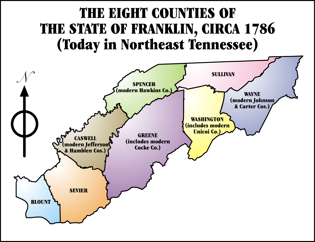
The State of Franklin (1784-1790). State of Franklin was composed of the modern Tennessee counties of:
|
||||
| Date | 2006-01-31 00:05 | ||||
| Source | I, Iamvered, drew this map myself. | ||||
| Author | Iamvered | ||||
| ⧼wm-license-information-permission⧽ (⧼wm-license-information-permission-reusing-text⧽) |
|
||||
| ⧼wm-license-information-other-versions⧽ |
|

تاريخ الملف
اضغط على زمن/تاريخ لرؤية الملف كما بدا في هذا الزمن.
| زمن/تاريخ | صورة مصغرة | الأبعاد | مستخدم | تعليق | |
|---|---|---|---|---|---|
| حالي | ★ مراجعة معتمدة 22:20، 30 أكتوبر 2023 | | 1٬340 × 1٬029 (210 كيلوبايت) | Pastakhov (نقاش | مساهمات) | Upload https://upload.wikimedia.org/wikipedia/commons/6/62/8FranklinCounties.png |
لا يمكنك استبدال هذا الملف.
وصلات
الصفحات التالية تحتوي على وصلة لهذه الصورة: