ملف:2010 Eruption at Mount Merapi, Indonesia (ASTER).jpg
حجم هذه المعاينة: 397 × 600 بكسل. البعد الآخر: 1٬558 × 2٬353 بكسل.
الملف الأصلي (1٬558 × 2٬353 بكسل حجم الملف: 609 كيلوبايت، نوع MIME: image/jpeg)
وصف قصير
| Description |
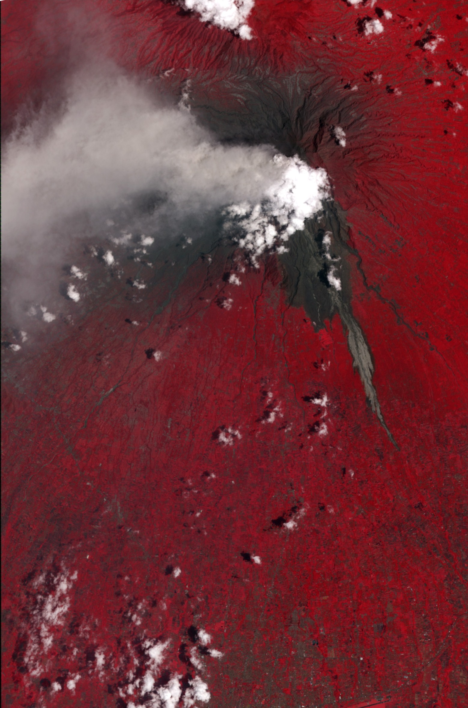
English: This false-color satellite image shows evidence of a large pyroclastic flow along the Gendol River south of Mount Merapi. Light gray volcanic deposits (either from pyroclastic flows or lahars) fill the course of the Gendol. Just north of the Merapi Golf Course (light red feature) is a much wider area where a pyroclastic flow spread across the landscape, causing almost total devastation. Within this dark gray area, most of the trees were knocked down and the ground was coated by ash and rock. The flow deposits are largely surrounded by healthy vegetation, colored bright red. A light gray ash plume extends the west of the volcano, guided by the prevailing winds. Near the plume, heavy ash-fall has coated the fields and forests, coloring them dull red to gray. |
| Date | 2010-11-15 |
| Source | NASA Earth Observatory |
| Author | NASA/GSFC/METI/ERSDAC/JAROS |
Image captured by the ASTER instrument on NASA's Terra satellite.
ترخيص
 |
تاريخ الملف
اضغط على زمن/تاريخ لرؤية الملف كما بدا في هذا الزمن.
| زمن/تاريخ | صورة مصغرة | الأبعاد | مستخدم | تعليق | |
|---|---|---|---|---|---|
| حالي | ★ مراجعة معتمدة 05:51، 2 ديسمبر 2023 | | 1٬558 × 2٬353 (609 كيلوبايت) | Pastakhov (نقاش | مساهمات) | Upload https://upload.wikimedia.org/wikipedia/commons/3/38/2010_Eruption_at_Mount_Merapi%2C_Indonesia_%28ASTER%29.jpg |
لا يمكنك استبدال هذا الملف.
وصلات
لا يوجد صفحات تصل لهذه الصورة.
.jpg&oldid=3664767)