دورست
Dorset | |||||||||||||||||||||||||||||||||||||||||||||||||||||||||||||||
|---|---|---|---|---|---|---|---|---|---|---|---|---|---|---|---|---|---|---|---|---|---|---|---|---|---|---|---|---|---|---|---|---|---|---|---|---|---|---|---|---|---|---|---|---|---|---|---|---|---|---|---|---|---|---|---|---|---|---|---|---|---|---|---|
| الشعار: "Who's Afear'd" | |||||||||||||||||||||||||||||||||||||||||||||||||||||||||||||||
 | |||||||||||||||||||||||||||||||||||||||||||||||||||||||||||||||
| الإحداثيات: 50°50′N 2°20′W / 50.833°N 2.333°W | |||||||||||||||||||||||||||||||||||||||||||||||||||||||||||||||
| البلد | المملكة المتحدة | ||||||||||||||||||||||||||||||||||||||||||||||||||||||||||||||
| المقاطعة | إنگلترة | ||||||||||||||||||||||||||||||||||||||||||||||||||||||||||||||
| المنطقة | الجنوب الغربي | ||||||||||||||||||||||||||||||||||||||||||||||||||||||||||||||
| التأسيس | التاريخية | ||||||||||||||||||||||||||||||||||||||||||||||||||||||||||||||
| منطقة التوقيت | UTC±00:00 (توقيت گرينتش المتوسط) | ||||||||||||||||||||||||||||||||||||||||||||||||||||||||||||||
| • الصيف (التوقيت الصيفي) | UTC+01:00 (توقيت بريطانيا الصيفي) | ||||||||||||||||||||||||||||||||||||||||||||||||||||||||||||||
| أعضاء البرلمان | List of MPs | ||||||||||||||||||||||||||||||||||||||||||||||||||||||||||||||
| الشرطة | Dorset Police | ||||||||||||||||||||||||||||||||||||||||||||||||||||||||||||||
| |||||||||||||||||||||||||||||||||||||||||||||||||||||||||||||||
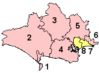
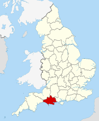
دورست (بالانجليزية: Dorset) مقاطعة إنجليزية في جنوب غرب إنجلترا. و هي مطلة على ساحل القناة الإنجليزية مركز المقاطعة هي مدينة دورشستر. يحد مقاطعة دورست مقاطعة ديفون إلى الغرب ، وسومرست إلى الشمال الغربي ويلتشاير إلى الشمال الشرقي وهامپشاير إلى الشرق و القناة الإنجليزية إلى الجنوب. حوالى نصف عدد سكان دورست يقطن في جنوب شرق المقاطعة. بقية المقاطعة ريفي الطابع إلى حد كبير مع الكثافة السكانية المنخفضه نسبيا.
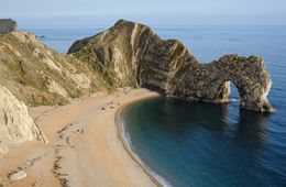
تشتهر دورست بسواحلها الجميلة، ومنها الساحل الجوراسي Jurassic Coast، الذي يحوي العديد من المعالم مثل خليج لولوورث، شاطئ شيسيل ، جزيرة پورتلاند و باب دوردل. تحوي المقاطعة العديد من البلدات التي تحوي المنتجعات مثل بلدة بورنموث، وبلدة بول، وبلدة وايموث. يتنمي للمقاطعة الأديب الانجلزي توماس هاردي.
. . . . . . . . . . . . . . . . . . . . . . . . . . . . . . . . . . . . . . . . . . . . . . . . . . . . . . . . . . . . . . . . . . . . . . . . . . . . . . . . . . . . . . . . . . . . . . . . . . . . . . . . . . . . . . . . . . . . . . . . . . . . . . . . . . . . . . . . . . . . . . . . . . . . . . . . . . . . . . . . . . . . . . . .
التاريخ
الجغرافيا الطبيعية
المناخ
قالب:Weymouth, Dorset weatherbox
الديمغرافيا
| UK Census 2011 | Dorset[1] [2][3] |
Bournemouth [4][5] |
پول [6][7] |
South West [2][3] |
England [2][3] | ||||||||||||||||||||||||
|---|---|---|---|---|---|---|---|---|---|---|---|---|---|---|---|---|---|---|---|---|---|---|---|---|---|---|---|---|---|
| التعداد | 412,905 | 183,491 | 147,645 | 5,288,935 | 53,012,456 | ||||||||||||||||||||||||
| بيض | 97.9% | 91.9% | 95.8% | 95.4% | 85.5% | ||||||||||||||||||||||||
| مختلطون | 0.8% | 2.3% | 1.3% | 1.4% | 2.2% | ||||||||||||||||||||||||
| آسيويون | 0.7% | 2.9% | 1.8% | 1.5% | 7.0% | ||||||||||||||||||||||||
| سود | 0.2% | 1.0% | 0.3% | 1.0% | 3.4% | ||||||||||||||||||||||||
| صينيون أو غيرهم | 0.3% | 1.9% | 0.8% | 0.7% | 1.7% | ||||||||||||||||||||||||
| مسيحيون | 65.3% | 57.1% | 60.4% | 60.4% | 59.4% | ||||||||||||||||||||||||
| غير المسيحيين | 1.3% | 4.6% | 2.3% | 2.5% | 8.7% | ||||||||||||||||||||||||
| لا دين | 25.2% | 30.5% | 29.7% | 29.3% | 24.7% | ||||||||||||||||||||||||
| غير مذكور | 8.0% | 7.8% | 7.6% | 7.9% | 7.2% | ||||||||||||||||||||||||
| ^ Excluding Bournemouth and Poole | |||||||||||||||||||||||||||||
| التعداد التاريخي لدورست | |||||||||||||||||||||||||||||||||||||||||||||||||||||||||||||||||||||||||||||||||
|---|---|---|---|---|---|---|---|---|---|---|---|---|---|---|---|---|---|---|---|---|---|---|---|---|---|---|---|---|---|---|---|---|---|---|---|---|---|---|---|---|---|---|---|---|---|---|---|---|---|---|---|---|---|---|---|---|---|---|---|---|---|---|---|---|---|---|---|---|---|---|---|---|---|---|---|---|---|---|---|---|---|
|
|
|
| ||||||||||||||||||||||||||||||||||||||||||||||||||||||||||||||||||||||||||||||
| Pre-1974 statistics were gathered from local government areas that now comprise Dorset المصدر: Great Britain Historical GIS.[8] | |||||||||||||||||||||||||||||||||||||||||||||||||||||||||||||||||||||||||||||||||
الاقتصاد والصناعة
| Industry | Dorset[C] [9] |
Poole [10] |
Bournemouth [11] |
Great Britain [9] | |||||||||||||||||||||||||
|---|---|---|---|---|---|---|---|---|---|---|---|---|---|---|---|---|---|---|---|---|---|---|---|---|---|---|---|---|---|
| التصنيع | 11.9% | 15.8% | 3.2% | 10.2% | |||||||||||||||||||||||||
| الإنشاءات | 5.3% | 4.6% | 3.2% | 4.8% | |||||||||||||||||||||||||
| الخدمات | 81.5% | 79% | 93.1% | 83.5% | |||||||||||||||||||||||||
| Tourism-related[B] | 10.2% | 7.7% | 12% | 8.2% | |||||||||||||||||||||||||
|
A.^ Excludes self-employed, government-supported trainees and armed forces | |||||||||||||||||||||||||||||
انظر أيضاً
- Custos Rotulorum of Dorset—list of keepers of the rolls for Dorset
- Dorset—list of MPs for the abolished Dorset county constituency
- List of High Sheriffs of Dorset
- List of hills of Dorset
- Dorset Police
- Dorset Police and Crime Commissioner
الملاحظات
الهامش
- ^ "Dorset 2016/2017". High Sheriffs Association. Retrieved 5 December 2016.
- ^ أ ب ت "Key Statistics – Ethnic Group". Office for National Statistics. 2011. Retrieved 3 February 2015.
- ^ أ ب ت "Key Statistics – Religion". Office for National Statistics. 2011. Retrieved 3 February 2015.
- ^ "Key Statistics – Ethnic Group". Office for National Statistics. 2011. Retrieved 1 February 2015.
- ^ "Key Statistics – Religion". Office for National Statistics. 2011. Retrieved 1 February 2015.
- ^ "Key Statistics – Ethnic Group". Office for National Statistics. 2011. Retrieved 3 February 2011.
- ^ "Key Statistics – Religion". Office for National Statistics. 2011. Retrieved 3 February 2011.
- ^ "Dorset Modern (post 1974) County: Total Population". A Vision of Britain through time. جامعة پورتسموث. Retrieved 10 January 2010.
- ^ أ ب "Labour Market Profile Dorset". Office for National Statistics. Archived from the original on 23 March 2012. Retrieved 20 May 2011.
{{cite web}}: Unknown parameter|deadurl=ignored (|url-status=suggested) (help) - ^ "Labour Market Profile Poole". Office for National Statistics. Archived from the original on 23 March 2012. Retrieved 20 May 2011.
{{cite web}}: Unknown parameter|deadurl=ignored (|url-status=suggested) (help) - ^ "Labour Market Profile Bournemouth". Office for National Statistics. Archived from the original on 23 March 2012. Retrieved 20 May 2011.
{{cite web}}: Unknown parameter|deadurl=ignored (|url-status=suggested) (help)
. . . . . . . . . . . . . . . . . . . . . . . . . . . . . . . . . . . . . . . . . . . . . . . . . . . . . . . . . . . . . . . . . . . . . . . . . . . . . . . . . . . . . . . . . . . . . . . . . . . . . . . . . . . . . . . . . . . . . . . . . . . . . . . . . . . . . . . . . . . . . . . . . . . . . . . . . . . . . . . . . . . . . . . .
المراجع
- Blamires, Harry (1983). A Guide to twentieth century literature in English. London: Taylor & Francis. ISBN 978-0-416-36450-7.
- Chaffey, John (2004). The Dorset Landscape, Its Scenery and Geology. Tiverton, Devon: Devon Books. ISBN 1-871164-43-5.
- Cullingford, Cecil N. (1980). A History of Dorset. Chichester, West Sussex: Phillimore & Co. ISBN 0-85033-255-9.
- Darby, H.C.; Welldon Finn, R. (2009). The Domesday Geography of South-West England. Cambridge: Cambridge University Press. ISBN 0-521-11803-4.
- Draper, Jo (2003). Dorset; The Complete Guide. Wimborne, Dorset: Dovecote Press. ISBN 0-946159-40-8.
- Ensom, Paul (1998). Discover Dorset: Geology. Wimborne, Dorset: Dovecote Press. ISBN 1-874336-52-0.
{{cite book}}: Cite has empty unknown parameter:|titlelink1=(help) - Hilliam, David (2010). The Little Book of Dorset. Stroud, Gloucestershire: The History Press. ISBN 978-0-7524-5704-8.
- Kinross, John (2003). Discovering England's smallest churches. London: Wiedenfeld & Nicholson. ISBN 1-84212-728-4.
- Lehane, Brendan (2006). Dorset's Best Churches. Wimborne, Dorset: Dovecote Press. ISBN 1-904349-41-2.
- Moxey, Sarah (1997). Avon Valley Footpath Guide. Wellington, Somerset: Halsgrove. ISBN 978-1-874448-26-6.
- Newman, John; Pevsner, Nikolaus (2002) [1972]. Dorset. The Buildings of England. London: Yale University Press. ISBN 0-300-09598-8.
- Putnam, Bill (1998). Discover Dorset: The Prehistoric Age. Wimborne, Dorset: Dovecote Press. ISBN 1-874336-62-8.
- Salmon, Arthur Leslie (1910). Dorset. Cambridge County Geographies. Cambridge: Cambridge University Press. OCLC 3761265.
- Wightman, R. (1983). Portrait of Dorset. London: Robert Hale. ISBN 0-7090-0844-9.
- Wright, John (2003). Discover Dorset, Rivers and Streams. Wimborne, Dorset: Dovecote Press. ISBN 1-904349-10-2.
- Yarrow, Anne (2009). Corfe Castle. Swindon, Wiltshire: National Trust. ISBN 978-1-84359-004-0.
- Yorke, Barbara (1995). Wessex in the Early Middle Ages. London: Continuum International Publishing Group. ISBN 978-0-7185-1856-1.
وصلات خارجية
- دورست at the Open Directory Project
 Dorset travel guide from Wikivoyage
- Dorset County Museum
- Images of Dorset at the English Heritage Archive


