جيجيانغ
| ||||||||||||||||||||||||||||||||||||||||||||||||||||||||||||||||||||||||||||||||||||||||
| ||||||||||||||||||||||||||||||||||||||||||||||||||||||||||||||||||||||||||||||||||||||||

.svg)
.svg)
ژىجيانگ/جيجيانغ } (كانت تُكتب في السابق "Chekiang تشىكيانگ" هي مقاطعة شرقية ساحلية في جمهورية الصين الشعبية. الكلمة ژىجيانگ (النهر المتعرج) كانت الاسم القديم لنهر چيانتانگ،[4] الذي يمر عبر هانگژو، العاصمة الإقليمية. اسم المقاطعة عادة ما يـُختصر إلى "ژى Zhe" (浙).
تجاور ژىجيانگ كلاً من جيانگسو وشانغهاي في الشمال، وآنهوي في شمال الغرب، وجيانگشي في الغرب، وفوجيان في الجنوب. يقع بحر شرق الصين شرق المحافظة، والذي تقع وراءه جزر ريوكيو في اليابان. يبلغ تعداد ژىجيانگ 64.6 مليون نسمة، مما يجعلها ثامن أكبر مقاطعة في الصين. المدن الأخرى الجديرة بالذكر تضم ننگبو و ونژو. وكانت تـُكنـَّى 'العمود الفقري للصين' لكونها قوة دافعة رئيسية في الاقتصاد الصيني ولكونها مسقط رأس العديد من الأشخاص البارزين، ومنهم الزعيم الصيني الوطني چيانگ كاي-شك والمبادر جاك ما. تتألف ژىجيانگ من 90 ناحية (منهم مدن بمستوى ناحية ومديريات).[5]
منطقة ژىجيانگ كانت تسيطر عليها مملكة يوى أثناء فترة الربيع والخريف. وضمتها لاحقاً امبراطورية چين في 222 ق.م. وتحت أسرة مينگ المتأخرة و أسرة تشينگ التي تلتها، أصبحت موانئ ژىجيانگ مراكز هامة للتجارة الدولية. وقد احتلتها امبراطورية اليابان أثناء الحرب الصينية اليابانية الثانية ووُضِعت تحت سيطرة دولة عميلة لليابانيين تُدعى حكومة الصين الوطنية المعاد تنظيمها. وبعد هزيمة اليابان، أصبح اقتصاد ژىجيانگ راكداً في ظل سياسات ماو زىدونگ.[6]
ومع ذلك، فبعد الإصلاح الاقتصادي الصيني، نمت مقاطعة ژىجيانگ لتصبح واحدة من أغنى مقاطعات الصين، حيث احتلت المرتبة الرابعة من حيث الناتج المحلي الإجمالي على المستوى الوطني و الخامسة من حيث ن.م.ا. للفرد، بقيمة الناتج المحلي الإجمالي الاسمي 5.62 تريليون يوان صيني¥ (849 بليون دولار) في 2018. يقوم اقتصاد ژىجيانگ على الصناعات الكهروميكانيكية و النسيج، والصناعات الكيماوية والمواد الغذائية ومواد البناء.
تتكون ژىجيانگ في الغالب من تلال، تمثل حوالي 70% من إجمالي مساحتها، بمناسيب أعلى باتجاه الجنوب والغرب. ولـژىجيانگ أطول خط حالي في الصين. نهر چيانتانگ الذي ينساب عبر المقاطعة، والذي منه اِشتـُقَّ اسمها. وضمن المقاطعة توجد ثلاثة آلاف جزيرة، وهو أكبر عدد في الصين. العاصمة هانگژو تميز نهاية القناة الكبرى وتطل على خليج هانگژو في شمال ژىجيانگ، الذي يفصل شانغهاي عن ننگبو. يضم الخليج العديد من الجزر الصغيرة التي تُسمى جمعاً جزر ژوشان.
هانگژو هي مدينة مهمة تاريخياً في الصين وتعتبر مدينة عالمية بتصنيف "Beta+" حسب GaWC.[7] وتضم البحيرة الغربية البارزة. العديد من تنويعات الصينية يتكلم بها سكان ژىجيانگ، إلا أن أبرزهم هي صينية وو.
. . . . . . . . . . . . . . . . . . . . . . . . . . . . . . . . . . . . . . . . . . . . . . . . . . . . . . . . . . . . . . . . . . . . . . . . . . . . . . . . . . . . . . . . . . . . . . . . . . . . . . . . . . . . . . . . . . . . . . . . . . . . . . . . . . . . . . . . . . . . . . . . . . . . . . . . . . . . . . . . . . . . . . . .
أصل الاسم
اسم القاطعة مشتق من نهر ژى (浙江؛ Zhè Jiāng�)، الاسم السابق لنهر چيانتانگ الذي يجري أمام هانگژو ويشكل مصبه خليج هانگژو. وعادةً ما يُفهَم بالمعنى "النهر الملوي" أو "المنثني"، من معنى الكلمة الصينية 折؛[8] ولكنه أكثر احتمالاً أن يكون مركب صوتي-دلالي تشكل من اضافة 氵 (جذر "ماء" المستخدم لأسماء الأنهار) إلى الصوت 折 (پنين zhé ولكن الصينية القديمة المعاد بناؤها *tet),[9] محافظاً على اسم من وو الأولية مملكة يوى المحلية، مماثل لكل من يوهانگ و كوايجي و جيانگ.[بحاجة لمصدر]
التاريخ
قبل التاريخ
ثقافة كواهوچياو كانت ثقافة من العصر الحجري المبكر ازدهرت في منطقة هانگژو في الفترة 6,000-5,000 ق.م.[10][11]
وكانت ژىجيانگ موقعاً لثقافات العصر الحجري الحديث هىمودو (التي بدأت في 5500 ق.م.) و ليانگژو (التي بدأت في 3400 ق.م.).[12]
التاريخ القديم
منطقة ژىجيانگ الحالية كانت خارج دائرة النفوذ الرئيسية لحضارة شانگ في الألفية الثانية ق.م. بدلاً من ذلك، كان يسكنها شعوب عـُرِفت جَمعاً بإسم دونگيوى.
بدأت مملكة يوى في الظهور في اليوميات والسجلات المكتوبة أثناء فترة الربيع والخريف. ووفقاً للتأريخات، فإن مملكة يوى كانت في شمال ژىجيانگ. ويزعم شيجي أن قادتها كانوا ينحدرون من مؤسس شيا يو الأكبر. "أغنية مراكبي يوى" (صينية: 越人歌؛ پنين: Yuèrén Gē؛ حرفياً: 'Song of the man of Yue'�) نـُسِخـَت حرفيا إلى الصينية وسجلها المؤلفون في شمال الصين أو الداخل الصيني في خىبـِيْ وهـِنان حوالي 528 ق.م. تـُظهـِر الأغنية أن شعب يوى تكلم لغةً غير مفهومة للهجات شمال وجنوب الصين، كما أنه لم يفهم لهجاتهم ولا لهجات الداخل الصيني. سيف گوجيان يحمل كتابة أختام الطيور والديدان. يوىنو (صينية: 越女؛ پنين: Yuènǚ؛ ويد–جايلز: Yüeh-nü؛ حرفياً: 'the Lady of Yue'�) كانت سيـّافة من دولة يوى. وللحد من توسع مملكة وو اتبعت تشو سياسة تقوية يوى.
تحت حكم الملك گوجيان، تعافت يوى من نكساتها المبكرة وضمت بالكامل أراضي غريمتها في 473 ق.م. ثم نقل ملوك يوى عاصمتهم من مقرها الأصلي حول جبل كوايجي في شاوشينگ الحالية إلى عاصمة وو السابقة في ما هو اليوم سوژو. وفي غياب قوة جنوبية تنقلب ضد يوى، عارضتها تشو مباشرةً، وفي 333 ق.م.، نجحت في تدميرها. أراضي يوى السابقة ضمتها امبراطورية چين في 222 ق.م. وانتظمت في قيادة مسماة على اسم كوايجي في ژىجيانگ ولكن في البداية كان مقرها في وو في جيانگسو.
هان والممالك الثلاث
قيادة كوايجي كانت مركز القوة المبدئي لتمرد شيانگ ليانگ و شيانگ يو على امبراطورية چين التي نجحت في البداية في استعادة مملكة تشو ولكنها سقطت في آخر الأمر أمام هان. وتحت هان اللاحقة، عادت السيطرة على المنطقة إلى الاستقرار تحت جبل كوايجي ولكن السلطة على ريف مينيوى كانت اسمية في أفضل الأحوال وسكانها اليُوى احتفظوا بهياكلهم السياسية والاجتماعية.
في بداية عهد الممالك الثلاث (220–280 م)، كانت ژىجيانگ مقراً لأميري الحرب يان بايهو و وانگ لانگ قبل هزيمتهما أمام سون تسى و سون چوان، اللذين أسسا لاحقاً مملكة وو. وبالرغم من نقل بلاطهم من كوايجي إلى جيانيى (نانجينگ الحالية) واستمروا في تطوير المنطقة واستفادوا من تدفق اللاجئين الفارين من الاضطراب في شمال الصين. بُنِيَت القمائن الصناعية وامتدت التجارة حتى منشوريا و فونان (ڤيتنام الجنوبية).
كانت ژىجيانگ جزءاً من وو أثناء الممالك الثلاث. وو (229–280)، التي يعرفها العامة بإسم وو الشرقية أو سون وو، كانت الدولة الأكثر تطوراً من حيث الاقتصاد بين الممالك الثلاث (220–280 م). تسجل الرواية التاريخية غراميات الممالك الثلاث أن ژىجيانگ كان لديها بحرية قوية هي الأفضل عتاداً. تصوّر القصة كيف أن دولتي وِيْ (魏) و شو (蜀)، افتقدا الموارد الطبيعية، فتحاشتا المواجهة المباشرة مع الـوو. ففي النزاعات المسلحة مع وو، اعتمدت الدولتان بشكل كثيف على تكتيكات التخفي والخداع لسرقة عتاد وو، بما في ذلك الأسهم والأقواس.
الأسرات الست
Despite the continuing prominence of Nanjing (then known as Jiankang), the settlement of چيانتانگ، الاسم السابق لـ Hangzhou, remained one of the three major metropolitan centers in the south to provide major tax revenue to the imperial centers in the north China. The other two centers in the south were Jiankang and Chengdu. في 589، رُقـِّيَت چيانتانگ في المكانة وتغير اسمها إلى هانگژو.
Following the fall of Wu and the turmoil of the Wu Hu uprising against the Jin dynasty (266–420), most of elite Chinese families had collaborated with the non-Chinese rulers and military conquerors in the north. Some may have lost social privilege and took refuge in areas south of the Yangtze River. Some of the Chinese refugees from North China might have resided in areas بالقرب من هانگژو. For example, the clan of Zhuge Liang (181–234), a chancellor of the state of Shu Han from Central Plain in north China during the Three Kingdoms period, gathered together في ضاحية هانگژو، مشكـِّلة القرية الحصرية المغلقة قرية ژوگى (Zhege Cun), consisting of villagers all with family name "Zhuge." The village has intentionally isolated itself from the surrounding communities for centuries to this day and only recently came to be known in public. It suggests that a small number of powerful, elite Chinese refugees from the Central Plain might have taken refuge south of the Yangtze River. However, considering the mountainous geography and relative lack of agrarian lands in Zhejiang, most of these refugees might have resided in some areas in South China beyond Zhejiang, where fertile agrarian lands and metropolitan resources were available, mainly Southern Jiangsu, Eastern Fujian, Jiangxi, Hunan, Anhui and provinces where less cohesive, organized regional governments had been in place. Metropolitan areas of Sichuan was another hub for refugees, given that the state of Shu had long been founded and ruled by political and military elites from the Central Plain and North China. Some refugees from North China might have found residence in South China depending on their social status and military power in the north. The rump Jin state or the Southern dynasties vied against some elite Chinese from the Central Plain and south of the Yangtze River.
عهدا سوي وتانگ
Zhejiang, as the heartland of the Jiangnan (Yangtze River Delta), remained the wealthiest area during the Six Dynasties (220 or 222–589), Sui and Tang. After being incorporated into the Sui dynasty, its economic richness was used for the Sui dynasty's ambitions to expand north and south, particularly into Korea and Vietnam. The plan led the Sui dynasty to restore and expand the network which became the Grand Canal of China. The Canal regularly transported grains and resources from Zhejiang, through its metropolitan center Hangzhou (and its hinterland along both the Zhe River and the shores of Hangzhou Bay) and from Suzhou and thence to the North China Plain. The débâcle of the Korean war led to Sui's overthrow by the Tang, who then presided over a centuries-long golden age for the country. Zhejiang was an important economic center of the empire's Jiangnan East Circuit and was considered particularly prosperous. Throughout the Tang dynasty, The Grand Canal had remained effective, transporting grains and material resources to North China plain and metropolitan centers of the empire. As the Tang dynasty disintegrated, Zhejiang constituted most of the territory of the regional kingdom of Wuyue.
عهد وويوى
,_King_of_Wuyue.jpg)
After the collapse of the Tang dynasty in 907, the entire area of what is now Zhejiang fell under the control of the kingdom Wuyue established by King Qian Liu, who selected Hangzhou (a city in the modern day area of Zhejiang) as his kingdom's capital. Despite being under Wuyue rule for a relatively short period of time, Zhejiang underwent a long period of financial and cultural prosperity which continued even after the kingdom fell.
After Wuyue was conquered during the reunification of China, many shrines were erected across the former territories of Wuyue, mainly in Zhejiang, where the kings of Wuyue were memorialised, and sometimes, worshipped as being able to dictate weather and agriculture. Many of these shrines, known as "Shrine of the Qian King" or "Temple to the Qian King," still remain today, with the most popularly visited example being that near West Lake in Hangzhou.
China's province of Zhejiang during the 940s was also the place of origin of the Hú family (Hồ in Vietnamese) from which the founder of the Hồ Dynasty who ruled Vietnam, Emperor Hồ Quý Ly, came from.[13][14]
عهد سونگ

The Song dynasty re-established unity around 960. Under the Song, the prosperity of South China began to overtake that of North China. After the north was lost to the Jurchen Jin dynasty in 1127 following the Jingkang Incident, Hangzhou became the capital of the Song dynasty under the name Lin'an, which was renowned for its prosperity and beauty, it was suspected to have been the largest city in the world at the time.[15]
From then on, northern Zhejiang and neighboring southern Jiangsu have been synonymous with luxury and opulence in Chinese culture. The Mongol conquest and the establishment of the Yuan dynasty in 1279 ended Hangzhou's political clout, but its economy continued to prosper. The famous traveler Marco Polo visited the city, which he called "Kinsay" (after the Chinese Jingshi, meaning "Capital City") claiming it was "the finest and noblest city in the world."[16]
Greenware ceramics made from celadon had been made in the area since the 3rd-century Jin dynasty, but it returned to prominence—particularly in Longquan—during the Southern Song and Yuan. Longquan greenware is characterized by a thick unctuous glaze of a particular bluish-green tint over an otherwise undecorated light-grey porcellaneous body that is delicately potted. Yuan Longquan celadons feature a thinner, greener glaze on larger vessels with decoration and shapes derived from Middle Eastern ceramic and metalwares. These were produced in large quantities for the Chinese export trade to Southeast Asia, the Middle East and (during the Ming) Europe. By the Ming, however, production was notably deficient in quality. It is in this period that the Longquan kilns declined, to be eventually replaced in popularity and ceramic production by the kilns of Jingdezhen in Jiangxi.[17]
. . . . . . . . . . . . . . . . . . . . . . . . . . . . . . . . . . . . . . . . . . . . . . . . . . . . . . . . . . . . . . . . . . . . . . . . . . . . . . . . . . . . . . . . . . . . . . . . . . . . . . . . . . . . . . . . . . . . . . . . . . . . . . . . . . . . . . . . . . . . . . . . . . . . . . . . . . . . . . . . . . . . . . . .
فترتا يوان ومينگ

Zhejiang was finally conquered by the Mongols in the late 13th century who later established the short lived Yuan dynasty. Zhejiang became part of the much larger Jiangzhe Province.
The Ming dynasty, which drove out the Mongols in 1368, finally established the present day province of Zhejiang with its borders having little changes since this establishment.
As in other coastal provinces, number of fortresses were constructed along the Zhejiang coast during the early Ming to defend the land against pirate incursions. Some of them have been preserved or restored, such as Pucheng in the south of the province (Cangnan County).
عهد تشينگ
Under the late Ming dynasty and the Qing dynasty that followed it, Zhejiang's ports were important centers of international trade.

"In 1727 the to-min or 'idle people' of Cheh Kiang province (a Ningpo name still existing), the yoh-hu or 'music people' of Shanxi province, the si-min or 'small people' of Kiang Su (Jiangsu) province and the Tanka people or 'egg-people' of Canton (to this day the boat population there), were all freed from their social disabilities and allowed to count as free men."[18] "Cheh Kiang" is another romanization for Zhejiang. The Duomin (صينية: 惰民؛ پنين: duò mín؛ ويد–جايلز: to-min�) are a caste of outcasts in this province.
During the First Opium War, the British navy defeated Eight Banners forces at Ningbo and Dinghai. Under the terms of the Treaty of Nanking, signed in 1843, Ningbo became one of the five Chinese treaty ports opened to virtually unrestricted foreign trade. Much of Zhejiang came under the control of the Taiping Heavenly Kingdom during the Taiping Rebellion, which resulted in a considerable loss of life in the north-western and central parts of the province, sparing the rest of Zhejiang from the disastrous depopulation that occurred. In 1876, Wenzhou became Zhejiang's second treaty port. Jianghuai Mandarin speakers later came to settle in these depopulated regions of northern Zhejiang.
الفترة الجمهورية
During the Second Sino-Japanese War, which led into World War II, much of Zhejiang was occupied by Japan and placed under the control of the Japanese puppet state known as the Reorganized National Government of China. Following the Doolittle Raid, most of the B-25 American crews that came down in China eventually made it to safety with the help of Chinese civilians and soldiers. The Chinese people who helped them, however, paid dearly for sheltering the Americans. The Imperial Japanese Army began the Zhejiang-Jiangxi Campaign to intimidate the Chinese out of helping downed American airmen. The Japanese killed an estimated 250,000 civilians from the area of Hangzhou to Nanchang and also Zhuzhou while searching for Doolittle's men.[19]
فترة الجمهورية الشعبية
After the People's Republic of China took control of Mainland China in 1949, the Republic of China government based in Taiwan continued to control the Dachen Islands off the coast of Zhejiang until 1955, even establishing a rival Zhejiang provincial government there, creating a situation similar to Fujian province today. During the Cultural Revolution (1966–76), Zhejiang was in chaos and disunity and its economy was stagnant, especially during the high tide (1966–69) of the revolution. The agricultural policy favoring grain production at the expense of industrial and cash crops intensified economic hardships in the province. Mao's self-reliance policy and the reduction in maritime trade cut off the lifelines of the port cities of Ningbo and Wenzhou. While Mao invested heavily in railroads in interior China, no major railroads were built in South Zhejiang, where transportation remained poor.[6]
Zhejiang benefited less from central government investment than some other provinces due to its lack of natural resources, a location vulnerable to potential flooding from the sea and an economic base at the national average. Zhejiang, however, has been an epicenter of capitalist development in China and has led the nation in the development of a market economy and private enterprises.[6] Northeast Zhejiang, as part of the Yangtze Delta, is flat, more developed and industrial.[6]
الجغرافيا


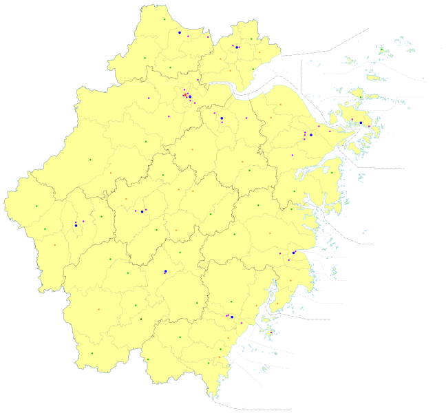
مساحتها أكبر من 100000 كيلومتر مربع (38600 ميل مربع) وعدد سكانها 46 مليون نسمة. ژجيانگ هي موطن العديد من الأقليات العرقية من بينها هان، وهواي، ومانتشو، ومياو. ژجيانگ هي أكثر محافظات الصين جزراً، لوجود أكثر من 200 جزيرة على طول ساحلها. وهي تقع على ساحل بحر الشرق.
أشهر المدن

السياحة

. . . . . . . . . . . . . . . . . . . . . . . . . . . . . . . . . . . . . . . . . . . . . . . . . . . . . . . . . . . . . . . . . . . . . . . . . . . . . . . . . . . . . . . . . . . . . . . . . . . . . . . . . . . . . . . . . . . . . . . . . . . . . . . . . . . . . . . . . . . . . . . . . . . . . . . . . . . . . . . . . . . . . . . .
التقسيمات الادارية
تنقسم ژجيانگ إلى أحد عشر تقسيماً بمستوى محافظة: كل prefecture-level cities (including two sub-provincial cities):
| التقسيمات الادارية في ژىجيانگ | |||||||||||
|---|---|---|---|---|---|---|---|---|---|---|---|
| كود التقسيم[20] | التقسيم | المساحة (كم²)[21] | تعداد 2020[22] | المقر | التقسيمات[23] | ||||||
| المديريات | النواحي | ن. ذاتية | مدن بمستوى ن. | ||||||||
| 330000 | مقاطعة ژىجيانگ | 101800.00 | 64,567,588 | مدينة هانگژو | 37 | 32 | 1 | 20 | |||
| 330100 | مدينة هانگژو | 16840.75 | 11,936,010 | Jianggan District | 10 | 2 | 1 | ||||
| 330200 | مدينة ننگبو | 9816.23 | 9,404,283 | Yinzhou District | 6 | 2 | 2 | ||||
| 330300 | مدينة ونژو | 12255.77 | 9,572,903 | Lucheng District | 4 | 5 | 3 | ||||
| 330400 | مدينة جياشينگ | 4008.75 | 5,400,868 | Nanhu District | 2 | 2 | 3 | ||||
| 330500 | مدينة هوژو | 5818.44 | 3,367,579 | Wuxing District | 2 | 3 | |||||
| 330600 | مدينة شاوشينگ | 8279.08 | 5,270,977 | Yuecheng District | 3 | 1 | 2 | ||||
| 330700 | مدينة جينهوا | 10926.16 | 7,050,683 | مديرية ووتشنگ | 2 | 3 | 4 | ||||
| 330800 | مدينة چوژو | 8841.12 | 2,276,184 | Kecheng District | 2 | 3 | 1 | ||||
| 330900 | مدينة ژوشان | 1378.00 | 1,157,817 | Dinghai District | 2 | 2 | |||||
| 331000 | مدينة تايژو | 10,083.39 | 6,622,888 | Jiaojiang District | 3 | 3 | 3 | ||||
| 331100 | مدينة ليشوي | 17298.00 | 2,507,396 | Liandu District | 1 | 6 | 1 | 1 | |||
| التقسيمات الادارية بالصينية وبمختلف طرق الرومنة | ||||
|---|---|---|---|---|
| بالعربية | بالصينية | پنين | رومنة وو | |
| Zhejiang Province | 浙江省 | Zhèjiāng Shěng | tseh koan san | |
| مدينة هانگژو | 杭州市 | Hángzhōu Shì | ghaon tseu zy | |
| مدينة ننگبو | 宁波市 | Níngbō Shì | nyin bo zy | |
| مدينة ونژو | 温州市 | Wēnzhōu Shì | uen tseu zy | |
| مدينة جياشينگ | 嘉兴市 | Jiāxīng Shì | ka shin zy | |
| مدينة هوژو | 湖州市 | Húzhōu Shì | ghou tseu zy | |
| مدينة شاوشينگ | 绍兴市 | Shàoxīng Shì | zau shin zy | |
| مدينة جينهوا | 金华市 | Jīnhuá Shì | cin gho zy | |
| مدينة چوژو | 衢州市 | Qúzhōu Shì | jiu tseu zy | |
| مدينة ژوشان | 舟山市 | Zhōushān Shì | tseu se zy | |
| مدينة تايژو | 台州市 | Tāizhōu Shì | de tseu zy | |
| مدينة ليشوي | 丽水市 | Líshuǐ Shì | li syu zy | |
The eleven prefecture-level divisions of Zhejiang are subdivided into 90 county-level divisions (36 districts, 20 county-level cities, 33 counties, and one autonomous county). Those are in turn divided into 1,570 township-level divisions (761 towns, 505 townships, 14 ethnic townships, and 290 subdistricts). Hengdian belongs to Jinhua, which is the largest base of shooting films and TV dramas in China. Hengdian World Studios is called "China's Hollywood." At the year end of 2017, the total population is 56.57 million.[24]
المناطق الحضرية
| التعداد حسب المناطق الحضرية للمحافظات ومدن النواحي | |||||
|---|---|---|---|---|---|
| # | المدينة | المساحة الحضرية[25] | مساحة المديرية[25] | City proper[25] | تاريخ التعداد |
| 1 | هانگژو[أ] | 5,162,093 | 6,241,971 | 8,700,373 | 2010-11-01 |
| (1) | Hangzhou (new districts)[أ] | 838,452 | 1,284,359 | انظر هانگژو | 2010-11-01 |
| 2 | ونژو[ب] | 2,686,825 | 3,039,439 | 9,122,102 | 2010-11-01 |
| (2) | Wenzhou (new district)[ب] | 39,193 | 87,683 | انظر ونژو | 2010-11-01 |
| 3 | ننگبو[ت] | 2,583,073 | 3,491,597 | 7,605,689 | 2010-11-01 |
| (3) | Ningbo (new district)[ت] | 239,992 | 491,697 | انظر ننگبو | 2010-11-01 |
| 4 | تايژو | 1,189,276 | 1,902,510 | 5,968,838 | 2010-11-01 |
| 5 | Cixi | 1,059,942 | 1,462,383 | see Ningbo | 2010-11-01 |
| 6 | Rui'an | 927,383 | 1,424,667 | انظر ونژو | 2010-11-01 |
| 7 | ييوو | 878,903 | 1,234,015 | see جينهوا | 2010-11-01 |
| 8 | جياشينگ | 762,643 | 1,201,882 | 4,501,657 | 2010-11-01 |
| 9 | Wenling | 749,013 | 1,366,794 | see Taizhou | 2010-11-01 |
| 10 | هوژو | 748,471 | 1,293,219 | 2893542 | 2010-11-01 |
| 11 | Yueqing | 725,972 | 1,389,332 | see Wenzhou | 2010-11-01 |
| 12 | جينهوا | 710,597 | 1,077,245 | 5,361,572 | 2010-11-01 |
| 13 | يوياو | 672,909 | 1,010,659 | see Ningbo | 2010-11-01 |
| 14 | شاوشينگ[ث] | 643,199 | 883,836 | 4,912,239 | 2010-11-01 |
| (14) | Shaoxing (new districts)[ث] | 1,297,652 | 2,188,785 | see Shaoxing | 2010-11-01 |
| 15 | ژوجي | 606,683 | 1,157,938 | see Shaoxing | 2010-11-01 |
| 16 | ژوشان | 542,190 | 842,989 | 1,121,261 | 2010-11-01 |
| 17 | Linhai | 503,377 | 1,028,813 | see Taizhou | 2010-11-01 |
| 18 | Dongyang | 455,912 | 804,398 | see Jinhua | 2010-11-01 |
| 19 | چوژو | 422,688 | 805,963 | 2,122,661 | 2010-11-01 |
| 20 | Tongxiang | 400,417 | 815,848 | see Jiaxing | 2010-11-01 |
| 21 | Haining | 397,690 | 806,966 | see Jiaxing | 2010-11-01 |
| 22 | Yongkang | 376,246 | 723,490 | see Jinhua | 2010-11-01 |
| (23) | يوهوان[ج] | 362,135 | 616,346 | see Taizhou | 2010-11-01 |
| 24 | Pinghu | 346,892 | 671,834 | see Jiaxing | 2010-11-01 |
| 25 | Shengzhou | 345,674 | 679,762 | see Shaoxing | 2010-11-01 |
| 26 | ليشوي | 293,968 | 451,418 | 2,116,957 | 2010-11-01 |
| 27 | لانشي | 208,272 | 560,514 | see Jinhua | 2010-11-01 |
| 28 | Jiangshan | 200,341 | 467,862 | see Quzhou | 2010-11-01 |
| 29 | Jiande | 183,518 | 430,750 | see Hangzhou | 2010-11-01 |
| 30 | Longquan | 117,239 | 234,626 | see Lishui | 2010-11-01 |
- ^ أ ب New districts established after census: Fuyang (Fuyang CLC), Lin'an (Lin'an CLC). These new districts not included in the urban area & district area count of the pre-expanded city.
- ^ أ ب New district established after census: Dongtou (Dongtou County). The new district not included in the urban area & district area count of the pre-expanded city.
- ^ أ ب New district established after census: Fenghua (Fenghua CLC). The new district not included in the urban area & district area count of the pre-expanded city.
- ^ أ ب New districts established after census: Keqiao (Shaoxing County), Shangyu (Shangyu CLC). These new districts not included in the urban area & district area count of the pre-expanded city.
- ^ Yuhuan County is currently known as Yuhuan CLC after census.
الاقتصاد

Zhejiang is one of the richest and most developed provinces in China. As of 2018, its nominal GDP was 849 بليون دولار (5.62 تريليون يوان صيني¥), about 6.24% of the country's GDP and ranked 4th among province-level administrative units; the province's primary, secondary and tertiary industries were worth CN¥196.70 billion (US$29.72 billion), CN¥2.3506 trillion (US$355.22 billion) and CN¥3.0724 trillion (US$464.29 billion) respectively. Its nominal GDP per capita was US$14,907 (CN¥98,643) and ranked the 5th in the country. The private sector in the province has been playing an increasingly important role in boosting the regional economy since Economic Reform in 1978.[26]
Zhejiang's main manufacturing sectors are electromechanical industries, textiles, chemical industries, food and construction materials. In recent years Zhejiang has followed its own development model, dubbed the "Zhejiang model," which is based on prioritizing and encouraging entrepreneurship, an emphasis on small businesses responsive to the whims of the market, large public investments into infrastructure, and the production of low-cost goods in bulk for both domestic consumption and export. As a result, Zhejiang has made itself one of the richest provinces and the "Zhejiang spirit" has become something of a legend within China. However, some economists now worry that this model is not sustainable, in that it is inefficient and places unreasonable demands on raw materials and public utilities, and also a dead end, in that the myriad small businesses in Zhejiang producing cheap goods in bulk are unable to move to more sophisticated or technologically more advanced industries.[27] The economic heart of Zhejiang is moving from North Zhejiang, centered on Hangzhou, southeastward to the region centered on Wenzhou and Taizhou.[6] The per capita disposable income of urbanites in Zhejiang reached 55,574 yuan (US$8,398) in 2018, an annual real growth of 8.4%. The per capita disposable income of rural residents stood at 27,302 yuan (US$4,126), a real growth of 9.4%.[28]
| ن.م.ا. التاريخي لمقاطعة ژىجيانگ، 1978 –الحاضر (SNA2008)[26] (purchasing power parity of Chinese Yuan, as Int'l. dollar based on IMF WEO October 2017[29]) | |||||||||
| year | GDP | GDP per capita (GDPpc) based on mid-year population |
Reference index | ||||||
| GDP in millions | real growth (%) |
GDPpc | exchange rate 1 foreign currency to CNY | ||||||
| يوان صيني¥ | دولار | PPP (Int'l$.) |
CNY | USD | PPP (Int'l$.) |
USD 1 | Int'l$. 1 (PPP) | ||
| 2018 | 5,619,715 | 849,233 | 1,597,709 | 7.1 | 98,643 | 14,907 | 28,046 | 6.6174 | 3.5888 |
| 2017 | 5,176,826 | 766,732 | 1,442,495 | 7.8 | 92,057 | 13,634 | 25,651 | 6.7518 | 3.5888 |
| 2016 | 4,725,136 | 711,370 | 1,349,692 | 7.6 | 84,916 | 12,784 | 24,255 | 6.6423 | 3.5009 |
| 2015 | 4,288,649 | 688,564 | 1,208,240 | 8.0 | 77,644 | 12,466 | 21,875 | 6.2284 | 3.5495 |
| 2014 | 4,017,303 | 653,986 | 1,131,507 | 7.6 | 73,002 | 11,884 | 20,562 | 6.1428 | 3.5504 |
| 2013 | 3,775,658 | 609,646 | 1,055,567 | 8.2 | 68,805 | 11,110 | 19,236 | 6.1932 | 3.5769 |
| 2012 | 3,473,913 | 550,323 | 978,347 | 8.0 | 63,508 | 10,061 | 17,886 | 6.3125 | 3.5508 |
| 2011 | 3,236,338 | 501,074 | 923,217 | 9.0 | 59,331 | 9,186 | 16,925 | 6.4588 | 3.5055 |
| 2010 | 2,774,765 | 409,892 | 838,146 | 11.9 | 51,758 | 7,646 | 15,634 | 6.7695 | 3.3106 |
| 2005 | 1,341,768 | 163,796 | 469,314 | 12.8 | 27,062 | 3,304 | 9,466 | 8.1917 | 2.8590 |
| 2000 | 614,103 | 74,181 | 225,831 | 11.0 | 13,415 | 1,620 | 4,933 | 8.2784 | 2.7193 |
| 1995 | 355,755 | 42,600 | 130,342 | 16.8 | 8,149 | 976 | 2,986 | 8.3510 | 2.7294 |
| 1990 | 90,469 | 18,914 | 53,136 | 3.9 | 2,138 | 447 | 1,256 | 4.7832 | 1.7026 |
| 1985 | 42,916 | 14,614 | 30,617 | 21.7 | 1,067 | 363 | 761 | 2.9366 | 1.4017 |
| 1980 | 17,992 | 12,007 | 12,031 | 16.4 | 471 | 314 | 315 | 1.4984 | 1.4955 |
| 1978 | 12,372 | 7,349 | 21.9 | 331 | 197 | 1.6836 | |||
الديمغرافيا

| تاريخ التعداد | |||||||||||||||||||||||||||||||||||||
|---|---|---|---|---|---|---|---|---|---|---|---|---|---|---|---|---|---|---|---|---|---|---|---|---|---|---|---|---|---|---|---|---|---|---|---|---|---|
|
| ||||||||||||||||||||||||||||||||||||
الدين
Islam arrived 1,400 years ago in Zhejiang. Today Islam is practiced by a small number of people including virtually all the Hui Chinese living in Zhejiang.[41] Another religion present in the province is She shamanism (practiced by She ethnic minority).
|


ملاحظات
- ^ The data was collected by the Chinese General Social Survey (CGSS) of 2009 and by the Chinese Spiritual Life Survey (CSLS) of 2007, reported and assembled by Xiuhua Wang (2015)[40] in order to confront the proportion of people identifying with two similar social structures: ① Christian churches, and ② the traditional Chinese religion of the lineage (i. e. people believing and worshipping ancestral deities often organised into lineage "churches" and ancestral shrines). Data for other religions with a significant presence in China (deity cults, Buddhism, Taoism, folk religious sects, Islam, et. al.) was not reported by Wang.
- ^ قد تضم أيضاً عدداً ضئيلاً من المسلمين.
مراجع
- ^ "Communiqué of the Seventh National Population Census (No. 3)". National Bureau of Statistics of China. 11 May 2021. Retrieved 11 May 2021.
{{cite web}}: CS1 maint: url-status (link) - ^ خطأ استشهاد: وسم
<ref>غير صحيح؛ لا نص تم توفيره للمراجع المسماةstat - ^ "Sub-national HDI - Subnational HDI - Global Data Lab". globaldatalab.org. Retrieved 2020-04-17.
- ^ أصول أسماء مقاطعات الصين، جريدة الشعب الصينية.
- ^ "区划人口". www.zj.gov.cn. Retrieved 2021-02-13.
- ^ أ ب ت ث ج Wei, Yehua Dennis; Ye, Xinyue (2004-02-16). "Regional Inequality in China: A Case Study of Zhejiang Province". Tijdschrift voor Economische en Sociale Geografie. 95: 44–60. doi:10.1111/j.0040-747X.2004.00292.x. Retrieved 2013-09-10.[dead link]
- ^ "GaWC - The World According to GaWC 2018". www.lboro.ac.uk. Archived from the original on 3 May 2017. Retrieved 2019-06-12.
- ^ People's Daily Online. "Origin of the Names of China's Provinces Archived 27 أبريل 2016 at the Wayback Machine." (in صينية).
- ^ Baxter, William & al. Baxter-Sagart Old Chinese Reconstruction. Accessed 20 May 2012.
- ^ Leping Jiang & Li Liu, اكتشاف كانو منحوت عمره 8000 سنة في كواهوچياو في أسفل نهر يانگزي، الصين. Archived 27 سبتمبر 2016 at the Wayback Machine antiquity.ac.uk
- ^ Yang, Xiaoyan; Zheng, Yunfei; Crawford, Gary W.; Chen, Xugao (2014). "أدلة أثرية على زراعة واستئناس الخوخ (Prunus persica) في الصين". PLOS ONE. 9 (9): e106595. Bibcode:2014PLoSO...9j6595Z. doi:10.1371/journal.pone.0106595. ISSN 1932-6203. PMC 4156326. PMID 25192436.
{{cite journal}}: CS1 maint: unflagged free DOI (link) - ^ Hays, Jeffrey. "HEMUDU, LIANGZHU AND MAJIABANG: CHINA'S LOWER YANGTZE NEOLITHIC CULTURES | Facts and Details". factsanddetails.com (in الإنجليزية). Archived from the original on 28 November 2018. Retrieved 2018-11-28.
- ^ K. W. Taylor (9 May 2013). A History of the Vietnamese. Cambridge University Press. pp. 166–. ISBN 978-0-521-87586-8. Archived from the original on 24 February 2017. Retrieved 29 October 2016.
- ^ Kenneth R. Hall (2008). Secondary Cities and Urban Networking in the Indian Ocean Realm, C. 1400-1800. Lexington Books. pp. 161–. ISBN 978-0-7391-2835-0. Archived from the original on 4 May 2017. Retrieved 29 October 2016.
- ^ "Largest Cities Through History". Geography.about.com. 2013-07-19. Archived from the original on 27 May 2005. Retrieved 2013-09-10.
- ^ "Internet History Sourcebooks Project". sourcebooks.fordham.edu. Archived from the original on 13 April 2019. Retrieved 13 April 2019.
- ^ Vainker, Shelaugh. Chinese Pottery and Porcelain. London: British Museum Press, 1991.
- ^ Edward Harper Parker (1903). China, past and present. London: Chapman and Hall, ld. p. 404. Archived from the original on 3 June 2013. Retrieved 2012-02-28.
the lot of both Manchu and Chinese bondsmen. In 1727 the to-min or "idle people " of Cheh Kiang province (a Ningpo name still existing), the yoh-hu or " music people " of Shan Si province, the si-min or "small people " of Kiang Su province, and the tan-ka or "egg-people" of Canton (to this day the boat population there), were all freed from their social disabilities, and allowed to count as free men. So far as my own observations go, after residing for a quarter of a century in half the provinces of China, north, south, east, and west, I should be inclined to describe slavery in China as totally invisible to the naked eye ; personal liberty is absolute where feebleness or ignorance do not expose the subject to the rapacity of mandarins, relatives, or speculators. Even savages and foreigners are welcomed as equals, so long as they conform unreservedly to Chinese custom. On the other hand, the oldfashioned social disabilities of policemen, barbers, and playactors still exist in the eyes of the law, though any idea of caste is totally absent therefrom, and "unofficially" these individuals are as good as any other free men. Having now taken a cursory view of Chinese slavery from its historical aspect, let us see what it is in practice. Though the penal code forbids and annuls the sale into slavery of free persons, even by a husband, father, or grandfather, yet the number of free persons who are sold or sell themselves to escape starvation and misery is considerable. It is nominally a punishable offence to keep a free man or lost child as a slave; also for parents to sell their children without the consent of the latter, or to drown their girls; but in practice the law is in both cases ignored, and scarcely ever enforced ; a fortiori the minor offence of selling children, even with their consent. Indeed, sales of girls for secondary wives is of daily occurrence, and, as we have seen, the Emperors Yung-cheng and K'ien-lung explicitly recognized the right of parents to sell children in times of famine, whilst the missionaries unanimously bear witness to the fact that the public sale of children in the streets—for instance, of Tientsin—was frequently witnessed during recent times of dearth. But slave markets and public sales are unknown in a general way. Occasionally old parents sell their children in order to purchase coffins for themselves. Only a few years ago a governor and a censor
- ^ "PBS Perilous Flight". Pbs.org. Archived from the original on 10 September 2017. Retrieved 2013-09-10.
- ^ 中华人民共和国县以上行政区划代码 (in الصينية المبسطة). Ministry of Civil Affairs. Archived from the original on 2 April 2015. Retrieved 11 December 2015.
- ^ Shenzhen Bureau of Statistics. 《深圳统计年鉴2014》 (in الصينية المبسطة). China Statistics Print. Archived from the original on 12 May 2015. Retrieved 2015-05-29.
- ^ Census Office of the State Council of the People's Republic of China; Population and Employment Statistics Division of the National Bureau of Statistics of the People's Republic of China (2012). 中国2010人口普查分乡、镇、街道资料 (1 ed.). Beijing: China Statistics Print. ISBN 978-7-5037-6660-2.
- ^ Ministry of Civil Affairs (August 2014). 《中国民政统计年鉴2014》 (in الصينية المبسطة). China Statistics Print. ISBN 978-7-5037-7130-9.
- ^ 中国统计年鉴—2018. National Bureau of Statistics of the People's Republic of China. Archived from the original on 6 January 2019. Retrieved 28 January 2019.
- ^ أ ب ت 中国2010年人口普查分县资料. Compiled by 国务院人口普查办公室 [Department of Population Census of the State Council], 国家统计局人口和社会科技统计司编 [Department of Population and Social Science and Statistics, National Bureau of Statistics]. Beijing: China Statistics Print. 2012. ISBN 978-7-5037-6659-6.
{{cite book}}: CS1 maint: others (link) - ^ أ ب Historical GDP of Zhejiang Province published on Zhejiang Statistical Yearbook 2017 Archived 22 ديسمبر 2017 at the Wayback Machine
- ^ "China Economy @ China Perspective". Thechinaperspective.com. 2013-09-06. Archived from the original on 8 October 2011. Retrieved 2013-09-10.
- ^ 2010年第六次全国人口普查主要数据公报. Stats.gov.cn. Archived from the original on 30 مايو 2010. Retrieved 10 سبتمبر 2013.
- ^ Purchasing power parity (PPP) for Chinese yuan is estimate according to IMF WEO (October 2017 Archived 14 فبراير 2006 at Archive-It) data; Exchange rate of CN¥ to US$ is according to State Administration of Foreign Exchange, published on China Statistical Yearbook Archived 20 أكتوبر 2015 at the Wayback Machine.
- ^ 1912年中国人口. Archived from the original on 24 September 2015. Retrieved 6 March 2014.
- ^ 1928年中国人口. Archived from the original on 24 September 2015. Retrieved 6 March 2014.
- ^ 1936-37年中国人口. Archived from the original on 24 September 2015. Retrieved 6 March 2014.
- ^ 1947年全国人口. Archived from the original on 13 September 2013. Retrieved 6 March 2014.
- ^ 中华人民共和国国家统计局关于第一次全国人口调查登记结果的公报. National Bureau of Statistics of China. Archived from the original on August 5, 2009.
- ^ 第二次全国人口普查结果的几项主要统计数字. National Bureau of Statistics of China. Archived from the original on September 14, 2012.
- ^ 中华人民共和国国家统计局关于一九八二年人口普查主要数字的公报. National Bureau of Statistics of China. Archived from the original on May 10, 2012.
- ^ 中华人民共和国国家统计局关于一九九〇年人口普查主要数据的公报. National Bureau of Statistics of China. Archived from the original on June 19, 2012.
- ^ 现将2000年第五次全国人口普查快速汇总的人口地区分布数据公布如下. National Bureau of Statistics of China. Archived from the original on August 29, 2012.
- ^ "Communiqué of the National Bureau of Statistics of People's Republic of China on Major Figures of the 2010 Population Census". National Bureau of Statistics of China. Archived from the original on July 27, 2013.
- ^ أ ب China General Social Survey 2009, Chinese Spiritual Life Survey (CSLS) 2007. Report by: Xiuhua Wang (2015, p. 15). Archived سبتمبر 25, 2015 at the Wayback Machine
- ^ خطأ استشهاد: وسم
<ref>غير صحيح؛ لا نص تم توفيره للمراجع المسماةzjsmzw presentation
وصلات خارجية
- Zhejiang Government website (بالصينية والإنگليزية واليابانية)
- Zhejiang Yiwu (بالإنگليزية)
- Zhejiang Hangzhou (بالإنگليزية)
| مقاطعات |  | |
|---|---|---|
| مناطق الحكم الذاتي | ||
| البلديات | ||
| SAR | ||
1 تايوان تطالب بها جمهورية الصين الشعبية إلا أن جمهورية الصين(ROC) تديرها. انظر الوضع السياسي لتايوان. | ||
|  | |
- CS1 maint: url-status
- Articles with dead external links from February 2019
- Articles with صينية-language sources (zh)
- CS1 maint: unflagged free DOI
- CS1 uses الصينية-language script (zh)
- CS1 الصينية المبسطة-language sources (zh-hans)
- CS1 maint: others
- Webarchive template other archives
- CS1 uses اليابانية-language script (ja)
- Short description is different from Wikidata
- Articles containing صينية-language text
- Coordinates on Wikidata
- مقالات تحتوي نصوصاً باللغة الصينية المبسطة
- Articles with unsourced statements from October 2020
- مقالات تحتوي نصوصاً باللغة الصينية
- Articles with hatnote templates targeting a nonexistent page
- ژىجيانگ
- دلتا نهر يانگتسي
- مقاطعات جمهورية الصين الشعبية
- شرق الصين
- Wu (region)
- دول وأقاليم تأسست في 1368