ملف:Wattasids - Simplified map.PNG
حجم هذه المعاينة: 560 × 600 بكسل. البعد الآخر: 636 × 681 بكسل.
الملف الأصلي (636 × 681 بكسل حجم الملف: 33 كيلوبايت، نوع MIME: image/png)
وصف قصير
| Description |
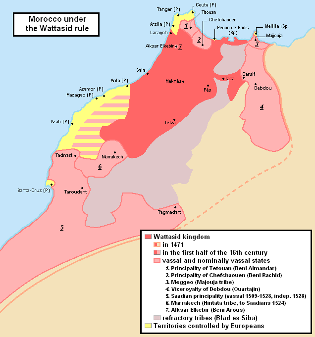
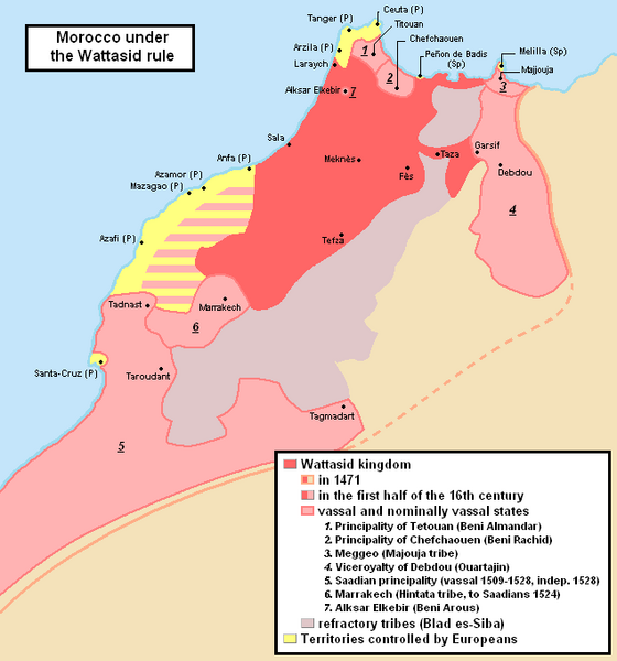
English: Simplified map of Morocco in the first half of the 15th century (Wattasid era). For the more detailed map, see File:Wattasid Morocco EN.PNG |
| Date | 2012-10-01 17:06:54 |
| Source | Own work |
| Author | Omar-toons |
| ⧼wm-license-information-other-versions⧽ | File:Wattasid Morocco EN.PNG |
ترخيص
|
تاريخ الملف
اضغط على زمن/تاريخ لرؤية الملف كما بدا في هذا الزمن.
| زمن/تاريخ | صورة مصغرة | الأبعاد | مستخدم | تعليق | |
|---|---|---|---|---|---|
| حالي | ★ مراجعة معتمدة 07:49، 18 يوليو 2025 | | 636 × 681 (33 كيلوبايت) | Pastakhov (نقاش | مساهمات) | Upload https://upload.wikimedia.org/wikipedia/commons/8/83/Wattasids_-_Simplified_map.PNG |
لا يمكنك استبدال هذا الملف.
وصلات
الصفحات التالية تحتوي على وصلة لهذه الصورة: