ملف:Staten Island (Jan Janssonius 1652).jpeg
حجم هذه المعاينة: 610 × 600 بكسل. البعدان الآخران: 2٬083 × 2٬048 بكسل | 2٬765 × 2٬719 بكسل.
الملف الأصلي (2٬765 × 2٬719 بكسل حجم الملف: 1٫5 ميجابايت، نوع MIME: image/jpeg)
وصف قصير
| Description |
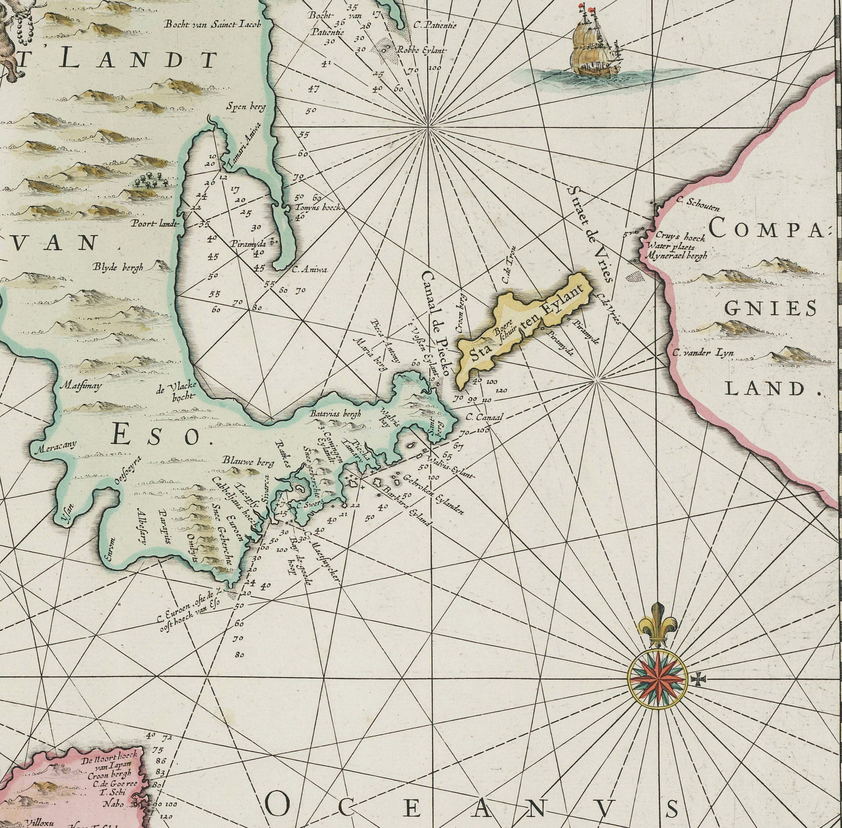
English: Nova et Accurata Iaponiae, Terrae Esonis, ac Insularum Adjacentium ex Novißimâ detectione descriptio Amstelodami Vendibilis apud P. Schenk, et G. Valk. C. P. [A New and Accurate Description of Japan, the Land of Eso (Hokkaido), and Adjacent Islands from the Newest Discovery for Sale with Legal Permission at the Shop of Pieter Schenk and Gerard Valk in Amsterdam]
A 455×550 mm copper-engraved map incorporating accounts (and gross misinformation) from the Dutch East India Company's expedition to Hokkaido and the Kurils under Maarten Gerritszoon Vries in 1643. |
| Date | 1700 [1652 original] |
| Source | Helmink Antique Maps |
| Author | صانع:Jan Janssonius |
| ⧼wm-license-information-other-versions⧽ | قالب:Extracted from |
ترخيص
|
|
This file is in the ملكية عامة because its copyright has expired in the United States and those countries with a copyright term of no more than the life of the author plus 100 years.
|
تاريخ الملف
اضغط على زمن/تاريخ لرؤية الملف كما بدا في هذا الزمن.
| زمن/تاريخ | صورة مصغرة | الأبعاد | مستخدم | تعليق | |
|---|---|---|---|---|---|
| حالي | ★ مراجعة معتمدة 11:13، 25 نوفمبر 2023 | | 2٬765 × 2٬719 (1٫5 ميجابايت) | Pastakhov (نقاش | مساهمات) | Upload https://upload.wikimedia.org/wikipedia/commons/c/cb/Staten_Island_%28Jan_Janssonius_1652%29.jpeg |
لا يمكنك استبدال هذا الملف.
وصلات
الصفحات التالية تحتوي على وصلة لهذه الصورة:
.jpeg&oldid=3588487)