ملف:Fishingcreek susquehanna rivermap.png
حجم هذه المعاينة: 596 × 600 بكسل. البعد الآخر: 1٬000 × 1٬006 بكسل.
الملف الأصلي (1٬000 × 1٬006 بكسل حجم الملف: 527 كيلوبايت، نوع MIME: image/png)
وصف قصير
| Description |
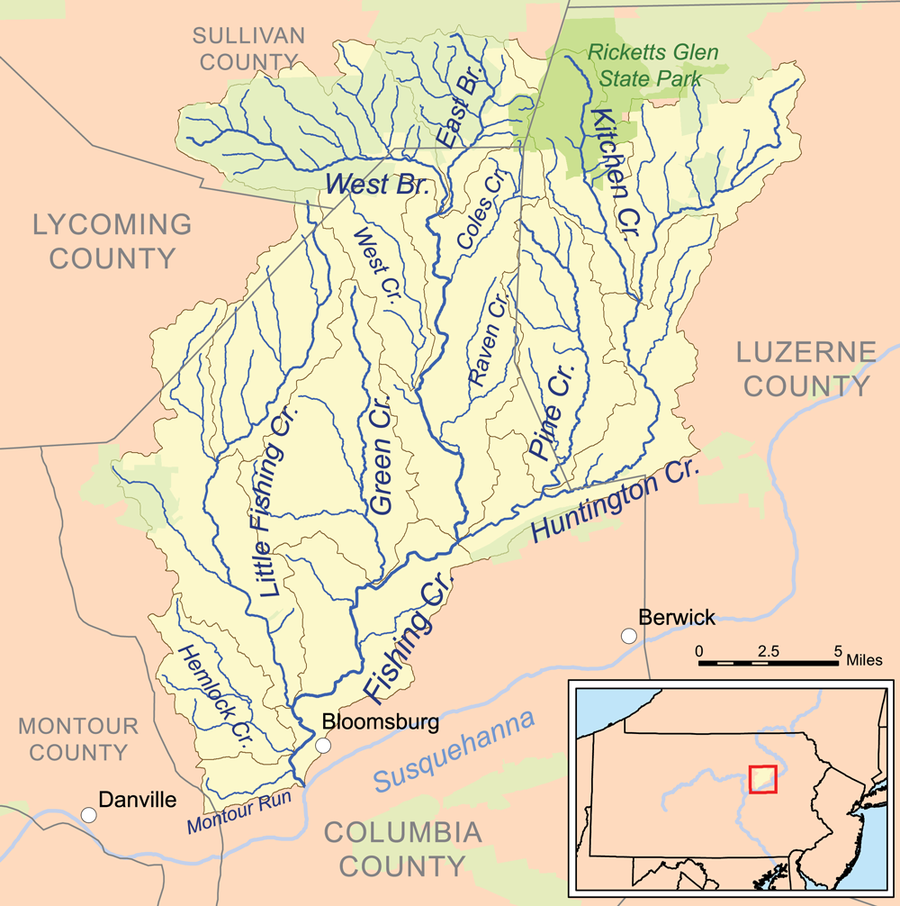
English: This is a map of the drainage basin of Fishing Creek. The drainage basin is in yellow. State protected lands are in green (primarily Pennsylvania State Game Lands). |
| Date | 2013-04-05 20:45:14 |
| Source | Own work, streams and basin boundaries are from the National Hydrography Dataset [1], state lands are from the Protected Areas Database [2], all other data are from the National Atlas [3]. |
| Author | Kmusser |
ترخيص
|
تاريخ الملف
اضغط على زمن/تاريخ لرؤية الملف كما بدا في هذا الزمن.
| زمن/تاريخ | صورة مصغرة | الأبعاد | مستخدم | تعليق | |
|---|---|---|---|---|---|
| حالي | ★ مراجعة معتمدة 15:00، 12 نوفمبر 2023 | | 1٬000 × 1٬006 (527 كيلوبايت) | Pastakhov (نقاش | مساهمات) | Upload https://upload.wikimedia.org/wikipedia/commons/6/60/Fishingcreek_susquehanna_rivermap.png |
لا يمكنك استبدال هذا الملف.
وصلات
لا يوجد صفحات تصل لهذه الصورة.