ملف:Aerial-Sal-Reis-Cape-Verde-2012.JPG
حجم هذه المعاينة: 800 × 563 بكسل. البعدان الآخران: 2٬560 × 1٬802 بكسل | 4٬351 × 3٬063 بكسل.
الملف الأصلي (4٬351 × 3٬063 بكسل حجم الملف: 1٫42 ميجابايت، نوع MIME: image/jpeg)
وصف قصير
| Description |
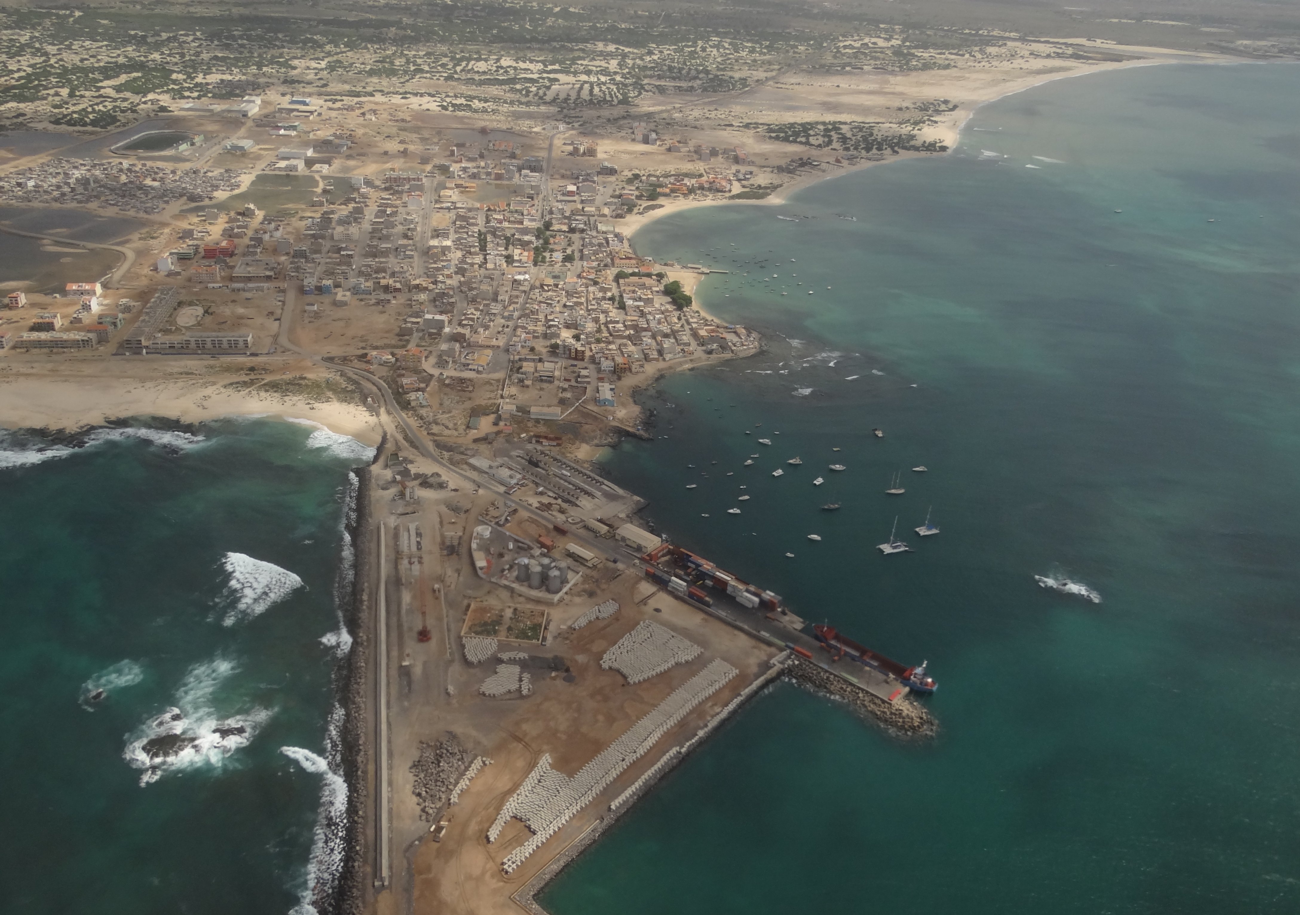
English: Sal Rei photographed from the west towards the east, from a plane.
Closest to us is the port and the ferry terminal with a few departures every week for other islands in Cape Verde. In the middle of the photo is the town centre with the town square lined with a few trees. On the left edge of the photo, below the sports stadium, is an "informal settlement", a shanty-town with few facilities available for the people. |
| Date | 2012-11-05 16:02:42 |
| Source | Own work by uploader, http://bjornfree.com/galleries.html |
| Author | Bjørn Christian Tørrissen |
16°10′34″N 22°55′2″W / 16.17611°N 22.91722°W
ترخيص
|
تاريخ الملف
اضغط على زمن/تاريخ لرؤية الملف كما بدا في هذا الزمن.
| زمن/تاريخ | صورة مصغرة | الأبعاد | مستخدم | تعليق | |
|---|---|---|---|---|---|
| حالي | ★ مراجعة معتمدة 22:38، 8 ديسمبر 2023 | | 4٬351 × 3٬063 (1٫42 ميجابايت) | Pastakhov (نقاش | مساهمات) | Upload https://upload.wikimedia.org/wikipedia/commons/3/32/Aerial-Sal-Reis-Cape-Verde-2012.JPG |
لا يمكنك استبدال هذا الملف.
وصلات
لا يوجد صفحات تصل لهذه الصورة.