جهلم
جهلم
Jhelum جِہلم | |
|---|---|
مدينة | |
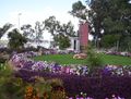
    Clockwise from top: Major Akram Shaheed Memorial, Tareekh-e-Jhelum book cover, Cantonment Square, CMH Mosque and Zamir Jaffri Cricket Stadium | |
| الكنية: | |
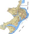
 Map of Jhelum City | |
 جهلم Jhelum Location within Pakistan  جهلم Jhelum جهلم Jhelum (پاكستان) | |
| الإحداثيات: 32°56′33″N 73°43′32″E / 32.94250°N 73.72556°ECoordinates: 32°56′33″N 73°43′32″E / 32.94250°N 73.72556°E[1] | |
| البلد | پاكستان |
| الإقليم | الپنجاب |
| الضلع | جهلم |
| Union Councils | 7 |
| الحكومة | |
| • Chairman MC | Khan Sher Bahadur Kaira (PMLN) |
| المساحة | |
| • الإجمالي | 22٫5 كم² (8٫7 ميل²) |
| المنسوب | 233 m (768 ft) |
| التعداد | |
| • الإجمالي | 190٬425 |
| • الترتيب | 44th, Pakistan |
| • الكثافة | 8٬500/km2 (22٬000/sq mi) |
| • Demonym | Jhelumi |
| اللغات | |
| • Official | الپنجابية، الأردو |
| منطقة التوقيت | UTC+5 (PKT) |
| Postal code | 49600 |
| Dialling code | 0544 |
| HDI | 829 (data for 2014–2015) ▲[4] |
| HDI Category | very high |
جهلم /ˈdʒeɪləm/ (أردو: جِہلم، بالپنجابي: جہلم)، هي مدينة على الضفة اليمنى لنهر جهلم، في ضلع جهلم، شمال الپنجاب، پاكستان. وهي تحتل الترتيب 44 كأكبر مدينة في پاكستان. تشتهر جهلم بإمداد الجيش البريطاني بالكثير من الجنود، قبل الاستقلال،[6] والقوات المسلحة الپاكستانية لاحقاً - ولذلك تشتهر باسم مدينة الجنود أو أرض الشهداء والمحاربين.[7][8]
Jhelum is a few miles upstream from the site of the ancient Battle of the Hydaspes between the armies of Alexander and King Porus. Possibly Jhelum City was the capital of Porus' Kingdom, Paurava. A city called Bucephala was founded nearby to commemorate the death of Alexander's horse, Bucephalus. Other notable sites nearby include the 16th-century Rohtas Fort, the Tilla Jogian complex of ancient temples, and the 16th-century Grand Trunk Road which passes through the city. According to the 2017 census of Pakistan, the population of Jhelum was 190,425.[9] The name of the city is derived from the words Jal (pure water) and Ham (snow), as the water that flows through the river originates in the Himalayas. There are a number of industries in and around Jhelum city, including a tobacco factory, wood, marble, glass and flour mills. Its near the capital of Pakistan.[10]
. . . . . . . . . . . . . . . . . . . . . . . . . . . . . . . . . . . . . . . . . . . . . . . . . . . . . . . . . . . . . . . . . . . . . . . . . . . . . . . . . . . . . . . . . . . . . . . . . . . . . . . . . . . . . . . . . . . . . . . . . . . . . . . . . . . . . . . . . . . . . . . . . . . . . . . . . . . . . . . . . . . . . . . .
أصل الاسم
Anjum Sultan Shahbaz recorded some stories of the name Jhelum in his book Tareekh-e-Jhelum as:[11]
| ” | Many writers have different opinions about the name of Jhelum. One suggestion is that in ancient days Jhelumabad was known as Jalham. The word Jhelum is reportedly derived from the words Jal (pure water) and Ham (snow). The name thus refers to the waters of a river (flowing besides the city) which have their origins in the snow-capped Himalayas.[12]
However, some writers believe that when "Dara-e-Azam" reached a certain place on the river bank after winning many battles, he fixed his flag at that place and called it "Ja-e-Alam" which means "Place of the Flag". With the passage of time it became Jhelum from "Ja-e-Alam". According to tradition, Saeed Bin Abi Waqas, brother of Saad Bin Abi Waqas, was sent to China to preach Islam, during his journey he arrived at the city of Jhelum, he saw the reflection of a city in the river and said "هذا جهيلم" (this is Jhelum), which means "City besides the river, in full moonlight". Ahmed Shah Abdali also used "Jheelum" in place of Jhelum and "Harian" for Kharian in his diary. |
“ |
التاريخ
التاريخ القديم
The Rajput, Gujjars, Labana,[13][14][15] who now hold the Salt Range and its northern plateau respectively, appear to have been the earliest inhabitants of Jhelum.[16] The next major point in the history of the district was the Battle of the Hydaspes between Alexander and the local ruler, Porus the Elder. Abisares (or Abhisara;[17] in Greek Αβισαρης), called Embisarus (Eμ Oβισαρoς) by Diodorus,[18] was an Indian king of the Abhira tribe.[19] descent beyond the river Hydaspes, whose territory lay in the mountains, sent embassies to Alexander both before and after the conquest of Porus in 326 BC, although inclined to espouse the side of the latter. Alexander not only allowed him to retain his kingdom but increased it, and on his death appointed his son as his successor. Porus' kingdom Paurava was on the left bank of the Jhelem River corresponding the limits of the present Gujrat District. The Gakhars appear to represent an early wave of conquerors from the west, who still inhabit a large tract in the mountain north of tilla range. Gakhars were the dominant race during the early Muslim era and they long continued to retain their independence, both in Jhelum itself and in the neighbouring district of Rawalpindi.[16]
العصور الوسطى
In 997 CE, Sultan Mahmud Ghaznavi, took over the Ghaznavid dynasty empire established by his father, Sultan Sebuktegin. In 1005 he conquered the Shahis in Kabul and followed it by the conquests of Punjab region including Jhelum. The Delhi Sultanate and later Mughal Empire ruled the region. The Punjab region became predominantly Muslim due to missionary Sufi saints whose dargahs dot the landscape of Punjab region.
The Mughals were Persianized Turks who claimed descent from both Timur and Genghis Khan and strengthened the Persianate culture of Muslim India. Being very few in number, main families of Mughal Barlas, the descent of Ameer-i Taimoor settled in Mong Rasool and afterward scattered to village chak Nazar, Shamaspur, Aima Afghana, khardiyala, Chak sikander, Malhar Muglain, Mota Garbi, Bhimber, they adopted a policy of converting the local Jats and Gakhars mandatory as recorded in the Baburnama.[20] Thus it is credited to the Mughals, who were largely responsible for the conversion of the Jats to Islam.[21]
With the collapse of the Mughal Empire after the death of Aurangzeb, the Durrani Empire had occupied the plains but were eventually ousted by the Sikhs.
الفترات اللاحقة
After the decline of the Mughal Empire, the region fell under Afghan occupation. During the decline of Afghan rule following the Third Battle of Panipat, the newly emerging Sikh Empire invaded and occupied Jhelum District in 1808 from its Gakhar ruler Raja Sultan Muqarrab Khan. In 1849 Jhelum passed with the rest of the Sikh territories to the British. The British conquered Jhelum in 1849 with the assistance of the local Gakhars who resented Sikh rule. In 1857 the 14th Native Infantry stationed at Jhelum town mutinied, and displayed a vigorous defence against a force sent from Rawalpindi to disarm them, but decamped for the night following the action, with the main body being subsequently arrested by the Kashmiri authorities, into whose territory they had escaped. They were then handed over to the British colonial authorities and executed for treason.

الراج البريطاني
During British rule, Jhelum was connected by the North-Western Railway to other cities in the Indian Empire, 1,367 miles from Calcutta, 1,413 from Bombay, and 849 from Karachi. The population according to the 1901 census of India was 14,951.[22]
According to the Imperial Gazetteer of India:
| ” | The present town is of modern origin, the old town, which may have been the Bucephala of Alexander having been, on the left or opposite bank of the river. Under Sikh rule the place was quite unimportant, being mainly occupied by a settlement of boatmen, and at the time of annexation contained about 500 houses. It was then chosen as the site of a cantonment and as the headquarters of the civil administration. For some years it was the seat of the Commissioner of the Division, but in 1859 his headquarters were transferred to Rawalpindi. Under British rule, Jhelum has steadily advanced in prosperity; and is the entrepôt for most of the trade of the District, though, since the completion of the Sind-Sāgar branch of the North-Western Railway; the salt trade no longer passes through it. It is an important timber dépôt, the timber from the Kashmir forests which is floated down the river being collected here. A good deal of boat-building is carried on. The cantonment, which is 3 miles from the civil station, contains the church and post office. The normal strength of the garrison is one Native cavalry and four Native infantry regiments. The municipality was founded in 1867. During the ten years ending 1902–3 the receipts averaged Rs. 32,100, and the expenditure Rs, 31,900. Receipts and expenditure from cantonment funds in the same period averaged Rs. 31,900 and Rs. 6,100 respectively. The chief income of the municipality in 1903-4 was Rs. 34,200 chiefly from octroi; and the expenditure was Rs. 41,000. The town has two Anglo vernacular schools, a municipal high school, and a middle school maintained by the American Presbyterian Mission. Besides the civil hospital, the mission also maintains a hospital.[22] | “ |

During the Mutiny of 1857, 35 British soldiers of the Regular 24th Regiment of Foot were killed at the Battle of Jhelum by mutineers from the Honourable East India Companies 14th Bengal Native Infantry (roughly 500 of the soldiers mutinied with roughly 100 of the Sikh soldiers remaining loyal). Among the dead was Captain Francis Spring, the eldest son of Colonel William Spring.[23] A lectern inside St John's Church Jhelum shows the names of those 35 soldiers. St John's Church is located in the Jhelum Cantonment, Pakistan beside the river Jhelum. It was built in 1860 and remains a landmark in the city. It was built as a Protestant church and was in use throughout the British period. For the past forty years, it has been closed to the public and in poor condition, however, it has since[when?] been renovated and reopened and is now maintained.
The British soldier William Connolly won a Victoria Cross for his bravery during this battle. Mirza Dildar Baig, also known as Khaki Shah, took part in the mutiny at Jhelum and was later celebrated by Indian Nationalists. He was captured and arrested with the remaining mutineers by authorities in Kashmir and later hanged near the river Jhelum. His grave is in a shrine in Jhelum Dildarnagar, and a small town in Uttar Pradesh is also named after him.
The railway bridge on the river Jhelum was built in 1873 by the British engineer William St. John Galwey. He also made the great Empress Victoria Bridge over the river Sutlej. During World War I, the Jhelum District "stood first" among districts in recruiting for the British war effort, with greater financial assistance from the British government channelled into the area in return.[24]
الاستقلال
The predominantly Muslim population supported Muslim League and Pakistan Movement. After the independence of Pakistan in 1947, the minority Hindus and Sikhs migrated to India while Muslim refugees from India settled down in the Jhelum District.
الإدارة

. . . . . . . . . . . . . . . . . . . . . . . . . . . . . . . . . . . . . . . . . . . . . . . . . . . . . . . . . . . . . . . . . . . . . . . . . . . . . . . . . . . . . . . . . . . . . . . . . . . . . . . . . . . . . . . . . . . . . . . . . . . . . . . . . . . . . . . . . . . . . . . . . . . . . . . . . . . . . . . . . . . . . . . .
الديموغرافيا
| سكان مدينة جهلم | |||
|---|---|---|---|
| Census | Pop. | %± | |
| 1961 | 52٬685 | ||
| 1972 | 70٬157 | 33.2% | |
| 1981 | 106٬462 | 51.7% | |
| 1998 | 145٬847 | 37.0% | |
| Est. 2009 | 188٬803 | ||
| Source:[25] | |||
المدينة


الجغرافيا
المناخ
| بيانات مناخ جهلم، پاكستان | |||||||||||||
|---|---|---|---|---|---|---|---|---|---|---|---|---|---|
| الشهر | يناير | فبراير | مارس | أبريل | مايو | يونيو | يوليو | أغسطس | سبتمبر | اكتوبر | نوفمبر | ديسمبر | العام |
| العظمى المتوسطة °س (°ف) | 19 (66) |
21 (69) |
27 (80) |
33 (91) |
38 (100) |
40 (104) |
36 (96) |
34 (93) |
34 (93) |
33 (91) |
27 (80) |
21 (69) |
30 (86) |
| الصغرى المتوسطة °س (°ف) | 4 (39) |
7 (44) |
12 (53) |
17 (62) |
22 (71) |
26 (78) |
26 (78) |
25 (77) |
23 (73) |
16 (60) |
9 (48) |
5 (41) |
16 (60) |
| هطول mm (inches) | 35 (1.4) |
46 (1.8) |
45 (1.8) |
32 (1.2) |
27 (1) |
51 (2) |
223 (8.8) |
225 (8.9) |
79 (3.1) |
18 (0.7) |
12 (0.5) |
25 (1) |
81٫8 (32٫2) |
| Source: Weatherbase 2015[26] | |||||||||||||
| بيانات مناخ جهلم، پاكستان | |||||||||||||
|---|---|---|---|---|---|---|---|---|---|---|---|---|---|
| الشهر | يناير | فبراير | مارس | أبريل | مايو | يونيو | يوليو | أغسطس | سبتمبر | اكتوبر | نوفمبر | ديسمبر | العام |
| العظمى القياسية °س (°ف) | 26.1 (79) |
30.7 (87.3) |
36.7 (98.1) |
43.3 (109.9) |
49.2 (120.6) |
49.0 (120.2) |
47.0 (116.6) |
42.2 (108) |
40.6 (105.1) |
37.8 (100) |
35.0 (95) |
27.8 (82) |
49٫2 (120٫6) |
| العظمى المتوسطة °س (°ف) | 19.7 (67.5) |
21.6 (70.9) |
26.6 (79.9) |
33.0 (91.4) |
38.1 (100.6) |
40.5 (104.9) |
35.9 (96.6) |
34.5 (94.1) |
35.0 (95) |
33.1 (91.6) |
27.6 (81.7) |
21.5 (70.7) |
30٫6 (87٫1) |
| المتوسط اليومي °س (°ف) | 12.3 (54.1) |
14.7 (58.5) |
19.5 (67.1) |
25.4 (77.7) |
30.1 (86.2) |
33.2 (91.8) |
30.9 (87.6) |
29.9 (85.8) |
29.0 (84.2) |
24.9 (76.8) |
18.7 (65.7) |
13.6 (56.5) |
23٫5 (74٫3) |
| الصغرى المتوسطة °س (°ف) | 5.0 (41) |
7.7 (45.9) |
12.5 (54.5) |
17.7 (63.9) |
22.0 (71.6) |
25.8 (78.4) |
25.8 (78.4) |
25.3 (77.5) |
23.0 (73.4) |
16.6 (61.9) |
9.9 (49.8) |
5.7 (42.3) |
16٫4 (61٫5) |
| الصغرى القياسية °س (°ف) | −0.6 (30.9) |
0.0 (32) |
4.0 (39.2) |
8.6 (47.5) |
13.0 (55.4) |
18.0 (64.4) |
19.4 (66.9) |
19.4 (66.9) |
15.0 (59) |
8.9 (48) |
1.1 (34) |
0.0 (32) |
−0٫6 (30٫9) |
| سقوط الأمطار mm (inches) | 33.8 (1.331) |
50.0 (1.969) |
60.5 (2.382) |
36.6 (1.441) |
31.8 (1.252) |
51.9 (2.043) |
237.3 (9.343) |
221.2 (8.709) |
77.7 (3.059) |
12.2 (0.48) |
9.9 (0.39) |
30.4 (1.197) |
853٫3 (33٫594) |
| Sunshine hours | 212.8 | 202.9 | 225.3 | 256.8 | 312.7 | 284.7 | 247.0 | 243.6 | 257.0 | 287.5 | 251.9 | 215.3 | 2٬997٫5 |
| Source: NOAA (1961–1990)[27] | |||||||||||||
. . . . . . . . . . . . . . . . . . . . . . . . . . . . . . . . . . . . . . . . . . . . . . . . . . . . . . . . . . . . . . . . . . . . . . . . . . . . . . . . . . . . . . . . . . . . . . . . . . . . . . . . . . . . . . . . . . . . . . . . . . . . . . . . . . . . . . . . . . . . . . . . . . . . . . . . . . . . . . . . . . . . . . . .
الفيضانات الرئيسية
المواقع الرئيسية


السياحة


السكك الحديدية

النقل الجوي
الاتصالات
الرياضة


التعليم
المستشفيات


الصناعات الرئيسية

معرض الصور
Map of Tehsil Jhelum
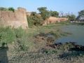
A fort in Jhelum City
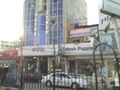
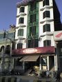
Stylo and Hush Puppies, Civil Line
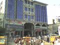
Saleem center, Civil Lines
Ladi's mart, MM#3
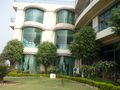
Cantonment Square, Jhelum
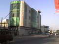
Mahfooz Plaza, Kazim Kamal Road
KFC Jhelum Cantt
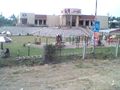
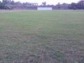
View of a match
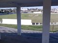
Zamir Jaffri Cricket Stadium
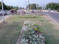
Tulip lawn Jhelum
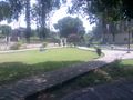
Kazim Kamal Park
Tulip hotel
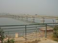
Jhelum River at Jhelum City


انظر أيضاً
- إندر كومار گرال، رئيس وزراء الهند رقم 13.
- كلية جهلم العسكرية
- ربيعة قري، أول امرأة مسلمة في المحاكم العليا بجنوب آسيا
- راولپندي
- تقسيم راولپندي
- هضبة پوتوهار
المصادر
- ^ "Location of Jhelum – Falling Rain Genomics". Fallingrain.com. Retrieved 2013-01-25.
- ^ "Weatherbase: Historical Weather for Jhelum, Pakistan". Weatherbase. 2008.
- ^ "Pakistan: Provinces and Major Cities - Population Statistics, Maps, Charts, Weather and Web Information". www.citypopulation.de.
- ^ "SOCIAL DEVELOPMENT IN PAKISTAN ANNUAL REVIEW 2014–15" (PDF). SOCIAL POLICY AND DEVELOPMENT CENTRE. 2016. Retrieved 26 March 2017.
- ^ "TRENDS IN REGIONAL HUMAN DEVELOPMENT INDICES: Table 2" (PDF). The United Nations. Archived from the original (PDF) on 21 May 2009. Retrieved 21 November 2010.
- ^ John Pike. "Dominated Recruitment". Globalsecurity.org. Retrieved 2013-01-25.
- ^ Shoaib, Syed (17 June 2009). "City of Soldiers". BBC News. Retrieved 2013-01-25.
- ^ "AAJ NEWS Report (City of martyrs and warriors)". Youtube.com. 10 February 2009. Retrieved 2013-01-25.
- ^ خطأ استشهاد: وسم
<ref>غير صحيح؛ لا نص تم توفيره للمراجع المسماةcitypop1 - ^ "Tehsil Municipal Administration Jhelum – Industries of Jhelum". Tehsil Municipal Administration Jhelum website. Archived from the original on 11 مايو 2013. Retrieved 24 يوليو 2021.
- ^ Shahbaz, Anjum Sultan (14 September 2012). Tareekh-e-Jhelum. History of Jhelum (2nd ed.). Book Corner, Main Bazar, Jhelum. p. 92. Retrieved 24 July 2021.
- ^ "The District Jhelum". Jhelum Police website. 2 March 2008. Archived from the original on 15 April 2009. Retrieved 24 July 2021.
- ^ Kapoor, Subodh (2002). Encyclopaedia of Ancient Indian Geography – Subodh Kapoor. ISBN 9788177552980. Retrieved 2013-01-25.
- ^ Kapoor, Subodh (16 July 2017). Encyclopaedia of Ancient Indian Geography. Cosmo Publications. ISBN 9788177552980 – via Google Books.
- ^ Arrian, Anabasis Alexandri, v. 8, 20, 29; Curtius Rufus, Historiae Alexandri Magni, viii. 12–14, ix. 1, x. 1
- ^ أ ب "Jhelum District Imperial Gazetteer of India, v. 14, p. 152". Digital South Asia Library website. Retrieved 24 July 2021.
- ^ Chisholm, Hugh (1910). "Alexander III (Alexander the Great)". Encyclopædia Britannica Eleventh Edition. Vol. 1.
- ^ Diodorus, Bibliotheca, xvii. 90
- ^ Enthoven, Reginald Edward (1990). The Tribes and Castes of Bombay: Ill – Reginald E. Enthoven. ISBN 9788120606302. Retrieved 24 July 2021.
- ^ "Biography of Abdur Rahim Khankhana". Archived from the original on 17 يناير 2006. Retrieved 24 يوليو 2021.
- ^ ^ a b c Robert L. Canfield, Turko-Persia in historical perspective, Cambridge University Press, 1991. pg 20: "The Mughals – Persianized Turks who invaded from Central Asia and claimed descent from both Timur and Genghis – strengthened the Persianate culture of Muslim India."
- ^ أ ب "Imperial Gazetteer of India, v. 14, p. 159-160". Digital South Asia Library website. Retrieved 24 July 2021.
- ^ The London Gazette, 19 May 1858 http://www.london-gazette.co.uk/issues/22141/pages/2492/page.pdf
- ^ The Indian Army and the Making of Punjab. Orient Blackswan. 2003. ISBN 9788178240596. Archived from the original on 19 August 2020. Retrieved 10 December 2017.
- ^ World-Gazetteer.com. "Jhelum City". Archived from the original on 18 July 2011. Retrieved 2010-09-19.
- ^ "Weatherbase: Historical Weather for Jhelum, Pakistan". Weatherbase. 2015. Retrieved 13 October 2015.
- ^ "Jhelum Climate Normals 1961–1990". National Oceanic and Atmospheric Administration. Retrieved 16 January 2012.
وصلات خارجية
- Jhelum District Official Portal
- Jhelum District UnOfficial Portal
- Jhelum Police Website
- TMA Jhelum Website
- Punjab Government website (Jhelum Profile)
 Jhelum travel guide from Wikivoyage
* تدل على عواصم إقليمية ** تدل على العاصمة الاتحادية | |

- Articles with hatnote templates targeting a nonexistent page
- Short description is different from Wikidata
- Pages using infobox settlement with possible nickname list
- Coordinates on Wikidata
- Pages using infobox settlement with unknown parameters
- Articles containing أردو-language text
- Articles containing Punjabi-language text
- Articles containing explicitly cited عربية-language text
- Vague or ambiguous time from May 2012
- جهلم
- أماكن مأهولة في پنجاب، پاكستان
- مدن پنجاب (پاكستان)