كانتون ريف بازل
| ريف بازل Basel-Landschaft | |||
| |||

| |||
| الأحداثيات | 47°7′N 7°44′E / 47.117°N 7.733°ECoordinates: 47°7′N 7°44′E / 47.117°N 7.733°E | ||
| العاصمة | ليستال | ||
| Largest city | Allschwil | ||
| عدد السكان | 269٬145 | ||
| - الكثافة | 520 /km² (1٬346 /sq mi) | ||
| المساحة | 518 كم² (200 م. م.) | ||
| أعلى نقطة | 1,169 m (3,835 ft) - Hinteri Egg | ||
| أوطى نقطة | 246 m (807 ft) - confluence of Birs river with the Rhine, at Birsfelden | ||
| Joined | 1501 | ||
| الاختصار | BL | ||
| اللغات | بالألمانية | ||
| التنفيذية | Regierungsrat (5) | ||
| التشريعية | Landrat (90) | ||
| البلديات | 86 municipalities | ||
| Districts | 5 Bezirke | ||
| الموقع الإلكتروين | BL.ch | ||
ريف بازل (بالألمانية: Basel-Landschaft ; ألمانية سويسرية: Basel-Land/Baselbiet)، هو أحد كانتونات سويسرا. العاصمة هي مدينة ليستال.
. . . . . . . . . . . . . . . . . . . . . . . . . . . . . . . . . . . . . . . . . . . . . . . . . . . . . . . . . . . . . . . . . . . . . . . . . . . . . . . . . . . . . . . . . . . . . . . . . . . . . . . . . . . . . . . . . . . . . . . . . . . . . . . . . . . . . . . . . . . . . . . . . . . . . . . . . . . . . . . . . . . . . . . .
التاريخ
الجغرافيا
السياسة
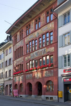
Former town hall in Liestal, the cantonal capital.
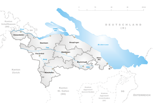
التقسيمات السياسية
الأحياء
البلديات
ينقسم الكانتون إلى 86 بلدية (اعتبارا من 2009[تحديث]).[1]
الديموغرافيا
الاقتصاد
انظر أيضا
- Augusta Raurica
- قائمة قلاع وحصون سويسرا
- Basellandschaftliche Zeitung, daily newspaper published in Liestal.
وصلات خارجية
- Official Page (بالألمانية)
- Official Statistics
- كانتون ريف بازل in German, French and Italian in the online Historical Dictionary of Switzerland.
 Media related to Canton of Basel-Country at Wikimedia Commons
المصادر
|


