بحيرة إرهاي
| بحيرة إر / إرهاي | |
|---|---|
 | |
| الموقع | يوننان |
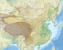
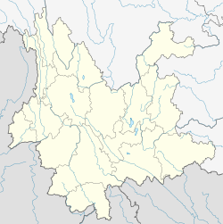
| الاحداثيات | 25°45′48″N 100°11′15″E / 25.76333°N 100.18750°ECoordinates: 25°45′48″N 100°11′15″E / 25.76333°N 100.18750°E |
| بلدان الحوض | الصين |
| أقصى طول | 40 كم |
| أقصى عرض | 8 كم |
| مساحة السطح | 250 كم² |
| متوسط العمق | 11 متر |
| حجم المياه | 2.5 كم³ |
| ارتفاع السطح | 1,972 متر |
| التجمعات السكنية | مدينة دالي |
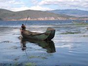
إرهاي Erhai أو بحيرة إر (صينية: 洱海؛ پنين: Ěrhǎi؛ حرفياً: 'بحر الأُذُن'�)، هي بحيرة فالق ألپية في مقاطعة يوننان، الصين. واسمها يعني "البحر على شكل أُذُن"، بسبب شكله كما يراه المحليون والمسافرون. كما كانت إرهاي تـُعرف بإسم يىيوزى أو بحيرة كونمنگ في العصور القديمة.
. . . . . . . . . . . . . . . . . . . . . . . . . . . . . . . . . . . . . . . . . . . . . . . . . . . . . . . . . . . . . . . . . . . . . . . . . . . . . . . . . . . . . . . . . . . . . . . . . . . . . . . . . . . . . . . . . . . . . . . . . . . . . . . . . . . . . . . . . . . . . . . . . . . . . . . . . . . . . . . . . . . . . . . .
الجغرافيا

تقع إرهاي على ارتفاع 1,972 متر فوق سطح البحر. ومن ناحية الحجم، فإن طول محور الشمال-جنوب للبحيرة هو 40 كم وعرض الشرق-غرب هو حوالي 7-8 كم. ومساحتها 250 كم²، مما يجعلها ثاني أكبر بحيرة مرتفعات في الصين، بعد بحيرة ديانتشي. ومحيطها يبلغ 116 كم، ومتوسط عمقها 11 متر وإجمالي سعة التخزين فيها 2.5 كم³.
The lake serves as a backdrop to all of مدينة دالي and sandwiches Dali Town in the west against the جبل تسانگ. The lake's head is at Shangguan Town, its northern extremity, and its southernmost point is at Xiaguan Town. The lake receives water from the Miju and Mici Rivers in the north, the Bolou River in the east, and smallers streams from the Cang Mountains in the west. Yangbi River, to the south, is the lake's outlet and eventually flows into the Lancang River (Mekong River).
الجذب السياحي
The lakeshore can be explored by hiking. Highlights include Erhai Park and the Butterfly Springs on the Western bank. Islands on the lake – including Guanyin Ge, Jinsuo Island (金梭岛؛ 'Golden Shuttle Island'�), Nanzhao Folklore Island (南诏风情岛�) and Xiaoputuo Island – are also available for visits.
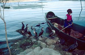
The lake is an important food source for the local people (Bais), who are famous for their fishing method: their trained cormorants catch fish and return them to fishmongers. The birds are prevented from swallowing their fish by rings fixed around their neck.
التنوع الحيوي
There is, or was, a rich biodiversity in Erhai. It is one of three major Yunnan lakes with a high number of endemics, the two other being Fuxian and Dian (Dianchi).[1] Of the 23 fish species and subspecies known from Erhai, 8 are endemic: Cyprinus barbatus, C. daliensis, C. longipectoralis, C. megalophthalmus, Paracobitis erhaiensis, Poropuntius daliensis (syn. Barbodes daliensis), P. exiguus (syn. B. exigua) and Zacco taliensis (syn. Schizothorax taliensis).[1] Among these, only C. barbatus and C. longipectoralis have been recorded since the year 2000; the remaining have not been recorded in decades and are likely extinct.[1] A few of the non-endemic natives have also been extirpated from the lake. In contrast, the lake is now home to more than 10 introduced fish species.[1]
A few native hydrophytes have also disappeared from the lake.[1]
البحيرة كانت مرعى للغزلان الملكية لمملكة نانژاو.


