أوركني
| الاسم الگيلي | Arcaibh |
|---|---|
| الموقع | |
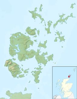 | |
Orkney shown within Scotland | |
| الإحداثيات | 59°N 3°W / 59°N 3°WCoordinates: 59°N 3°W / 59°N 3°W |
| Physical geography | |
| مجموعة الجزر | الجزر الشمالية |
| المساحة | 990 km2 (380 sq mi) |
| الادارة | |
| الدولة ذات السيادة | المملكة المتحدة |
| البلد | اسكتلندا |
| منطقة المجلس | Orkney Islands Council |
| الديمغرافيا | |
| التعداد | 21,349 (2011 census) |
| الكثافة السكانية | 52 per square mile (20/km2) |
| أكبر مستوطنة | كيركوول |
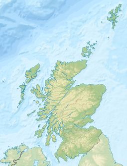
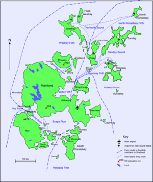
أوركني (Orkney؛ /ˈɔrkni/؛ بالغالية الاسكتلندية: [Arcaibh] Error: {{Lang}}: text has italic markup (help)[1][2]), also known as the Orkney Islands,[Notes 1] هي أرخبيل يقع مقابل الساحل الشمالي لـبريطانيا العظمى، على بعد 16 كيلومتر شمال ساحل كيثنس. وتتألف أوركني من نحو 70 جزيرة، عشرين منهم مأهولين بالسكان.[4][5][6] أكبر الجزر، مينلاند، كثيراً ما يشار إليها بإسم "البر الرئيسي the Mainland"، ومساحتها 523.25 كيلومتر مربع، مما يجعلها سادس أكبر جزيرة اسكتلندية[7] وعاشر أكبر جزيرة في الجزر البريطانية. أكبر مستوطنة ومركز اداري هي كيركوول.[8]
. . . . . . . . . . . . . . . . . . . . . . . . . . . . . . . . . . . . . . . . . . . . . . . . . . . . . . . . . . . . . . . . . . . . . . . . . . . . . . . . . . . . . . . . . . . . . . . . . . . . . . . . . . . . . . . . . . . . . . . . . . . . . . . . . . . . . . . . . . . . . . . . . . . . . . . . . . . . . . . . . . . . . . . .
أصل الاسم
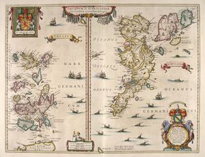
التاريخ
قبل التاريخ
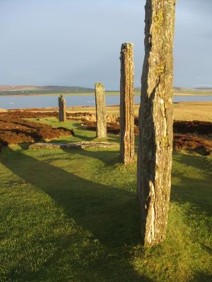
يبدو أن الشعوب النيوليتية (العصر الحجري الجديد) قد استوطنت جزر أوركني في وقت غابر يعود إلى 4,000 سنة مضت. فقد فقد عرّت أعاصير وعواصف خلال القرن التاسع عشر الأرض وظهرت قرى قديمة صغيرة مثل " مايس هاو" و "سكارا براي" . فاهتم علماء الآثار بها وبدأوا في تأريخها ومحاولة دراسة طريقة معيشة هؤلاء الأقدمين.
توجد في الجزر آثار من إنشاءات ذات جدران حجرية مستديرة تُدعى بروتش، تعود إلى ما بين القرن الثاني قبل الميلاد والقرن الثالث الميلادي. وربما كانت ملاجئ.
الحكم النرويجي
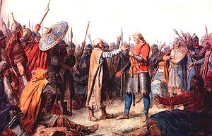
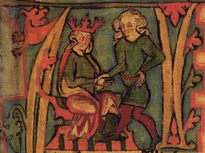
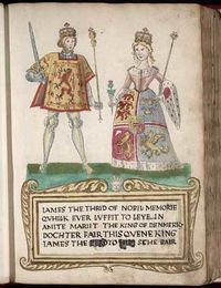
احتل الفايكنج جزر أوركني خلال القرنين الثامن والتاسع، وحكموا حتى عام 1468م. وقد رهن كريستيان الأول، ملك الدنمارك والنرويج، الجزر لدى ملك أسكتلندا من أجل مهر ابنته التي أراد تزويجها من جيمس الثالث ملك اسكتلندا. وكثير من أسماء الأماكن والعائلات نرويجية الأصل.
الحكم الاسكتلندي
خلال القرن التاسع عشر أصبحت سترومنيس ميناء مُهمًا للسفن التجارية التابعة لشركة خليج هدسون، ولقوارب صيد الحيتان والفُقمة، وقوارب صيد سمك الرنجة. وأثناء الحرب العالمية الأولى والثانية أصبحت سكابا فلو قاعدة بحرية مهمة. ومنذ السبعينيات وفرت صناعة النفط في بحر الشمال العديد من فرص العمل لسكان أوركني.[10]
القرن العشرون
السكان
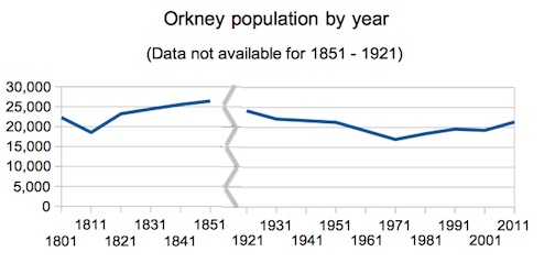
تعتبر كيركوول المركز الإداري وأكبر المدن. المساحة الإجمالية هي 976 كم².و يبلغ عدد السكان 19,450 نسمة حسب إحصاء عام 1991م. يُدعى سكان أوركني بالأوركاديين، وينحدرون من المستوطنين الأسكتلنديين والنرويجيين. وهناك العديد من الآثار في الجزر، مثل مقبرة مايشو، وقرية سكارابرية، التي ماتزال تحافظ على شكلها رغم أن عمرها يعود إلى 3 آلاف سنة ق.م. اللغة الرسمية هي الغيلية الأسكتلندية
|
||||||||||||||||||||||||||||||||||||||||||||||||||||||||||
الجغرافيا
. . . . . . . . . . . . . . . . . . . . . . . . . . . . . . . . . . . . . . . . . . . . . . . . . . . . . . . . . . . . . . . . . . . . . . . . . . . . . . . . . . . . . . . . . . . . . . . . . . . . . . . . . . . . . . . . . . . . . . . . . . . . . . . . . . . . . . . . . . . . . . . . . . . . . . . . . . . . . . . . . . . . . . . .
الجيولوجيا
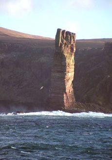
المناخ
لا ينبت في الجزر إلا القليل من الأشجار بسبب الرياح القوية. للبحر تأثير كبير على مناخ أوركني. ولا توجد حدود عليا ودنيا لدرجة الحرارة. والمناخ معتدل شتاءً ورطب صيفًا. ومعدل هطول الأمطار السنوي 940مم.
| بيانات مناخ Kirkwall, 26m asl, 1981-2010, Extremes 1951- | |||||||||||||
|---|---|---|---|---|---|---|---|---|---|---|---|---|---|
| الشهر | يناير | فبراير | مارس | أبريل | مايو | يونيو | يوليو | أغسطس | سبتمبر | اكتوبر | نوفمبر | ديسمبر | العام |
| العظمى القياسية °س (°ف) | 12.2 (54) |
12.8 (55) |
18.9 (66) |
18.3 (64.9) |
22.0 (71.6) |
22.8 (73) |
25.6 (78.1) |
24.8 (76.6) |
22.8 (73) |
19.4 (66.9) |
14.5 (58.1) |
12.8 (55) |
25٫6 (78٫1) |
| العظمى المتوسطة °س (°ف) | 6.4 (43.5) |
6.4 (43.5) |
7.6 (45.7) |
9.5 (49.1) |
12.0 (53.6) |
14.0 (57.2) |
15.9 (60.6) |
16.0 (60.8) |
14.1 (57.4) |
11.4 (52.5) |
8.6 (47.5) |
6.8 (44.2) |
10٫7 (51٫3) |
| الصغرى المتوسطة °س (°ف) | 1.9 (35.4) |
1.7 (35.1) |
2.4 (36.3) |
3.8 (38.8) |
5.6 (42.1) |
8.1 (46.6) |
10.2 (50.4) |
10.3 (50.5) |
8.8 (47.8) |
6.7 (44.1) |
4.2 (39.6) |
2.3 (36.1) |
5٫5 (41٫9) |
| الصغرى القياسية °س (°ف) | −7.8 (18) |
−7.0 (19) |
−6.8 (19.8) |
−4.9 (23.2) |
−2.1 (28.2) |
1.0 (33.8) |
3.4 (38.1) |
3.7 (38.7) |
0.5 (32.9) |
-1.6 (29.1) |
−5.5 (22.1) |
−7.6 (18.3) |
−7٫8 (18) |
| سقوط الأمطار mm (inches) | 109.7 (4.319) |
93.3 (3.673) |
95.7 (3.768) |
60.3 (2.374) |
48.0 (1.89) |
52.7 (2.075) |
57.4 (2.26) |
66.3 (2.61) |
95.3 (3.752) |
126.0 (4.961) |
126.0 (4.961) |
107.8 (4.244) |
1٬038٫5 (40٫886) |
| Avg. rainy days (≥ 1.0 mm) | 20.1 | 16.8 | 17.9 | 13.4 | 10.6 | 10.7 | 11.6 | 12.5 | 16.2 | 19.6 | 20.8 | 18.5 | 188٫7 |
| Sunshine hours | 32.2 | 59.3 | 98.2 | 136.8 | 190.0 | 148.6 | 132.2 | 129.7 | 105.3 | 75.8 | 40.1 | 24.5 | 1٬172٫4 |
| Source #1: Met Office[14] | |||||||||||||
| Source #2: Royal Dutch Meteorological Institute/KMNI[15] | |||||||||||||
الاقتصاد
الطاقة
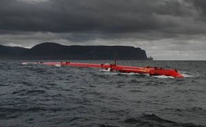
Orkney has significant wind and marine energy resources, and renewable energy has recently come into prominence. Although Orkney is connected to the mainland, it generates over 100% of its net energy from renewables.[16] This comes mainly from wind turbines situated right across Orkney.
العبارات
. . . . . . . . . . . . . . . . . . . . . . . . . . . . . . . . . . . . . . . . . . . . . . . . . . . . . . . . . . . . . . . . . . . . . . . . . . . . . . . . . . . . . . . . . . . . . . . . . . . . . . . . . . . . . . . . . . . . . . . . . . . . . . . . . . . . . . . . . . . . . . . . . . . . . . . . . . . . . . . . . . . . . . . .
اللغة والأدب والفولكلور
At the beginning of recorded history the islands were inhabited by the Picts, whose language was Brythonic.[Notes 2] The Ogham script on the Buckquoy spindle-whorl is cited as evidence for the pre-Norse existence of Old Irish in Orkney.[20][Notes 3]
الأوركاد
An Orcadian is a native of Orkney, a term that reflects a strongly held identity with a tradition of understatement.[22] Although the annexation of the earldom by Scotland took place over five centuries ago in 1472, most Orcadians regard themselves as Orcadians first and Scots second.[23]
التاريخ الطبيعي
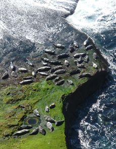
Orkney has an abundance of wildlife, especially of grey and common seals and seabirds such as puffins, kittiwakes, tysties, ravens, and bonxies. Whales, dolphins, and otters are also seen around the coasts. Inland the Orkney vole, a distinct subspecies of the common vole, is an endemic.[24][25] There are five distinct varieties, found on the islands of Sanday, Westray, Rousay, South Ronaldsay, and the Mainland, all the more remarkable as the species is absent on mainland Britain.[26]
انظر أيضاً
- Timeline of prehistoric Scotland
- Prehistoric Scotland
- Battle of Florvåg
- Bishop of Orkney
- List of places in Orkney
- Orkney club
- Orkney College
- Orkneyinga saga
- Rögnvald Kali Kolsson
- Stromness
- Udal Law
- Parishes of Orkney
- Constitutional status of Orkney, Shetland and the Western Isles
- Solar eclipse of 1 May 1185
المراجع
ملاحطات
- ^ Although "The Orkneys" is used by non-Orcadians and does have historical precedent, it is clear that this is frowned upon by the residents.[3]
- ^ There is convincing place-name evidence for the Picts use of Brythonic or P-Celtic, although no written records survive. No certain knowledge of any pre-Pictish language exists anywhere in Scotland, but there may well have been times of significant overlap.[18] For example, the early Scottish Earls spoke Gaelic when the majority of their subjects spoke Norn and both of these languages were then replaced by Insular Scots. It is therefore possible that the Pictish aristocracy spoke one language and the common folk an unknown precursor such as Proto-Celtic.[19]
- ^ Only two Q-Celtic words exist in the language of modern Orcadians - "iper" from eabhar, meaning a midden slurry, and "keero" from caora - used to describe a small sheep in the North Isles.[21]
الهامش
- ^ Dieckhoff, H. (1932) A Pronouncing Dictionary of Scottish Gaelic; reprinted in 1988 by Gairm ISBN 1-871901-18-9
- ^ Mark, C. ( 2004) The Gaelic-English Dictionary Routledge ISBN 0-415-29761-3
- ^ Anderson, Peter "Is 'The Orkneys' ever right? And other musings on 'Orkney' usage." Orkneyjar. Retrieved 29 July 2009.
- ^ Haswell-Smith (2004) pp. 336-403.
- ^ Wickham-Jones (2007) p. 1 states there are 67 islands.
- ^ أ ب قالب:NRS1C
- ^ Haswell-Smith (2004) pp. 334, 502.
- ^ Lamb, Raymond "Kirkwall" in Omand (2003) p. 184.
- ^ خطأ استشهاد: وسم
<ref>غير صحيح؛ لا نص تم توفيره للمراجع المسماةT69 - ^ أوركني أون اركاد، تاريخ الولوج 07/11/2009
- ^ خطأ استشهاد: وسم
<ref>غير صحيح؛ لا نص تم توفيره للمراجع المسماةThom434 - ^ خطأ استشهاد: وسم
<ref>غير صحيح؛ لا نص تم توفيره للمراجع المسماةvis - ^ خطأ استشهاد: وسم
<ref>غير صحيح؛ لا نص تم توفيره للمراجع المسماةGRO - ^ "Kirkwall 1981–2010 averages". UKMO. Retrieved 13 September 2012.
- ^ "Kirkwall Extremes". KNMI.
- ^ Llewelyn, Robert. "Orkney Island of the future". Fully Charged. Robert Llewelyn. Retrieved 20 May 2015.
- ^ "Welcome to Orkney Ferries". Orkney Ferries Ltd. Retrieved 16 May 2012.
- ^ Clarkson (2008) pp. 30-34.
- ^ Lamb, Gregor "The Orkney Tongue" in Omand (2003) pp. 248-49.
- ^ Forsyth, Katherine (1995). "The ogham-inscribed spindle-whorl from Buckquoy: evidence for the Irish language in pre-Viking Orkney?" (PDF). Proceedings of the Society of Antiquaries of Scotland. ARCHway. 125: 677–96. Retrieved 12 May 2012.
- ^ Lamb, Gregor "The Orkney Tongue" in Omand (2003) p. 250.
- ^ "The Orcadians - The people of Orkney" Orkneyjar. Retrieved 19 September 2009.
- ^ "‘We are Orcadian first, and Scottish second’ many people would tell me during the course of my fieldwork." McClanahan, Angela (2004) The Heart of Neolithic Orkney in its Contemporary Contexts: A case study in heritage management and community values. Historic Scotland/University of Manchester, p. 25 (§3.47) [1] Retrieved 8 January 2010.
- ^ "Northern Isles". SNH. Retrieved 27 September 2009.
- ^ Benvie (2004) pp. 126–38.
- ^ Haynes, S., Jaarola M., & Searle, J. B. (2003). "Phylogeography of the common vole (Microtus arvalis) with particular emphasis on the colonization of the Orkney archipelago" (abstract page). Molecular Ecology. 12 (4): 951–956. doi:10.1046/j.1365-294X.2003.01795.x. PMID 12753214.
{{cite journal}}: CS1 maint: multiple names: authors list (link) Retrieved 27 September 2009.
- Articles containing Scottish Gaelic-language text
- Coordinates on Wikidata
- Lang and lang-xx template errors
- Articles with hatnote templates targeting a nonexistent page
- Pages using div col with unknown parameters
- الجزر الشمالية
- أرخبيلات اسكتلندا
- أرخبيلات المحيط الأطلسي
- مناطق نائبيات اسكتلندا
- أوركني
- مقاطعات اسكتلندا
- مرتفعات وجزر اسكتلندا
- أقاليم اسكتلندا
- مستعمرات نرويجية سابقة
- مناطق مجالس اسكتلندا
- مستعمرات دنماركية سابقة
- Post towns in the KW postcode area
- الطاقة المتجددة في اسكتلندا


